
blah blah blah
Halls Ledge
Length: 3.2 miles out-and-backDifficulty (click for info): Easy
Elevation Gain: 760 feet (+100 feet on return)
Rating (click for info): 6/10
Elevation: 2580' (Valley Vista outlook)
Driving Directions:
Trailhead and parking area are on Carter Notch Road in Jackson, NH. From the northern junction of Rts. 16 and 302, drive north on Rt. 16 for 2.3 miles toward Jackson. Turn right onto Rt. 16A, a loop road which comes back to Rt. 16 just a half mile further up the road (don't confuse this road with another Rt. 16A which is also a loop road off the combined 16/302 just north of downtown North Conway). Drive through the covered bridge, and in half a mile, reach the junction with Rt. 16B. Rt. 16B is also a loop road whose two ends are right next to each other. Bear left to stay on 16A past its eastern branch, cross the bridge over the Ellis River, and turn right onto its western branch, which is Carter Notch Road. Pass Jackson Falls on the right as you start up this road, then after 2.1 miles, stay straight on Carter Notch Road as Rt. 16B turns back to the right. Keep going on this road - it turns into a dirt road after 2.3 miles, then ends at the trailhead in another 0.8 after passing a couple camp cabins. As the Hall's Ledge Trail is straight ahead, turn right into the parking area for Bog Brook Trail. The road continues past here as a ski trail. Click here for a Google map.
About the Hike:
Just to the south of the famous Wildcat Ski Area, the Wildcat Ridge runs down between the major thoroughfare of Rt. 16 and the remote valley of Wildcat Brook. The ridge is mainly forested but is networked with cross-country ski trails, which criss-cross the ridge and even connect up to the top of the Wildcat Ski Area. If you look at a map of hiking trails in the area, you will see two isolated trails crossing the ridge and running from Rt. 16 to the end of Carter Notch Road that seem to go nowhere. The northern of these trails, Hall's Ledge Trail, coincides with some of the ski trails in its eastern half and leads to two nice cleared viewpoints created by the local club that maintains the ski trails. Though the real Hall's Ledge has been completely viewless for a long time now, these artificial vistas are quite lovely and offer extensive views of the surrounding area between the two of them. While the trail coming from Rt. 16 is hardly ever used, rather steep, and overgrown in places, the hike is a nice smooth and easy ascent up the well-beaten surface of the ski trails if you take it from the eastern side as we describe here.
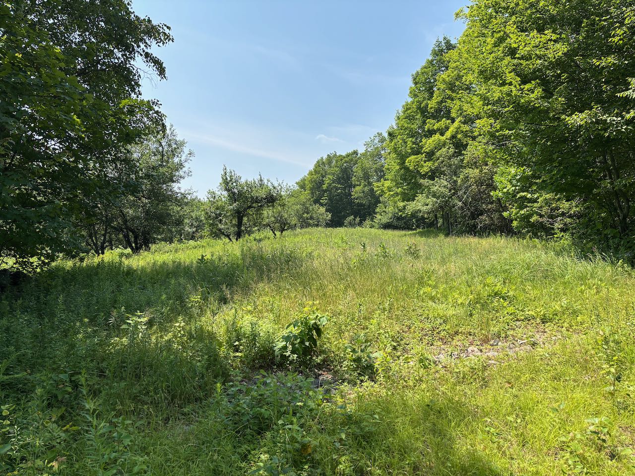
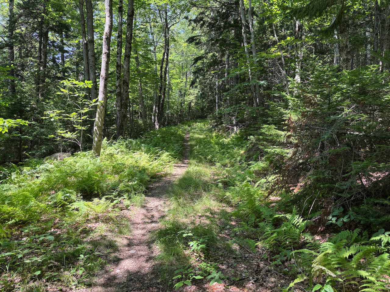
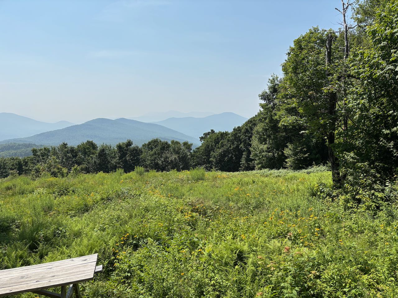
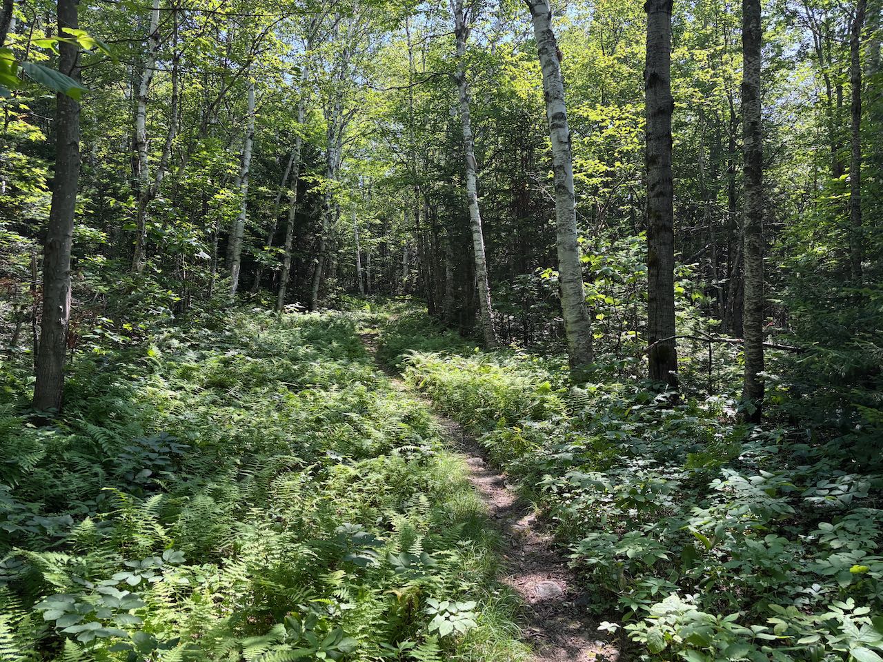
From the parking area for the Bog Brook Trail, walk back to the road and turn right past the kiosk onto the combined Hall's Ledge Trail and Wildcat Valley Ski Trail, which at this point is the continuation of the gravel road. The road rises very slightly, passing Quail Trail on the left after 0.2 miles and Beaver Bog Trail also on the left in another 0.15 miles. It soon becomes grassier and crosses through a clearing with an old apple orchard in another 0.2 miles, where another pair of ski trails diverge (Orchard Trail on the left and Carter Notch Spur on the right). Continue straight, heading back into the woods, as the trail quickly passes the lower junction with Hubs Loop on the right. It ascends more steadily now, climbing along the side of a ridge with a narrow, fern-lined footpath amidst the open forest corridor of the ski trail. It passes a cleared opening on the left with a slight view, and then it passes a boulder with a plaque with the name of the conservation area on it. After 0.4 miles, pass the other end of the Hubs Loop ski trail on the right. The trail remains straight and steady for the next 0.3 miles until it reaches the ridgetop, where the Wildcat Valley ski trail you've been following turns right to lead way up to Wildcat Mountain. Turn left and follow the hiking trail and a different ski trail also with the name Hall's Ledge Trail. The trail leads along the top of the ridge, slightly downhill for 0.1 miles and swings out to the Valley Vista outlook, where a picnic table sits in the middle of a large grassy clearing.
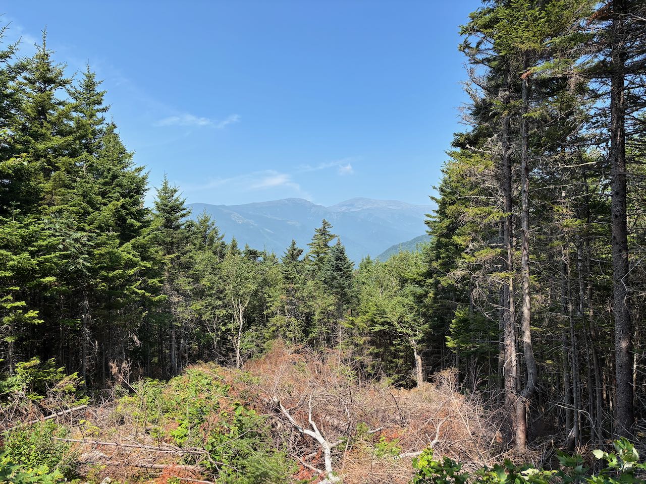
From here, you can enjoy a nice, fairly wide view out to the south of the mountains around Conway. All the way to the left, you can see the twin peaks of Doublehead Mountain over the Black Mountain Ridge. Next over is the triangular peak of Kearsarge North, with Thorn Mountain in front to the right. In the center of the view, a continuation of the ridge you are looking from, is Spruce Mountain. To the right, the Moat Mountain ridge is seen behind Iron Mountain, with Mt. Chocorua behind further in the distance. A signpost at the top of the clearing points out all these peaks in view. To continue to the next outlook, keep going on the trail as it winds around for 0.2 miles to the other side of the ridge, where the ski trail dead-ends. Behind another picnic table is a good view of Mt. Washington and Boott Spur. On the right side of the summit you can see quite well into Huntington Ravine. Past this viewpoint, the Holt's Ledge Trail turns left into the woods to head toward Rt. 16, but this is the last stop and you can turn around here.
Printable directions page