blah blah blah
Thompson Falls (Conway)
Length: 4.4 miles out-and-back with loopDifficulty (click for info): Easy
Elevation Gain: 290 feet (+480 feet on return)
Rating (click for info): 6/10
Height: 50'
Source: Moat Brook
Driving Directions:
Trailhead and parking area are at the end of High Street in Albany, NH (waterfall is in Hale's Location). (Seasonal road - check status on TrailsNH to verify gate status). From the junction of Rt. 16 and Rt. 153 in Conway (the traffic light just before the left turn onto Rt. 16 heading north), turn north onto Washington Street. In 0.2 miles, bear left through the triangle junction onto West Side Road. Continue 0.7 miles and turn left onto Passaconaway Road. Drive 1.2 miles, and turn right onto High Street, an occasionally rough dirt road. After 1.6 miles, pass the parking area for a mountain bike trail. In another mile, the road ends at the parking area. Click here for a Google map.
About the Hike:
Thompson Falls is the second and less commonly known waterfall with the same name in the Conway area. Though lacking quite the stature of the one at the base of Wildcat Mountain, this little-known waterfall has a similar appearance to it, with a chain of cascades crashing through boulders and over ledges. It's definitely one of the less-visited waterfalls in the area, so it could be a good destination on a busy day. Much of the foot traffic on the trail that leads to it is there for mineral collecting at one of the rare White Mountain mineral collecting sites. A small area is marked out at the base of Moat Mountain where rock enthusiasts are permitted to dig with hand tools in search of minerals. Further beyond the mineral site, the waterfall is hidden on an obscure trail off a forest road that you'd have to know about to find. It's a bit of a longer walk, but it's a well-built forest trail.
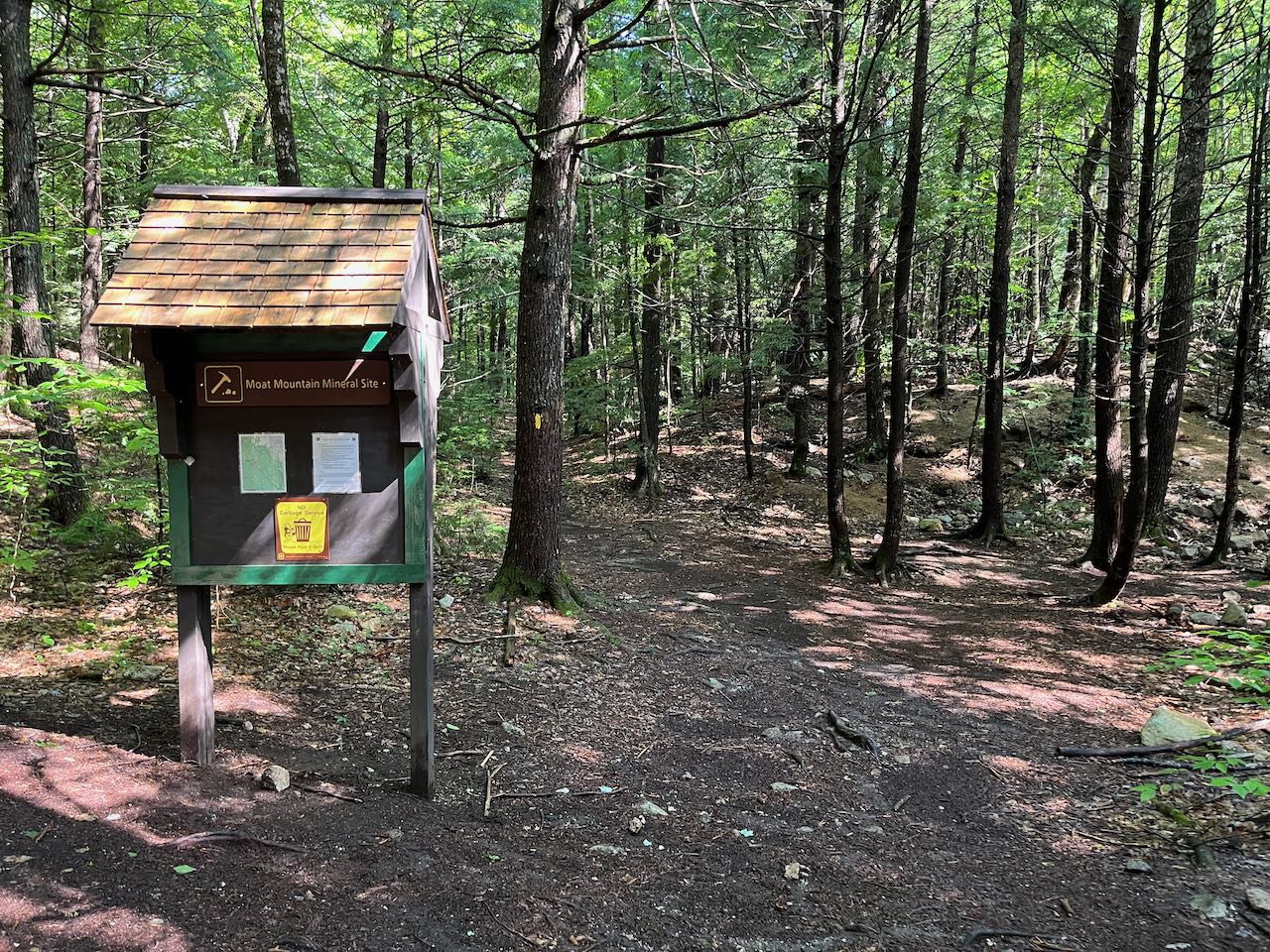
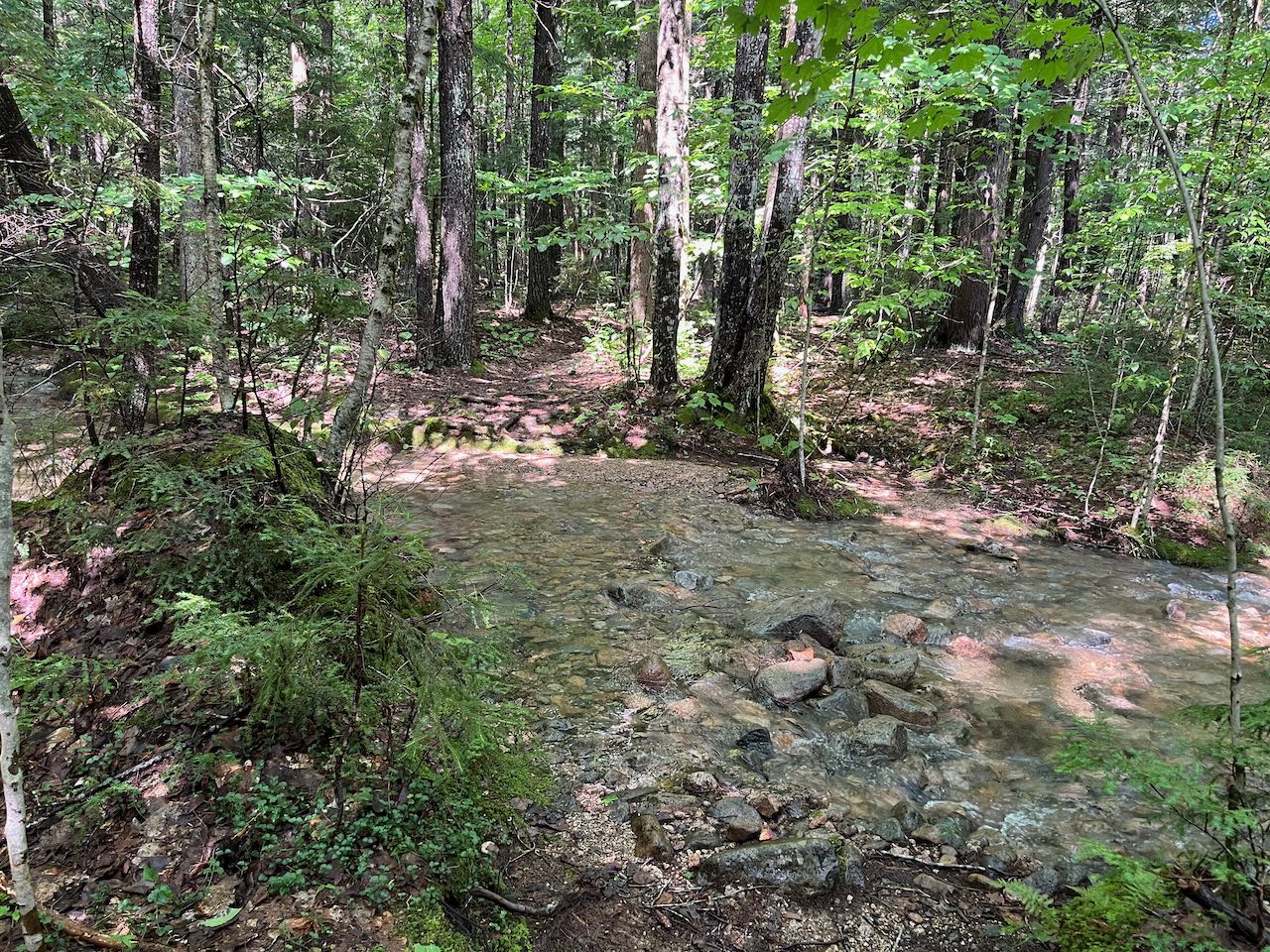
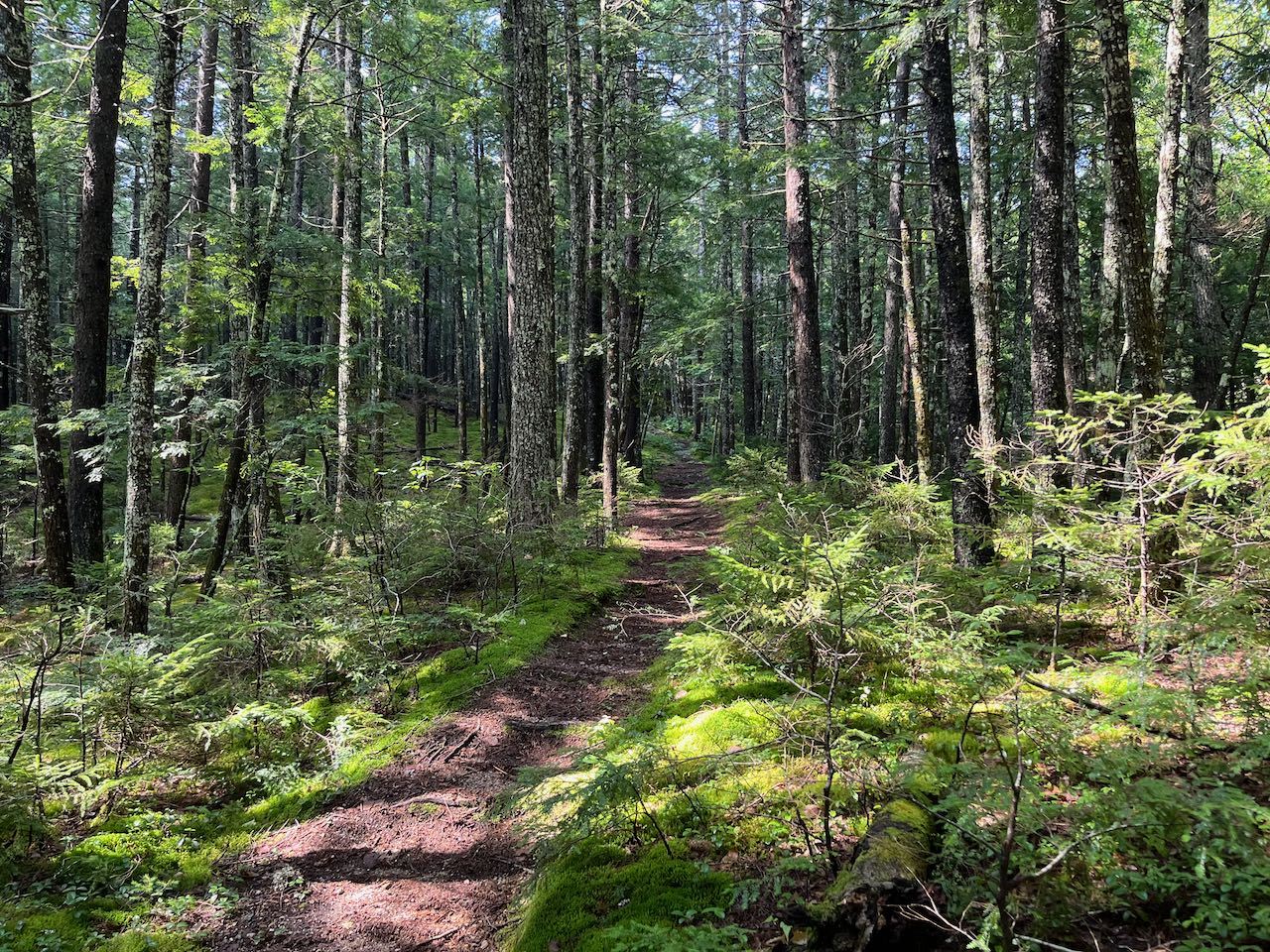
From the end of the parking area, head out on the Moat Mineral Site Trail on a flat gravel path in a transition zone into the woods. At 0.1 miles, bear right as a longer mountain bike trail junctions into the trail. Follow the trail through a hemlock forest over a small knoll and cross a usually-dry brook bed in another 0.25 miles. The trail crosses an actual small brook, with crystal-clear water, in another 0.15 miles. The trail climbs very gradually, and in 0.2 miles passes another junction with a mountain bike trail. Stay straight. In another 0.2 miles you'll see the kiosk that marks the entrance to the mineral collecting site. Blue paint marks delineate a square area in the forest where gravel banks are overturned by rock collectors in search of smokey quartz. Much of the foot traffic ends here - follow the yellow blazes carefully through the mineral site as the trail swings to the left and then turns right on the other side of one of the mounds. The trail descends gradually for 0.35 miles, then begins a series of tight switchbacks with more of a gravelly surface. The zig-zags continue for half a mile as the trail drops down in elevation to reach a gravel forest road.
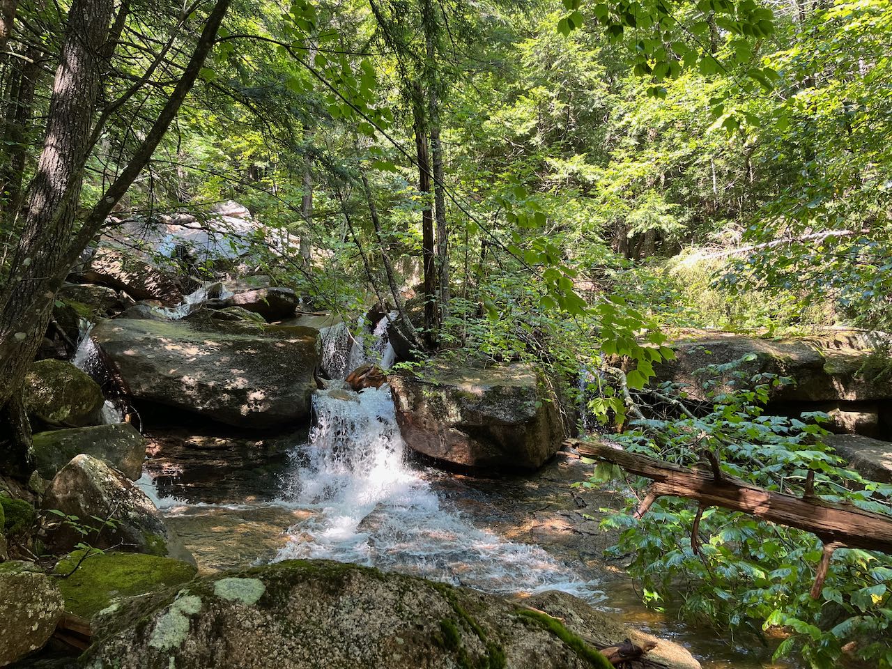
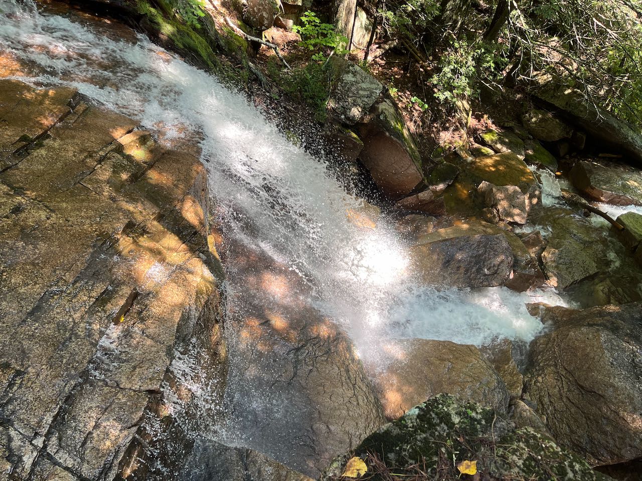
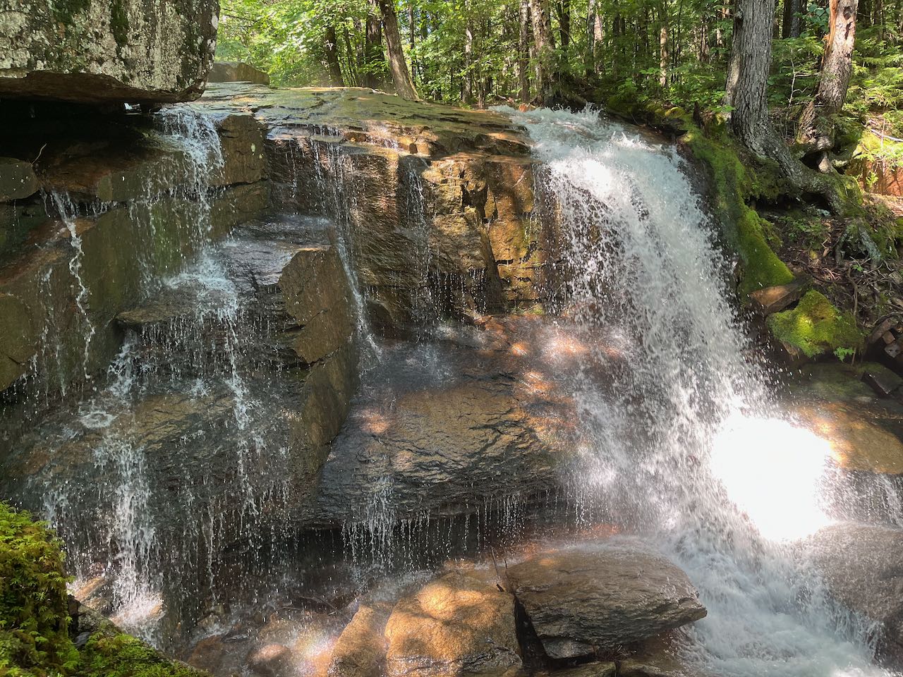
Turn right and follow the road a quarter mile downhill through a gate and look on the left for the sign marking Lower Stony Ridge Trail, a mountain bike trail. Start up this trail and soon fork left onto the Thompson Falls Trail, where all bike traffic goes the other way. In 0.1 miles, the trail crosses a shallow, stony brook that can be tricky to stay dry in if water is high. The trail climbs uphill on a moss-lined path, approaching Moat Brook. Soon, you will be able to see some of the lower cascades through the trees, although the base of the falls is quite difficult to access down the steep ravine. A series of scattered cascades plunge through boulders in the brook bed. Continue up just a bit further, and 0.2 miles from the brook crossing, you will encounter the upper plunge of the falls, which is the most impressive, right beside the trail. Step down through the rock slot, and you can be right up close with the 10-foot plunge over a blocky ledge. The lower cascades can't really be viewed from here either, as the water disappears around the corner of another ledge. The trail continues up along the brook for 0.2 miles and then bears away to reconnect with the road 0.2 miles above the junction with Moat Mineral Site Trail. This section of the trail can tend to be obscured and difficult to follow, and it may be easier to return the way you came.
Printable directions page