

blah blah blah
White Ledge
Length: 4.4 mile loopDifficulty (click for info): Hard
Elevation Gain: 1490 feet (+0 feet on descent)
Rating (click for info): 6/10
Elevation: 2004'
Prominence: 608'
Driving Directions:
Trailhead and parking area are at White Ledge Campground in Albany, NH. The entrance to the campground is on the north/west side of Rt. 16, 6.1 miles north of the junction with Rt. 13 in the village of Chocorua and 4.9 miles west of the junction with Rt. 112, the Kancamagus Highway. Pull into the campground and immediately bear right at two forks. Look for the kiosk and hiker parking on the right side of the campground road, with space for a few cars. During the winter season, the entrance is gated and you can park around the gate. Click here for a Google map.
About the Hike:
White Ledge is the name of a low but significant mountain that lives in the shadow of Mt. Chocorua, known really only for the campground named after it. Set off to the east of Chocorua and poking barely above 2000 feet, it is distinctly separated from Chocorua but shares some of its characteristics, such its its sweeping, pine-covered ledges. Views from the mountain are not wide open, but it offers some fascinating terrain and good scenery overall. The name comes from its cliff-faced eastern side, which drops off precipitously into a boulder-dense forest. A loop trail encircles the entire cliff, providing for a thorough tour of the mountain that visits all the best outlooks in addition to showcasing some of its rugged terrain.
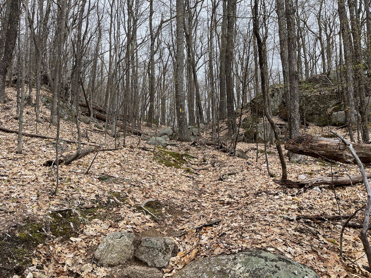
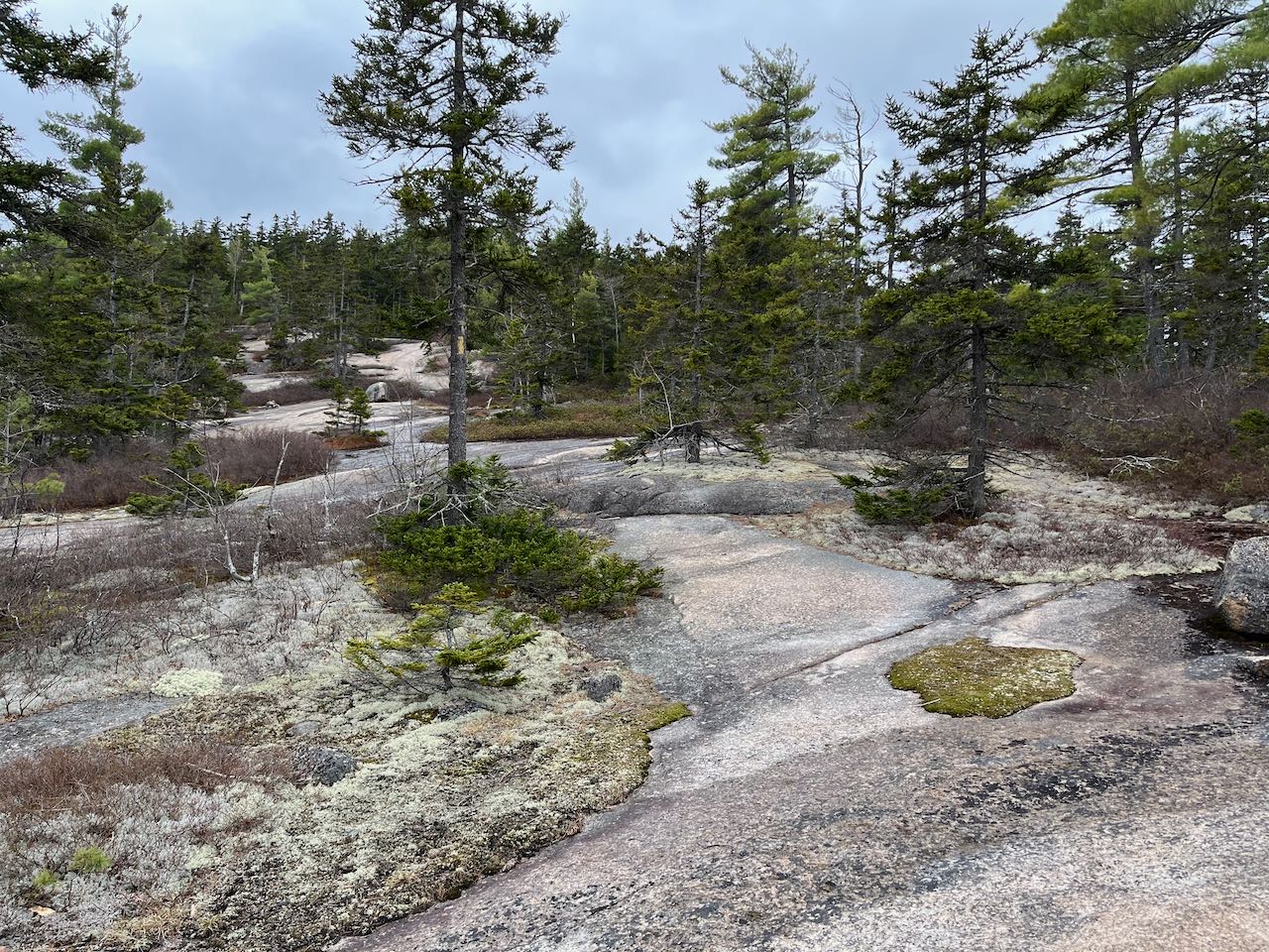
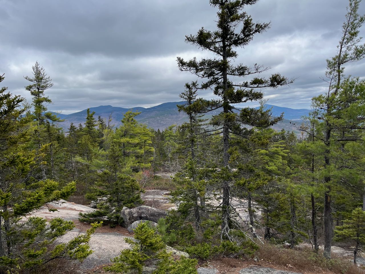
The trail begins in White Ledge Campground. From the designated hiker parking, continue on the road you drove in and fork to the right on the loop through the tentsites. Toward the end of the loop, after 0.1 miles, follow the signs for White Ledge Loop Trail into the woods between campsites 6 and 7. The trail climbs uphill gradually, in proximity to a brook, through a sparse forest of hemlocks. After another 0.2 miles, reach the start of the loop around White Ledge. The loop can be done in either direction, but we'll describe it going counterclockwise, on the longer leg first. Turn right and cross the brook and continue uphill through mixed woods. In 0.3 miles, the trail bears left to join an old woods road along a stone wall. The trail now heads straight toward the mountain, remaining at easy grades for 0.3 miles. It then makes a couple jogs and encounters steeper and rockier terrain. It's another 0.35 miles, with a rather steep section at the end, to climb up to the col between White Ledge and an odd knob below it called Roundtop. The trail then follows along the cliff side of White Ledge, descending easily alongside piles of talus scattered across the forest with only young trees surrounding. After 0.65 miles, the descent ends and the trail turns left to climb up a little ridge past a large rock pile, where the trail can be faint, to the main ridge of White Ledge, where the trail turns left again after 0.1 miles. The trail now ascends over bedrock on the northern side of the mountain through spruces. Open areas become more intermittent, and the trail breaks out onto wide, windswept ledges after 0.3 miles. Watch carefully for trail markings as the trail ascends diagonally left across the ledges, with views of the Moat Range rising behind. It re-enters the woods briefly and climbs moderately over ledge before coming out into the open again with better views to the north and east. From the highest ground, you can see over to Kearsarge North and the Green Hills, including Cranmore Ski Area.
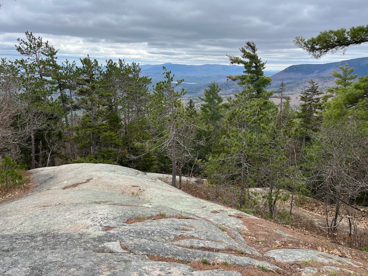
As the trail rounds the top of the mountain, it ducks back into the trees, and runs across the flat top. Look on the left as you go through the wooded section for a ledge opening with a very faint path leading out to it. This ledge provides the most open view on the mountain, facing to the southeast. Pleasant Mountain in Maine is seen from here, along with the low range around Cragged Mountain in Eaton and Freedom. The trail reaches the more open high point after 0.4 miles from the start of the ledges. Views are more limited here. Head straight across as the trail beelines across a long expanse of open rock. It begins to descend more steeply, zig-zagging down the ledges on the south side of the summit, with views over the treetops toward the Ossipee Range and Mt. Chocorua. After about a quarter mile and a few steep ledgy pitches, the trail dips down into the forest and continues its steady descent through rocky terrain. In another 0.3 miles, a side path leads a few steps to the left to a more open southeasterly outlook, offering a better view down over nearby Iona Lake and Whitton Pond. The trail drops directly down the southern ridge of the mountain, in similar terrain as what was seen on the ascent. It starts to moderate after 0.45 miles, and in another 0.3 miles crosses the brook near the beginning of the loop, reaching the junction in another 0.1. Return the way you came.
Printable directions page