blah blah blah
Wonalancet Falls
Length: 2.2 miles out-and-backDifficulty (click for info): Easy
Elevation Gain: 30 feet (+160 feet on return)
Rating (click for info): 6/10
Height: 30'
Source: Wonalancet River
Driving Directions:
Trailhead and parking area are on Rt. 113A in Tamworth, NH. Rt. 113A is a loop road, and the trailhead is located on the south side of the road, 7.1 miles from the junction with 113 in North Sandwich and 6.2 miles from the junction with 113 in Tamworth. If approaching from the west (North Sandwich) direction, look for the trailhead 0.4 miles after the sharp right turn (readily noticed on maps). Park on the south side of the road immediately after a bridge over the Wonalancet River. Click here for a Google map.
About the Hike:
Wonalancet Falls is one of those places that makes you feel like you've discovered a hidden treasure when you find it. It's off the beaten path but not far off the main road, in a place that you'd hardly expect to find a waterfall, on a meandering little river well below the nearby mountainous terrain. It's not usually marked on maps, and the trail that accesses it runs from point to point on Rt. 113A, with no indication of what's in between. Brook Path begins across from the trail to Mt. Paugus, not too far from the very busy trailhead at Ferncroft.
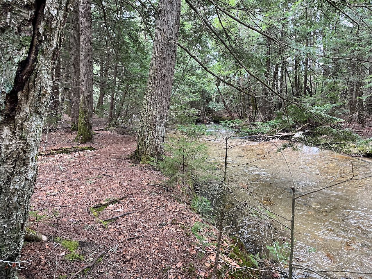
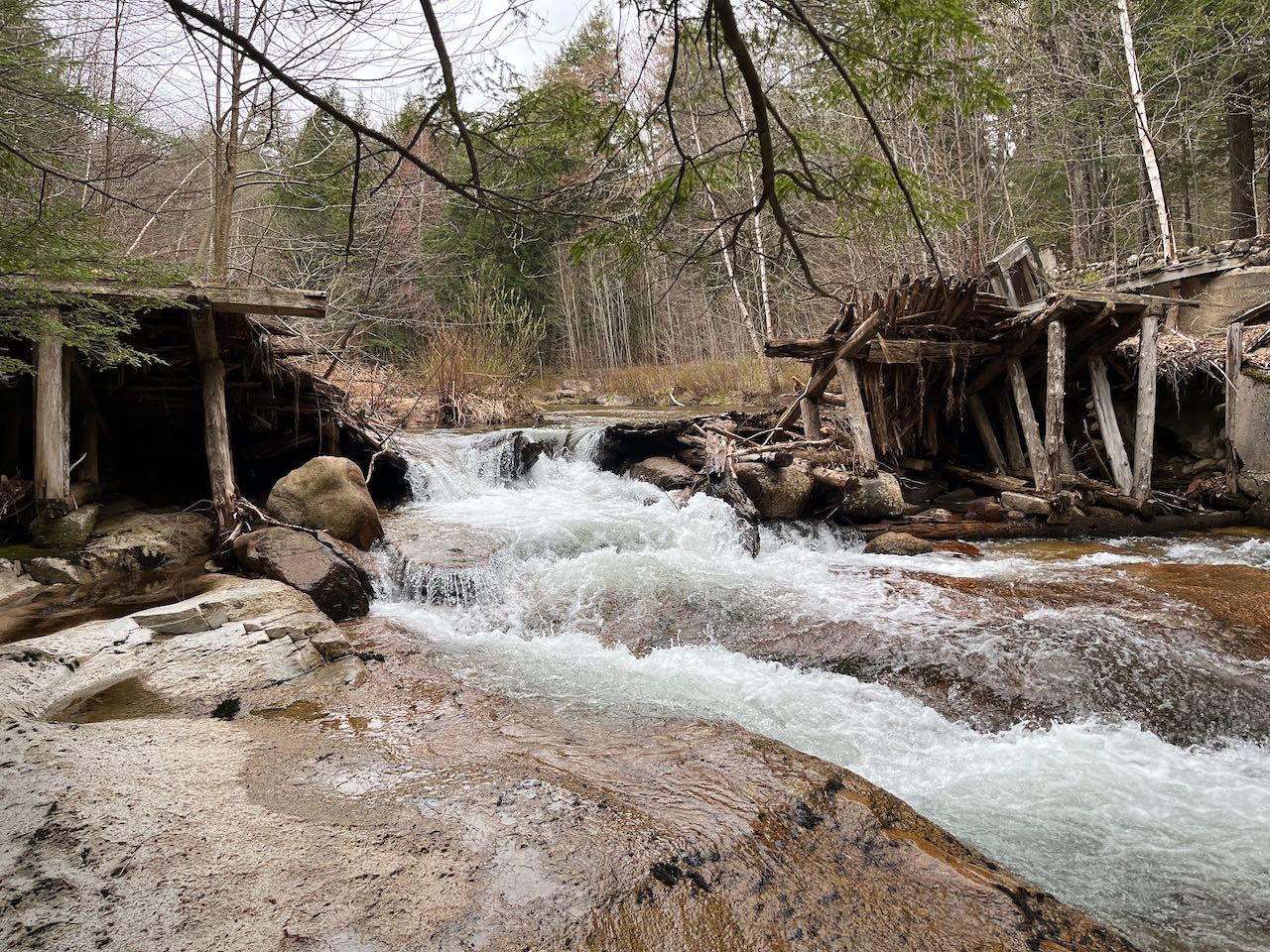
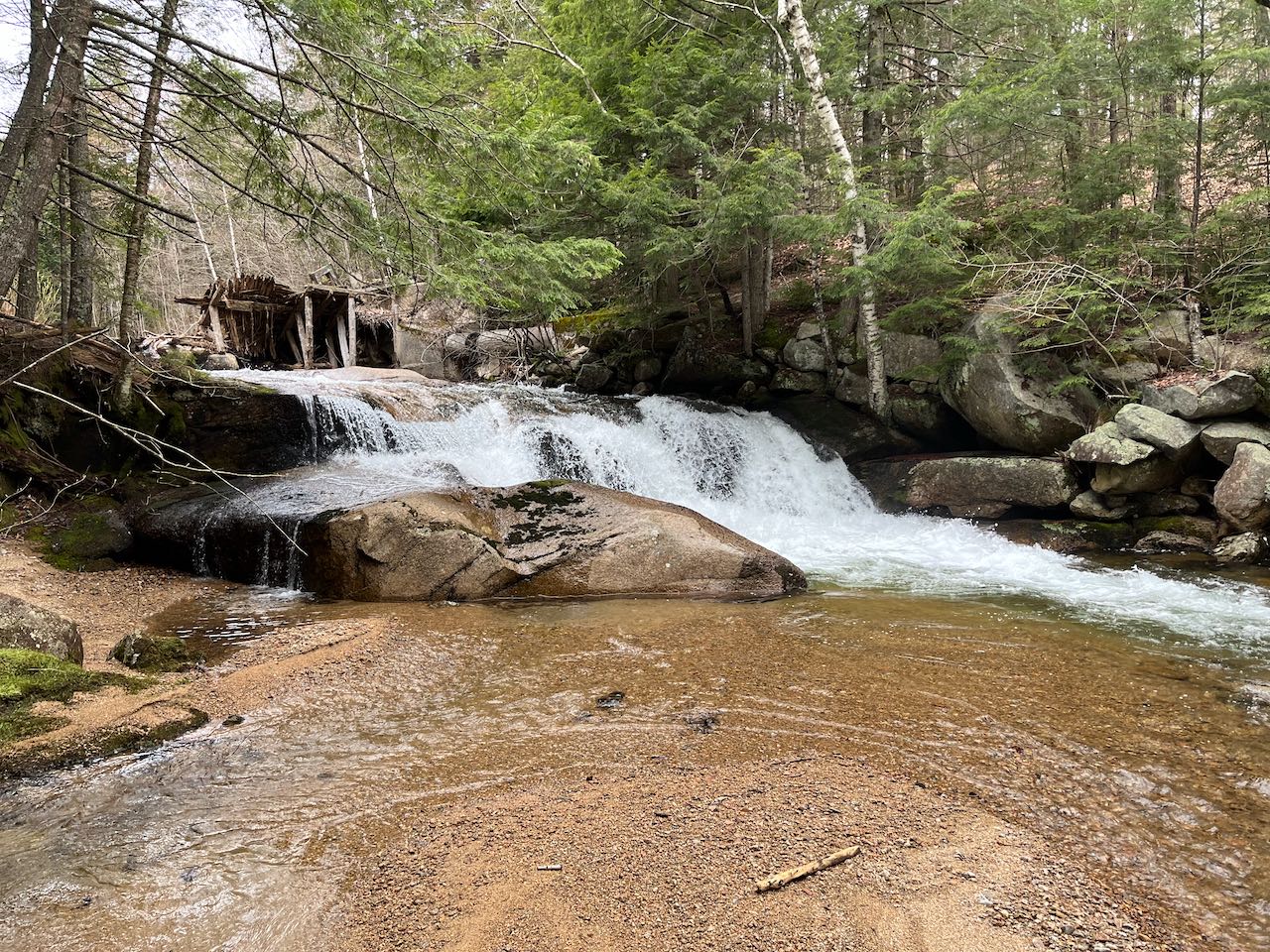
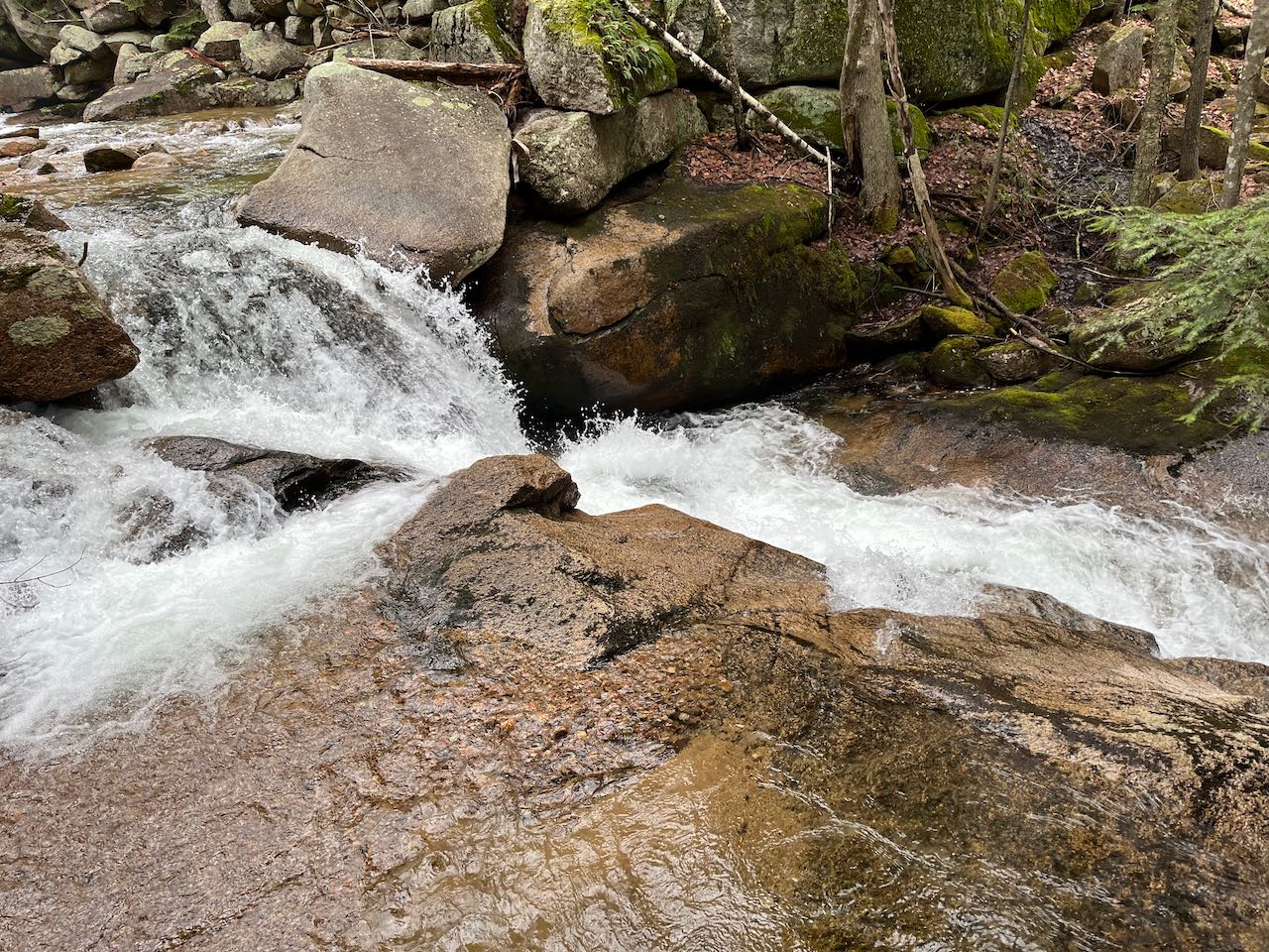
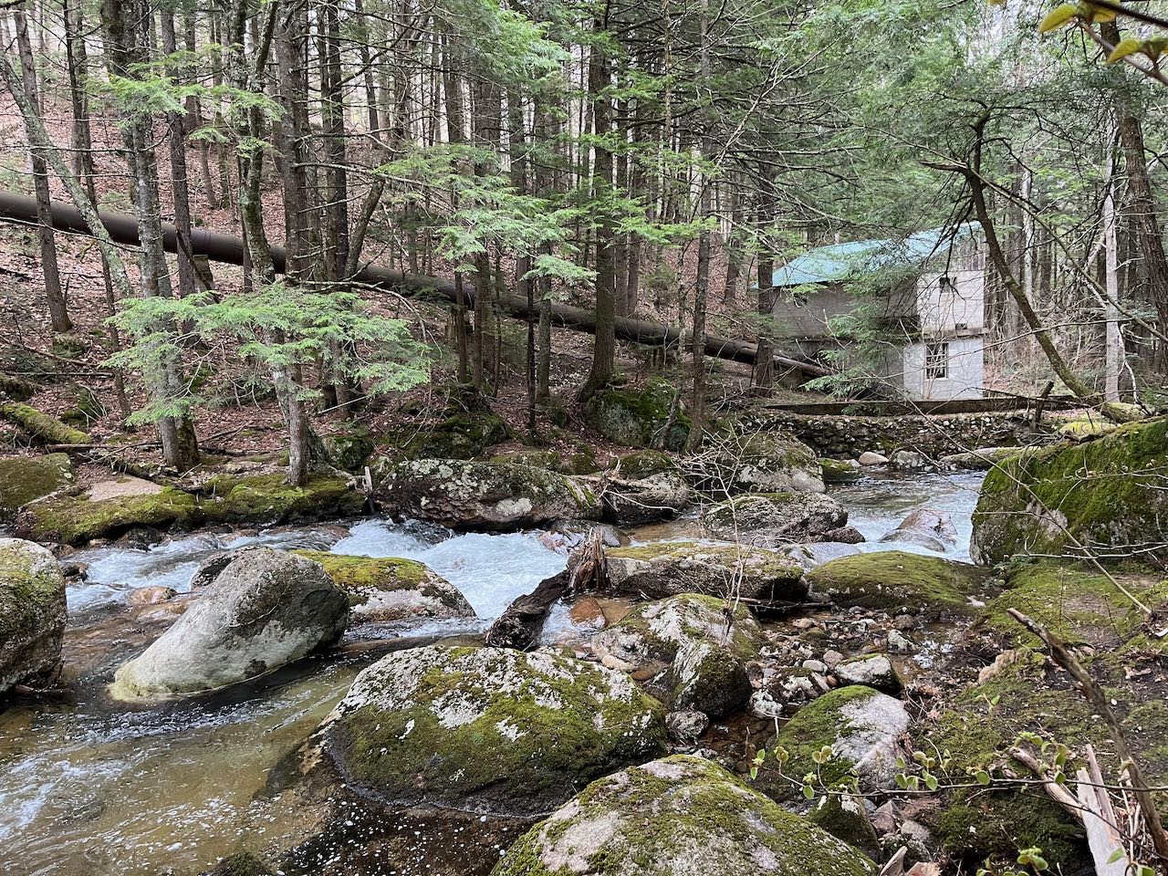
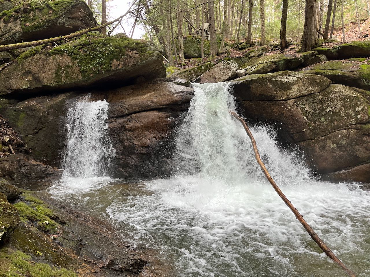
The trail heads out into the verdant forest, winding alongside the Wonalancet River, which has just crossed under the main road. It follows closely along the bank of the shallow, gravelly waterway, as a tributary begins to approach from the left side of the trail. It crosses the tributary on a wooden bridge after 0.15 miles and leads past the confluence, where large gravel deposits abound. It stays close beside the river underneath a tall hemlock canopy and crosses another stream on a wooden bridge after another 0.25 miles. After 0.2 miles, it passes by an area of small cascades through huge boulders in the river. It continues down through the sharp valley, passing by one large boulder in the trail, and crosses the river on a bridge in 0.2 miles. The trail climbs up the other side and intersects a snowmobile trail, follows it to a turn, and turns left, descending back toward the river. After 0.2 miles, the trail reaches the remains of the old mill on the river, where the the water breaks through the dam wall and begins a series of cascades over a ledgy brook bed. An old pipeline can be seen on the other side alongside a stone wall. The first significant cascade is just downstream of the dam, just a few feet tall but quite powerful in the early season. The river continues into more cascades further down as it plunges through a slot in the ledge and foams and bubbles. The trail passes around a high rock wall and the main falls come into view. Two side-by-side falls pour over the ledge, with the closer and smaller one coming from beneath a rock. The larger side thunders down, spreading out as it drops. Just further down from the falls, you'll find the pipeline connecting to an abandoned mill building across the river. The trail beyond here connects back to Rt. 113A further east. This portion is less travelled than the way you came.
Printable directions page