blah blah blah
Mt. Major
Length: 3.2 mile loopDifficulty (click for info): Moderate
Elevation Gain: 1140 feet (+10 feet on descent)
Rating (click for info): 7/10
Elevation: 1787'
Prominence: 192'
Driving Directions:
Trailhead and parking area are located on the west side of Rt. 11 in Alton, NH, 5.4 miles north of Rt. 140 in the center of Alton and 9.0 miles southeast of the junction with Rt. 11B, and just north of the scenic view pulloff. The parking area is marked by a sign and there is a forest society kiosk and pavillion at the back. If you visit near the weekend, you will likely be parking on the road shoulder some distance outside of the actual parking lot. Click here for a Google map.
Trail map
About the Hike:
Mt. Major, the easternmost summit in the Belknap Range is renowned for its panoramic views of Lake Winnipesaukee. It would easily make a top 5 list of most popular hikes in the entire state of New Hampshire. The extensive views of lakes and mountains in every direction is well-beloved for a reason. The hike, though very heavily used, is not a casual walk in the woods; there are sections that verge on ledge scrambling, and the trail is consistently rocky for the second half of the climb. It's short enough to be an afternoon hike, and the reward for the effort is excellent. It will be impossible to find yourself alone on the mountain no matter when you visit, and if you're there mid-day on a weekend, you may be walking a mile just to get to the trailhead because of the overflowing parking area. Still, Mt. Major is a classic hike every New Hampshire native must do at least once. In 2024, the Mt. Major Trail underwent a major reconstruction/relocation project to alleviate the severe impacts of its heavy usage.
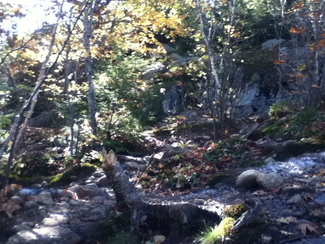
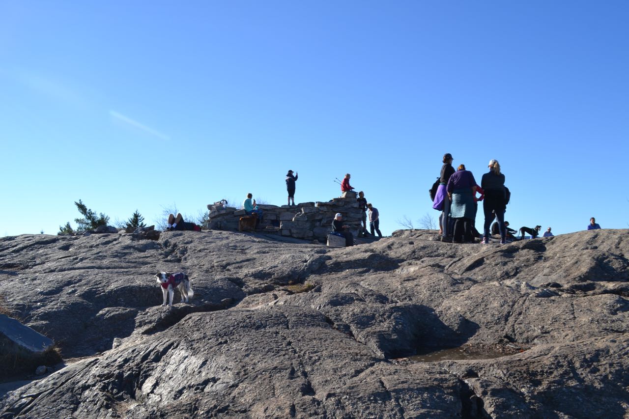
The Mt. Major Trail begins in the northwest corner of the parking area; it is to the right of Brook Trail. Follow the trail into the woods and soon connect into the rocky old road that formerly served as the lower part of the trail. In less than 0.1 miles, the relocation splits off to the right. The new trail, engineered with multitudes of switchbacks, ascends the slopes of Little Mt. Major, the sharp hill just on the side of Rt. 11. Hundreds of painstakingly placed granite steps make a winding course through a boulder-filled hillside for half a mile, to the east of the original route. The old trail along the woods road had followed just above the stream between the slopes of Mt. Major and the Little mountain, and became so worn down by rain and foot traffic that it had carved a trench shoulder-high into the ground, leaving a tangle of tree roots and loose gravel. The relocation joins back up with the old road just above this section, in the pass between the big and little mountains. Follow the wide path as it runs mostly flat around the hillside for 0.3 miles to a junction where Brook Trail continues ahead on the road. Turn left, uphill, onto Mt. Major Trail. The trail steepens and quickly becomes quite stony. It climbs uphill through some red pines, soon ascending over strips of ledge. After 0.4 miles, it reaches some openings where you begin to see views to the north over the lake. It continues over the intermittent ledges, soon reaching a minor plateau and dipping into the forest off the ledges. After 0.2 miles, it approaches the steep summit cone of the mountain, where the trail forks. The right fork leads straight up a very sharp and rocky pitch, while the left fork avoids some of the more treacherous terrain, and the paths rejoin after 0.1 miles. Just beyond, the trail really comes out into the open, where the beautiful views open up all around. It remains quite steep as you ascend over the bare rock for the last 0.1 miles until the stone foundation marking the summit of the mountain comes into view.
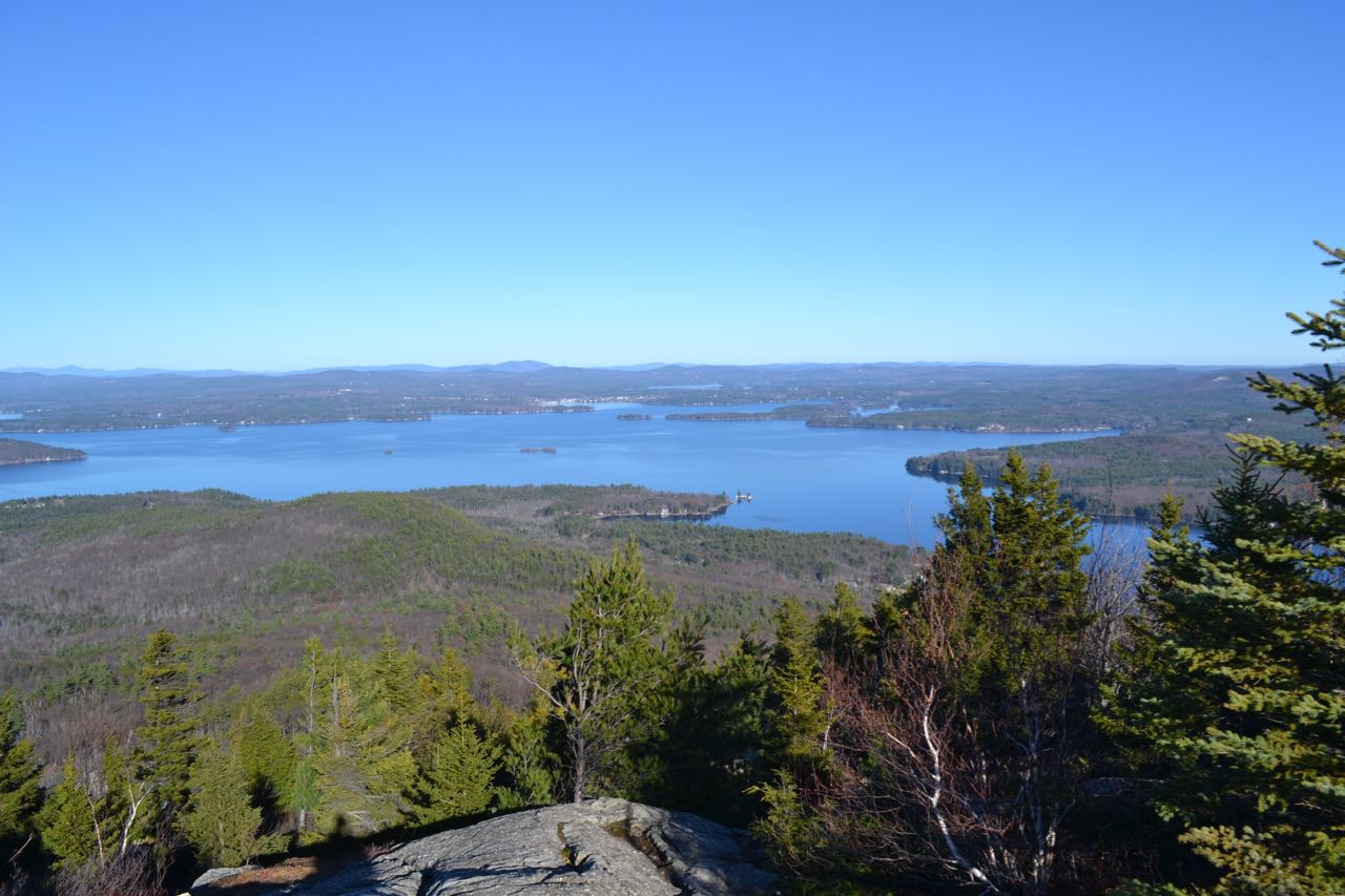
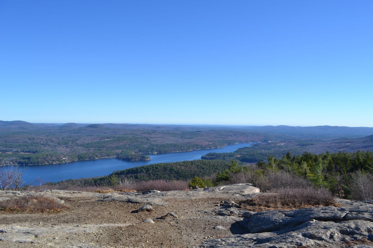
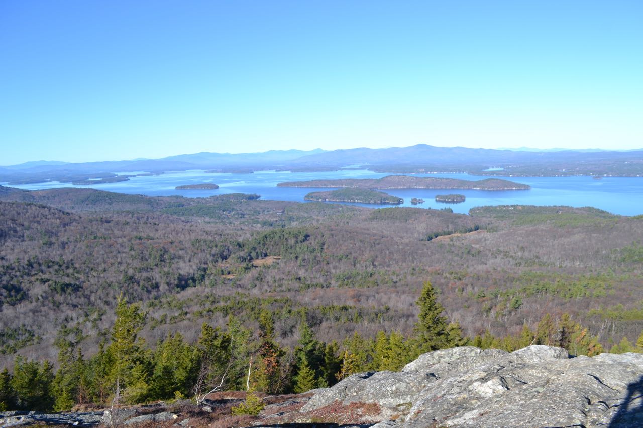
From the summit, there are very wide and close-up views of Lake Winnipesaukee. To the east are Copple Crown Mountain and the Moose Mountains. To the north is the circular Ossipee Range. The Sandwich Range of the White Mountains is a prominent feature across the lake to the left of the Ossipees. The smaller Squam Range also occupies a portion of the scene further to the left. To the west, the distant view is blocked by nearby Straightback Mountain and Quarry Mountain. Belknap Mountain, the highpoint of the range, pokes out between these two. The area around the summit itself is fairly large and provides many places to sit and enjoy the view; one spot on the southeast side provides a particularly nice view of Alton Bay.
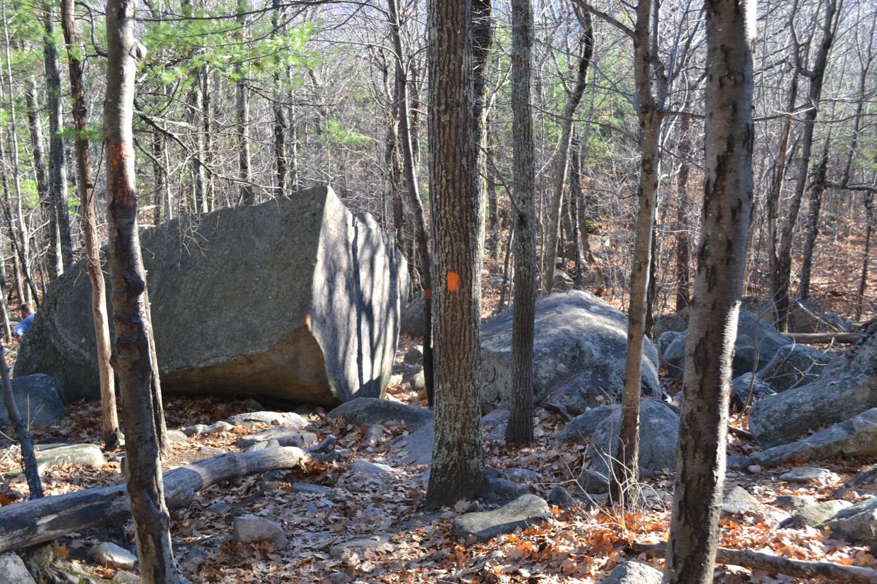
To descend from Mt. Major and complete the loop, find the top of the Boulder Loop Trail, to the south (left, facing up) of the Mt. Major Trail. Follow this trail across the southern ledges and past a small bog before entering the forest. For the first 0.4 miles from the summit, the trail descends at a pleasant grade, crossing more ledges in the forest. After this section, the trail makes a zig-zag, then drops over a very steep and rocky pitch toward the namesake of the trail, an extensive area of the forest with scattered boulders. After 0.2 miles, the steepest part is over, as the trail weaves through boulders and over large, flat rocks. In another 0.3 miles, the descent is mostly over as the trail swings left to join a woods road. In 0.3 more miles, it makes a right turn downhill, then turns left as the trail junctions with Jesus Valley-Beaver Pond Trail. From here, the woods road continues 0.4 miles to the parking area.
Printable directions page