blah blah blah
Appalachia Waterfalls
Length: 2.6 mile loopDifficulty (click for info): Easy
Elevation Gain: 530 feet (loop total)
Rating (click for info): 6/10
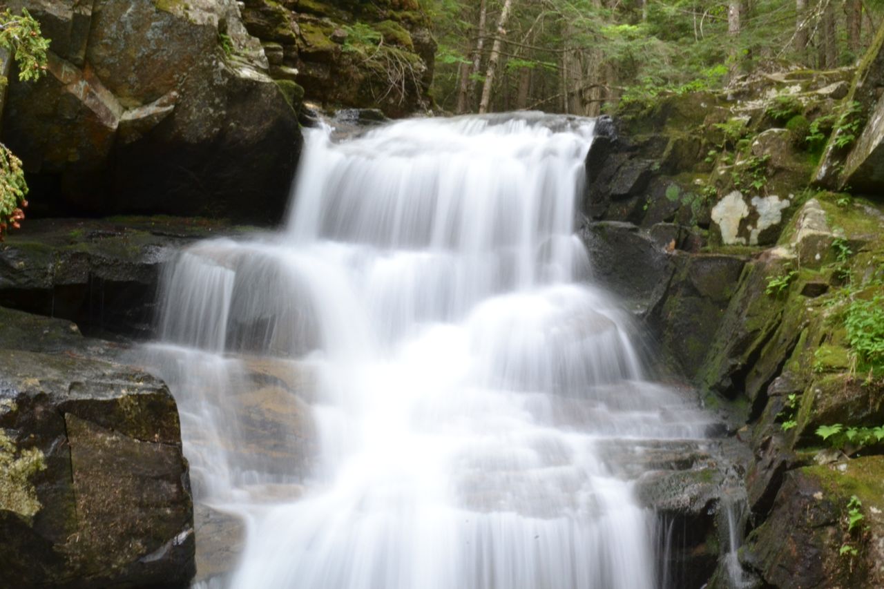
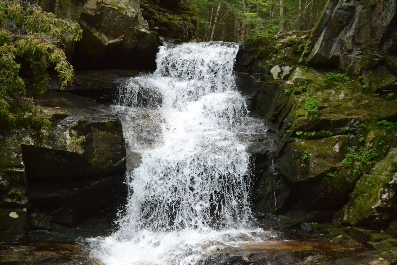
Height: 18' (Gordon), 25' (Salroc), 40' (Tama), and 20' (Coldbrook)
Source: Snyder Brook (Gordon, Salroc, and Tama) and Cold Brook (Coldbrook)
Driving Directions:
Parking area and trailhead are on the south side of Rt. 2 in Randolph, NH, one mile west of Pinkham B (Dolly Copp) Road and 7.1 miles east of the junction with Rt. 115. Look for the large lot with two entrances, which is almost always busy. It is also 5.3 miles west of Rt. 2's western junction with Rt. 16 (in the Upper Village of Gorham). Take note that on popular days and times, parking will overflow onto the sides of Rt. 2 for quite a distance. Click here for a Google Map.
About the Hike:
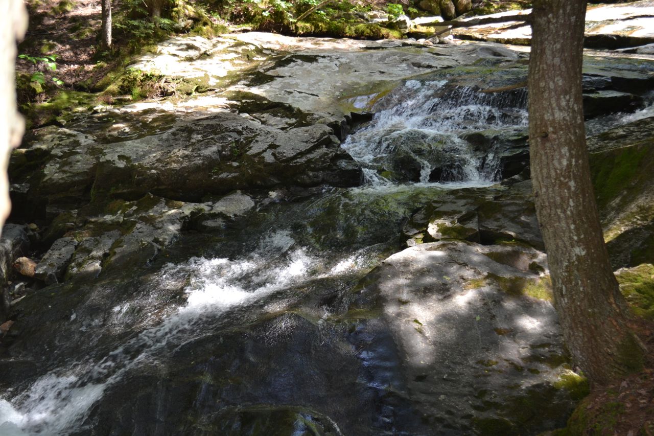
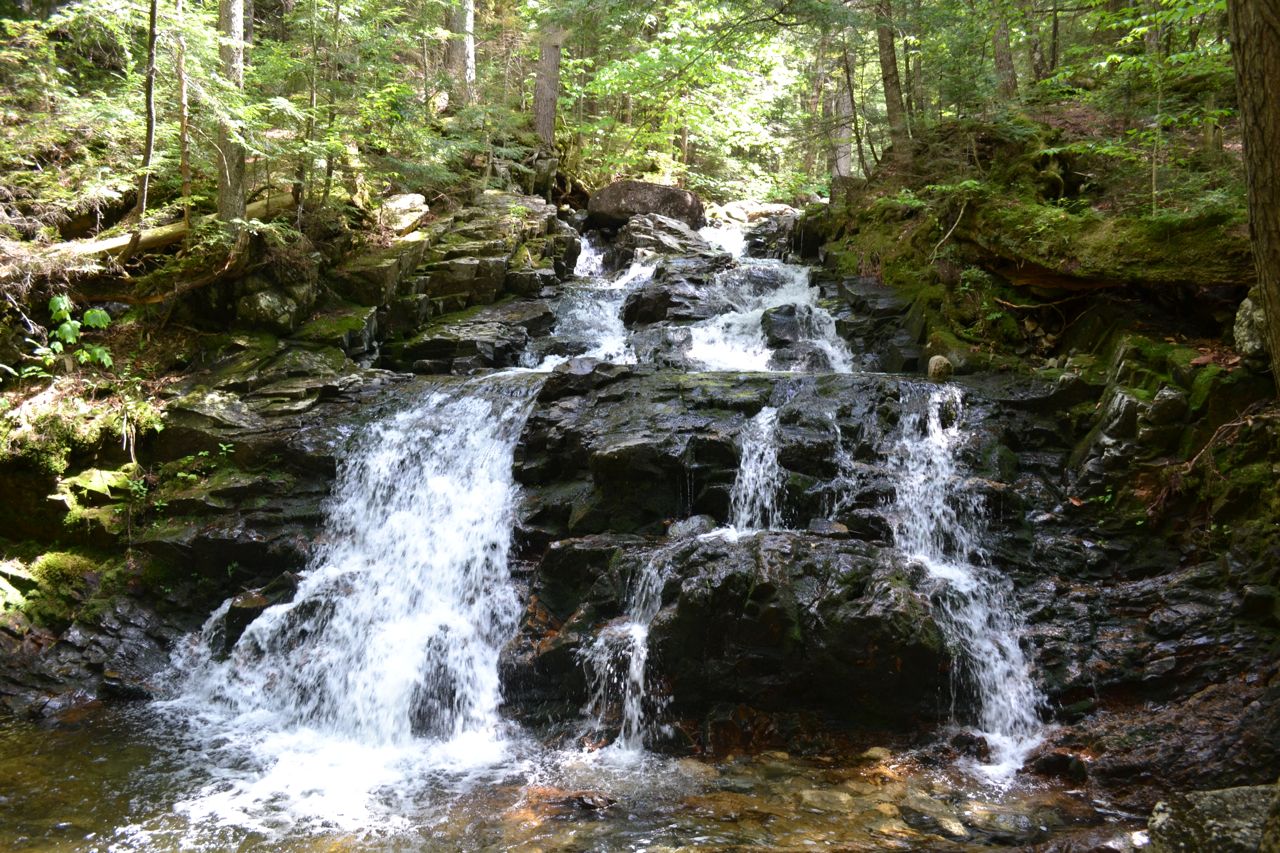
This short hike takes you to four small waterfalls around the bottom of the trail network on the Northern Presidentials. The four are conveniently located in a cluster for easy touring at one of the White Mountains' most popular trailheads for serious hikers. This classic waterfall loop, however, is quite mild and accessible. The trail is mostly level, with a small incline in some parts. The caliber of scenery and the unique character of each waterfall will make this an exciting excursion for anyone. From the parking area, follow the trail from the big kiosk to a junction in a power line clearing. Bear left onto Valley Way, then take the next left onto Maple Walk. Saunter through the verdant forest for 0.15 miles until Maple Walk ends at Fallsway. Turn left and walk a few steps downstream to see the first waterfall, Gordon Fall. This charming waterfall has a two-tiered drop and spreads out over segmented ledges. The magnitude is appropriate for a little mountain stream. Turn around and continue upstream on Fallsway. The trail stays a bit away from the brink, but within view, of the brook and ascends at a reasonable pace. After 0.35 miles, you will reach the second waterfall, Salroc Fall. Signs designate Lower and Upper Salroc Fall. Both are fine cascades, although the upper half is much larger and more graceful, draping over a sloping ledge.
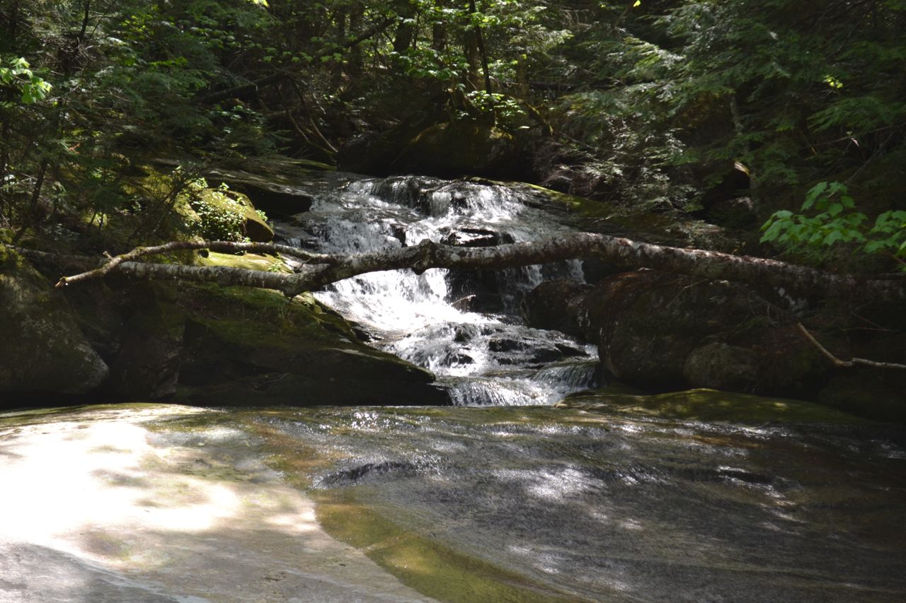
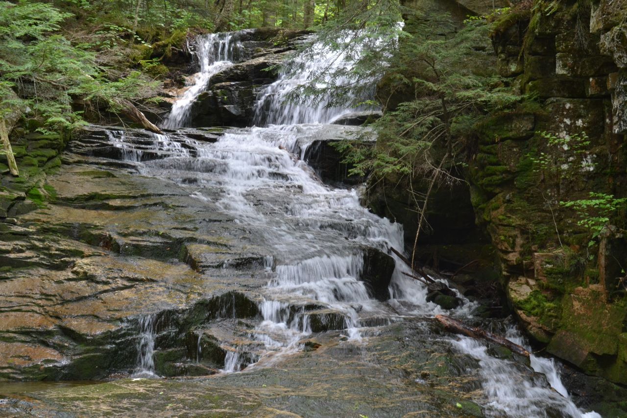
Just above Salroc Fall, the trail intersects Valley Way. The two trails merge for a short distance. Next, bear left back onto Fallsway and continue a short distance to the next waterfall. At an intersection with Brookbank, drop down to Tama Fall, a rushing water slide larger than the first two. Probably the most impressive of the falls on Snyder Brook, it pours down a series of rock steps at an angle beside a buttressing ledge. If you find your way around, views are available from both the bottom and top of the drop. After enjoying Tama Fall, retrace your steps a short distance to Valley Way and bear left to descend on that trail (as opposed to right, which is the way you came up on Fallsway). After a 0.3 mile descent, turn left onto Sylvan Way for a flat walk through the forest. Walk straight across the Air Line in less than 0.1 miles. The trail continues across the lower hillside, crossing under many sap lines on its way. In 0.4 miles, stay straight across another four-way with Beechwood Way. Then in another 0.1 miles, arrive near the highlight of the hike, Coldbrook Fall. The trail swings downhill along the brook and reaches a junction at a wooden bridge. Take note at the junction that to your right leads back to the parking area. Step out onto the bridge. Coldbrook Fall is a voluminous 40 foot plunge surrounded by a mossy and dark environment. Admire the view from Memorial Bridge for a while, then cross it and turn left upstream to approach the waterfall for the best perspective (you will need to bear left on The Amphibrach and then follow the spur trail left to the pool below the fall). After taking in the sights, return back across the bridge and turn left onto The Link. Walk downhill, passing the junction with Beechwood Way and bearing right off a woods road, soon passing a saphouse, where the sweet substance flowing through the plastic lines collects for storage. The Link approaches and parallels the powerlines, making a crossing over a stony brook 0.3 miles from the bridge. After another 0.3 miles of flat walking, at Air Line, one of the major thoroughfares to the high peaks. Turn left and walk back through the power line clearing to the parking lot.
Printable directions page