blah blah blah
Bald Mountain
Length: 2.9 mile loopDifficulty (click for info): Easy
Elevation Gain: 900 feet (+30 feet on descent)
Rating (click for info): 6/10
Elevation: 2033'
Prominence: 758'
Driving Directions:
Trailhead and parking area are on Willard Pond Road in Antrim, NH. Willard Pond Road begins on the northeast side of Rt. 123, 3.3 miles south of its junction with Rt. 9 and 3.7 miles north of its junction with Rt. 137 in the center of Hancock. This dirt road can be narrow and winding in some places. At 0.5 miles, bear left (this turn is more important to watch for on the way out), and then 0.2 miles further, bear left again. At 1.6 miles from the main road, look for the large parking area on the left just after a shack and a row of boulders. Click here for a Google map.
About the Hike:
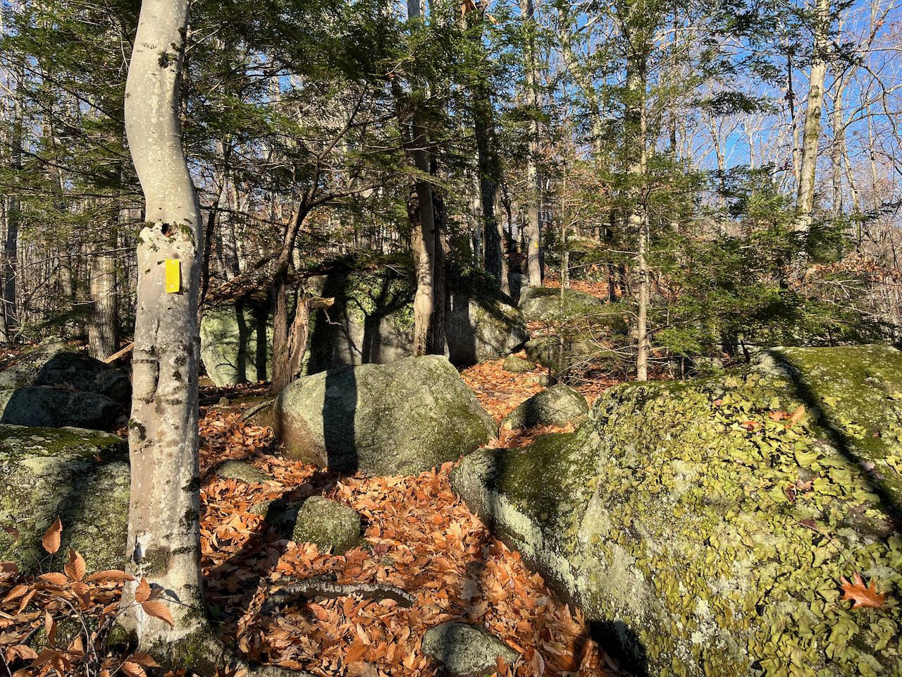
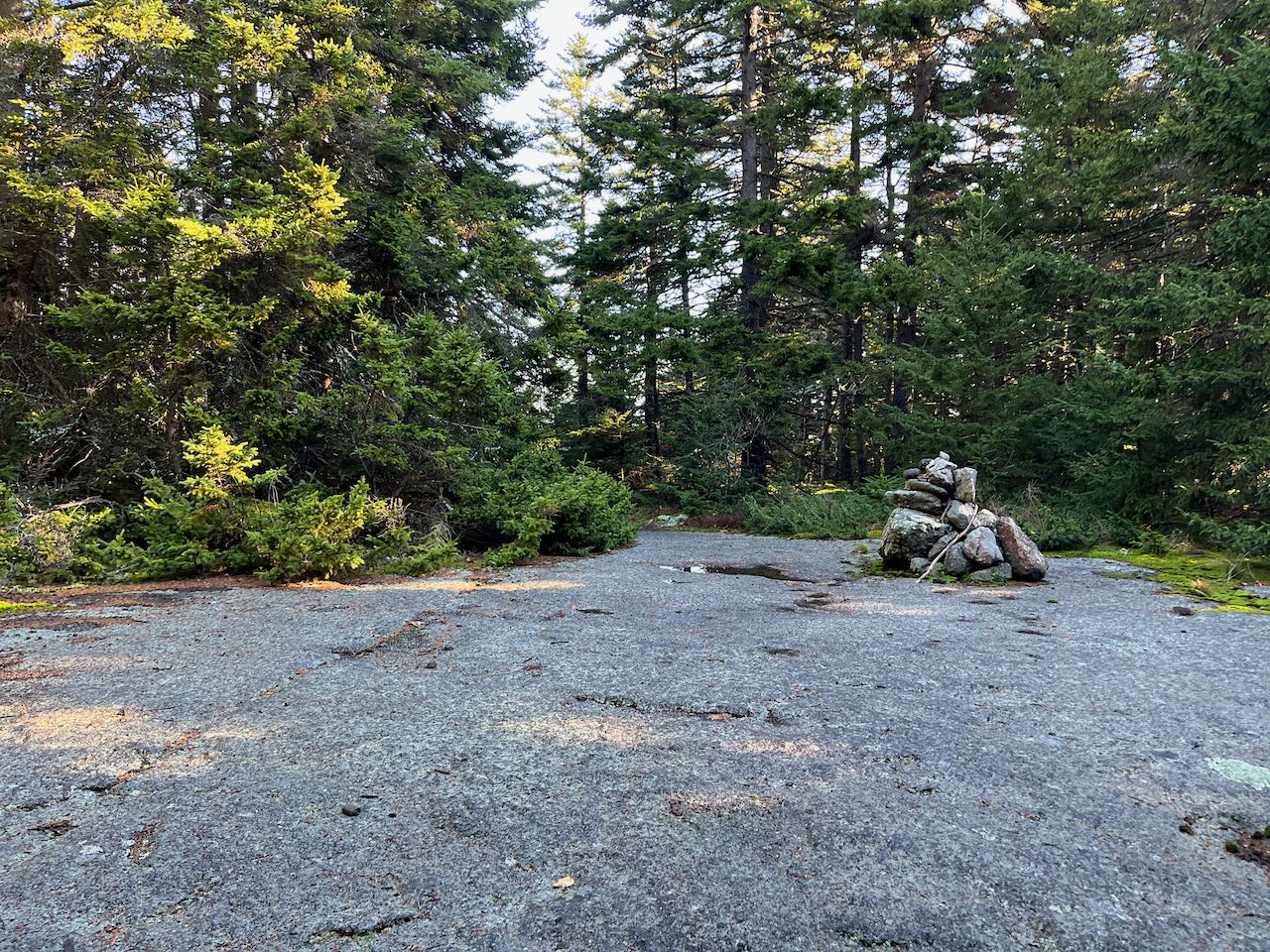
Bald Mountain's ledges, located in Audubon's dePierrefeu-Willard Pond Wildlife Sanctuary, are part of this simple and rewarding afternoon-style hike. The pleasing loop is a standout in southwestern New Hampshire, taking you up to a secluded ledge perch with views over a pond and then rounding out the trek with a walk along the same pond's shoreline. The first part of the trek is on Tamposi Trail, an easy one-mile trail to the top of Bald Mountain, which starts from the back left corner of the parking area. Climbing up an embankment, the trail rises briskly through a wonderland of boulders. After 0.2 miles, it turns right and crosses a stone wall, leveling off a bit. It dips down a bit and leaves the unusual abundance of rocks, then climbs again to reach a trail junction in 0.3 miles more. Bear left at this fork, staying on Tamposi Trail (the labeling on the signs is confusing). Plod steadily uphill for 0.3 miles. After a quick switchback, pass the little-used Spur Trail on the left. At this point, the trail levels off and crosses an abrupt changeover from hardwoods to conifers. Just after that, the trail bends right and ascends more gradually to the top of Bald Mountain. After another right turn up on the plateau, the trail passes over some bedrock at the highest point in 0.3 miles since the last junction. Continue downhill once past the summit, dropping 0.2 miles through the open woods to get to the viewpoint ledges.
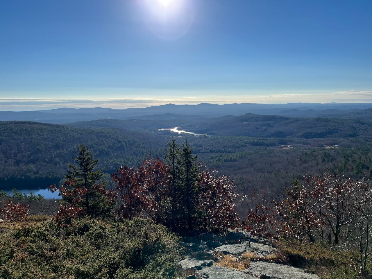
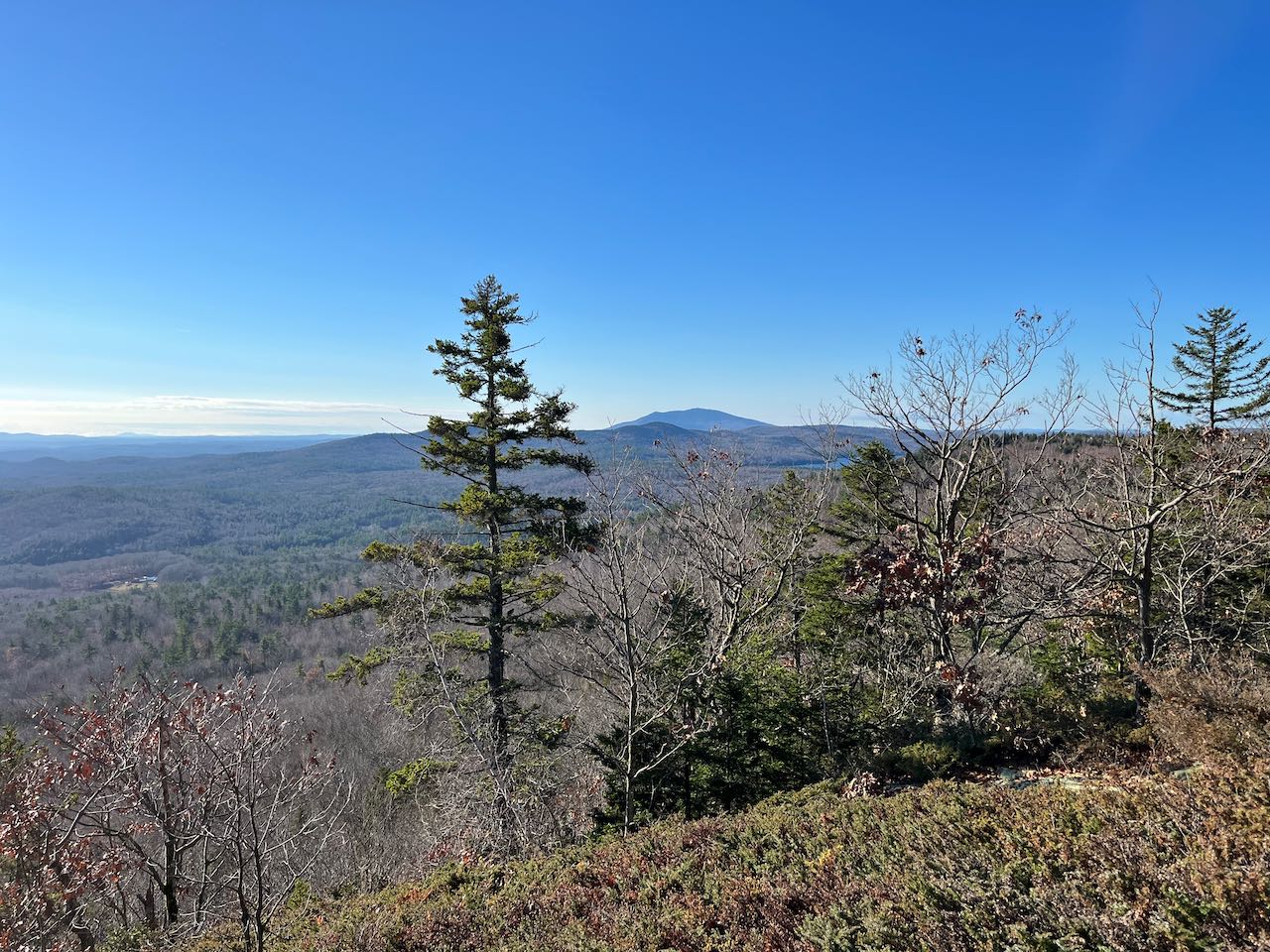
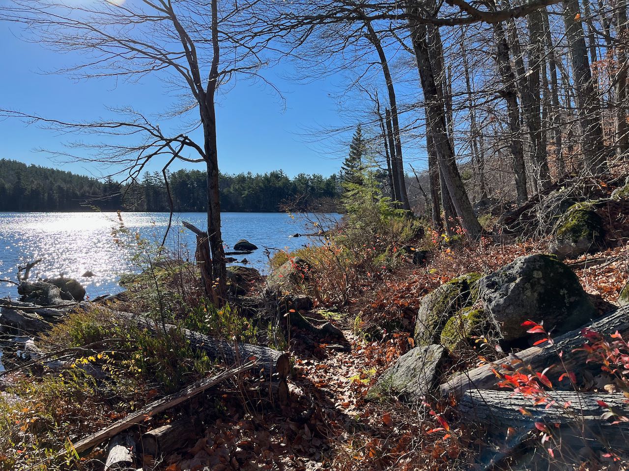
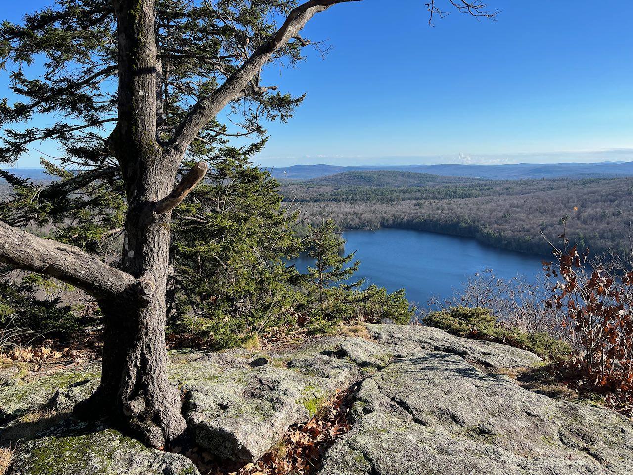
The broad ledges provide an expansive southerly view. The trail will continue down at a diagonal across the opening. To the left, off to the east, Crotched Mountain is the dominant feature, with the smaller Uncanoonuc Mountains seen to its left. Further over to the right, at the end of a long, trailing ridge, are Rose and Winn Mountains. To the southeast, over nearby Carpenter Marsh, are the twin Pack Monadnocks. Smaller summits in the Wapack Range continue to the right, including Temple Mountain and Barrett Mountain. Further in the distance, Wachusett Mountain stands by itself. More to the southwest through the trees, Mt. Monadnock rises behind the rolling ridge of Skatutakee and Thumb Mountains. After enjoying the ledges, head another 0.2 miles steadily downhill to reach a grassy overlook which provides a beautiful closer view of Willard Pond. You can also see further to the north, toward a wind farm over on Tuttle Hill. Bear left as you walk through this clearing, leaving Tamposi Trail, which closes its loop to the right, onto Bald Mountain Trail. The trail drops quickly, cutting across the hillside for just over 0.1 miles to cross a little drainage. It then descends through more boulder-filled forest for 0.4 miles, crossing some stone walls, to an intersection with Tudor Trail. Turn right to approach the shoreline of Willard Pond. The trail hugs the water's edge closely, passing many pretty viewpoints over the water, with nearby Goodhue Hill in the background. In 0.7 miles, emerge on Willard Pond Road and turn right to walk 0.1 miles back to the parking area.
Printable directions page