blah blah blah
Devil's Slide
Length: 1.6 miles out-and-backDifficulty (click for info): Moderate
Elevation Gain: 620 feet (+20 feet on return)
Rating (click for info): 6/10
Elevation: 1695'
Prominence: 478'
Driving Directions:
Trailhead and parking area are on Northside Road in Stark, NH. From Rt. 110 in the center of Stark (6.8 miles east of Rt. 3 in Northumberland), cross the Stark Covered Bridge and turn left onto Northside Road. Drive 0.8 miles and look for a wide, unmarked dirt pull-off on the right side of the road. It can be difficult to spot; after you cross the railroad tracks, there is an open field on the left side on the road - the pull-off is right across from where trees come between the road and the field. Click here for a Google map.
About the Hike:
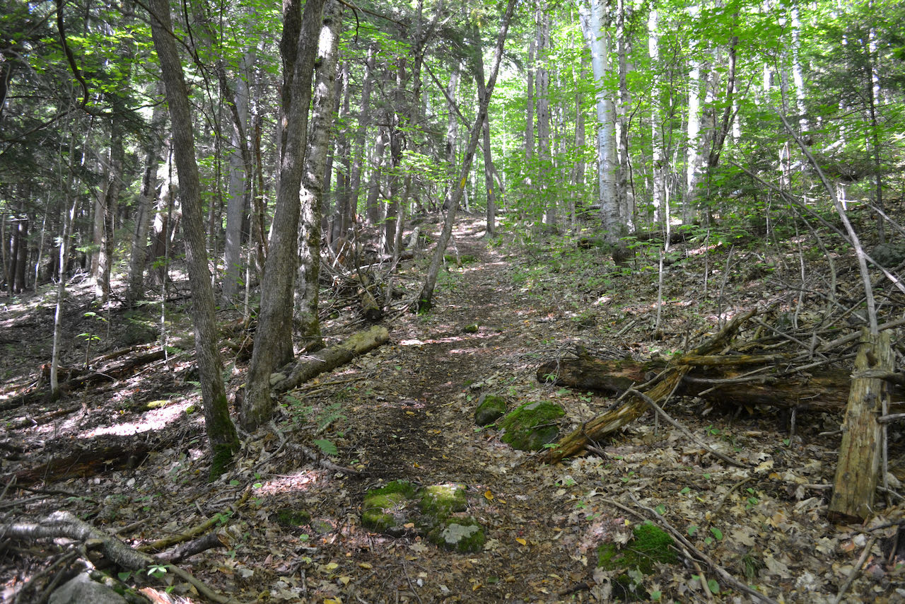
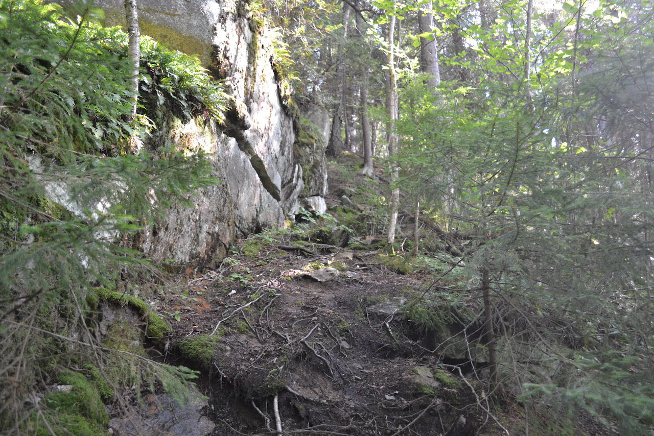
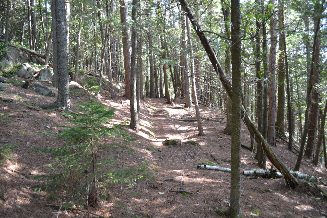
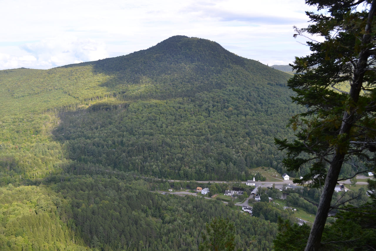
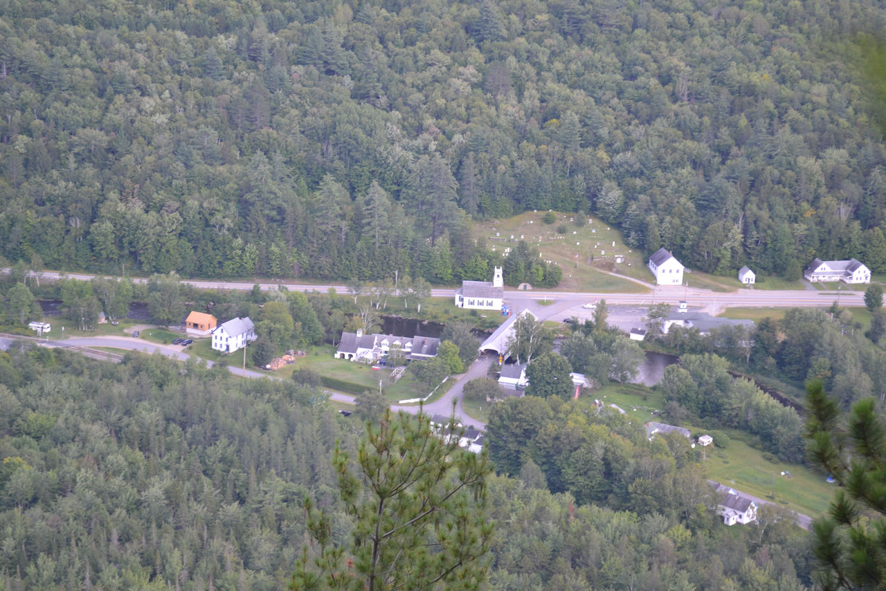
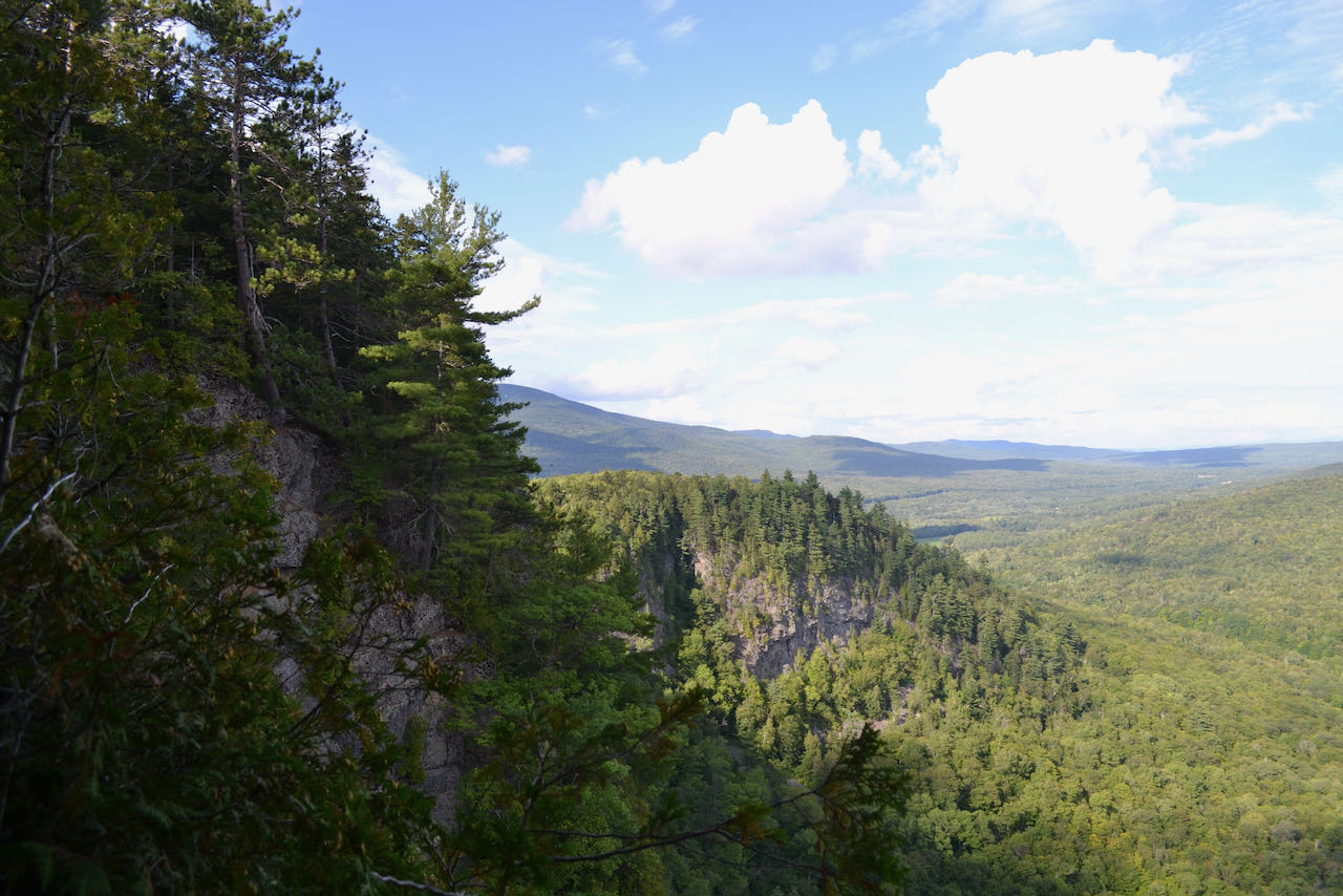
Devil's Slide is the menacing cliff which forms the backdrop for the town center of Stark. As picturesque as it is imposing, everything in downtown stark lives in its shadow. The small, curved ridge which houses the huge cliffs lies within the property of the Forest Society's Kauffmann Forest. Views from the top of the ridge can be accessed by a local, semi-official trail which ascends from the west. Be aware that the trail is not maintained by an official authority, and may require attention to navigate. Start your hike from the unmarked pull-off, and walk into the woods on a narrow path indicated by surveyor's flags. The trail ascends gradually up a minor ridge through open hardwoods for 0.2 miles; this initial section may be the most difficult to follow, so watch attentively for trail markings. At a junction where another path comes in from the right, turn left and continue upward as the trail becomes steeper and more defined. The trail is marked with yellow blazes as it climbs moderately, curling around to the north side of the summit. After about half a mile, the trail makes a sharp switchback and ascends parallel to a ledge band on the reverse side of the cliffs. It soon shoots uphill through a break in the ledges, then runs around the summit easily, passing just beneath the highest point and emerging at a perch directly over the cliffs (be careful not to approach to close to the drop-off). The most impressive feature of the view is the cliff itself. As you gaze east over the valley of the Upper Ammonoosuc River, it rises impressively alongside you. Straight ahead, you can enjoy a unique birds-eye view over the quaint Stark village, with the Stark Covered Bridge as its centerpiece and the lazy river bisecting the town. Mill Mountain rises directly behind.
Printable directions page