blah blah blah
Franconia Falls
Length: 6.8 miles out-and-backDifficulty (click for info): Easy
Elevation Gain: 420 feet (+60 feet on return)
Rating (click for info): 6/10
Height: 30'
Source: Franconia Brook
Driving Directions:
Trailhead and parking area are on the Kancamagus Highway in Lincoln, NH. Park at the very large Lincoln Woods Visitor Center parking, on the north side of the road, 5.1 miles east of Rt. 93 at exit 32. Look for the entrance immediately after crossing the bridge over the east branch of the Pemigewasset River. On busy weekends, parking spills out to the roadside along the Kancamagus Highway, in which case a connecting path can be walked from the west side of the bridge to the start of the Lincoln Woods Trail. Click here for a Google map.
About the Hike:
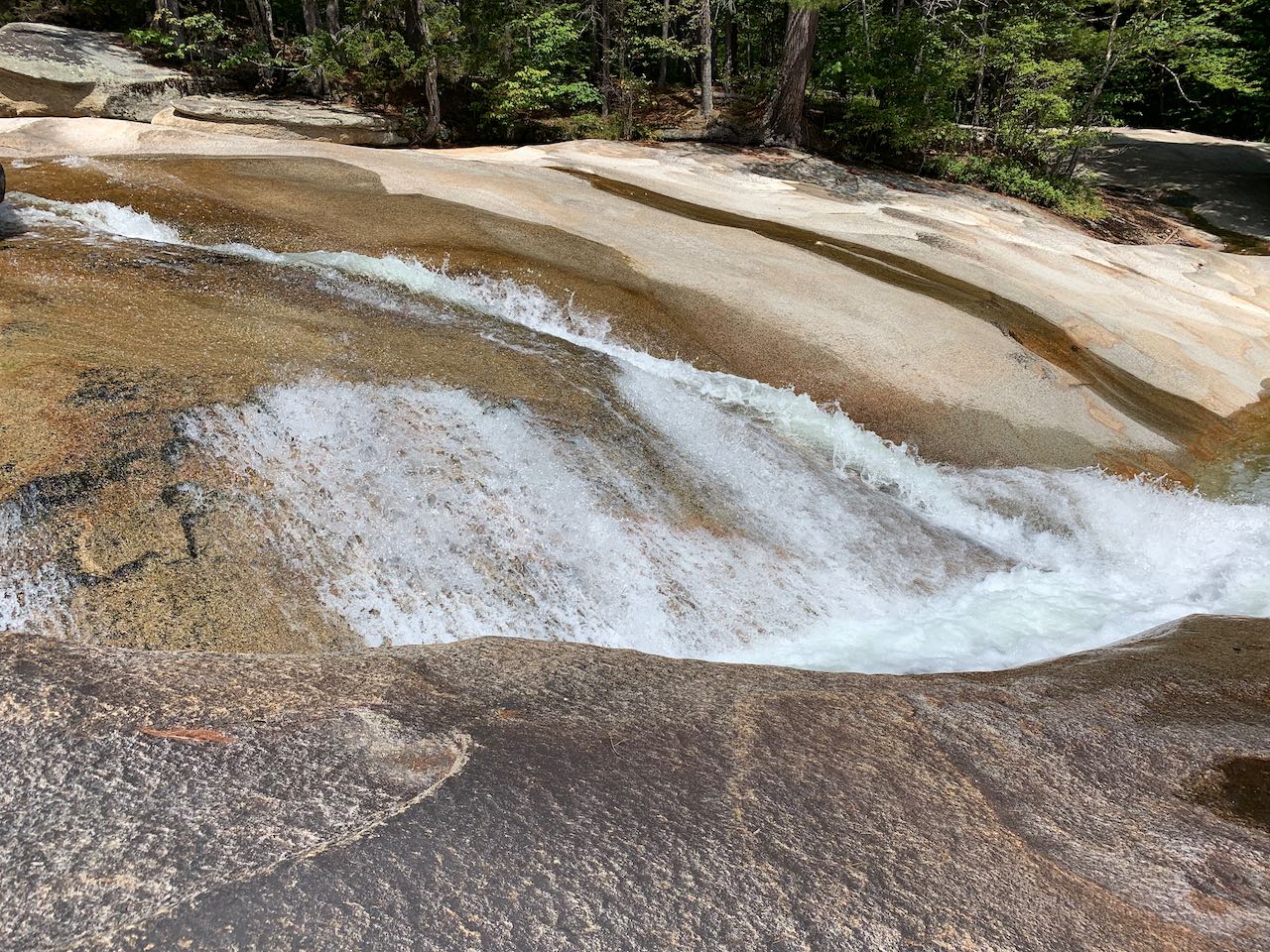
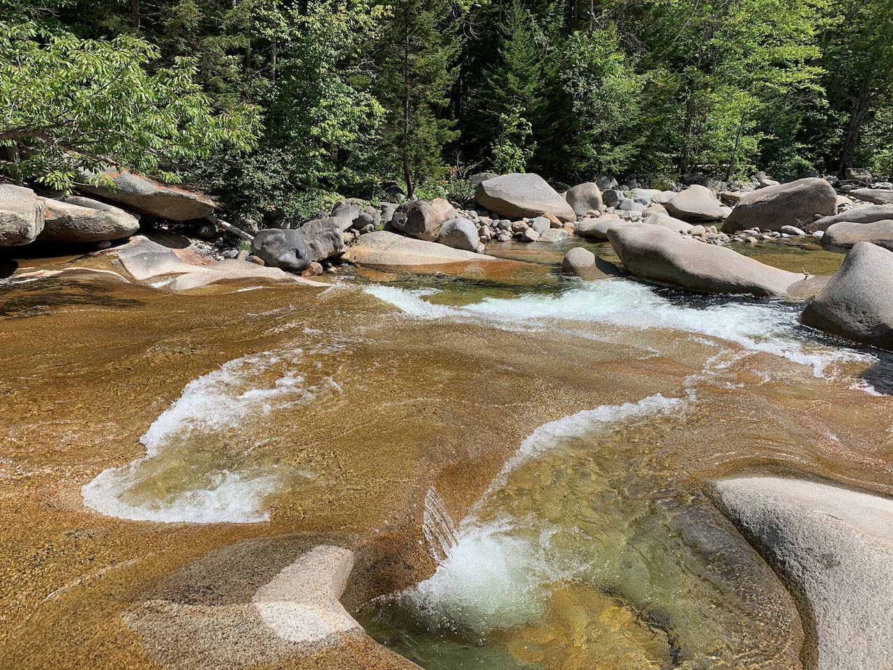
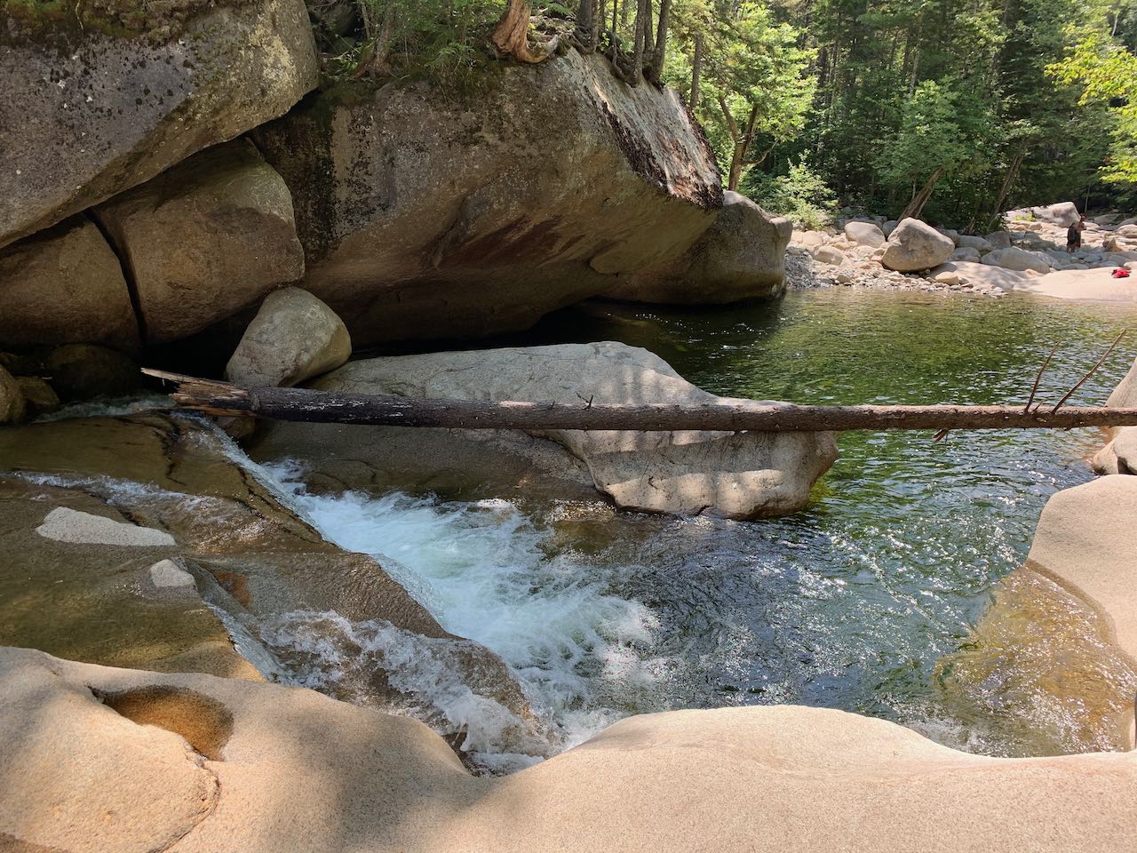
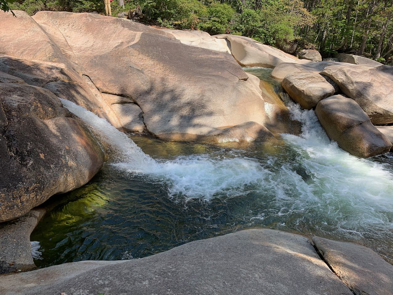
As probably the prime attraction at the eminent Lincoln Woods trailhead, where thousands of hikers visit every week to adventure into the remote Pemigewasset Wilderness for long camping trips or day hikes to isolated summits, rivers, and waterfalls, Franconia Falls has the allure of being an easy-to-reach destination that's lauded for being a fun, family-friendly natural waterpark. Similar to other White Mountain cascade chains like Diana's Baths, Franconia Falls is a series of splashing cascades across expansive, smoothed-out ledges. The string of plunges, fans, potholes, and chutes captivates everyone from waterfall enthusiasts to the beach-going type who seek a place to relax with water and sun. On hot summer weekends, crowds may set up all across the rock and play in the water, having reached the area on foot or on bicycle via the historical Lincoln Woods Trail. Visit midweek and early mornings to beat the crowds.
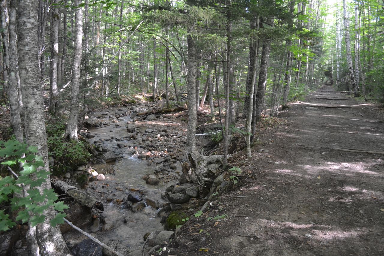
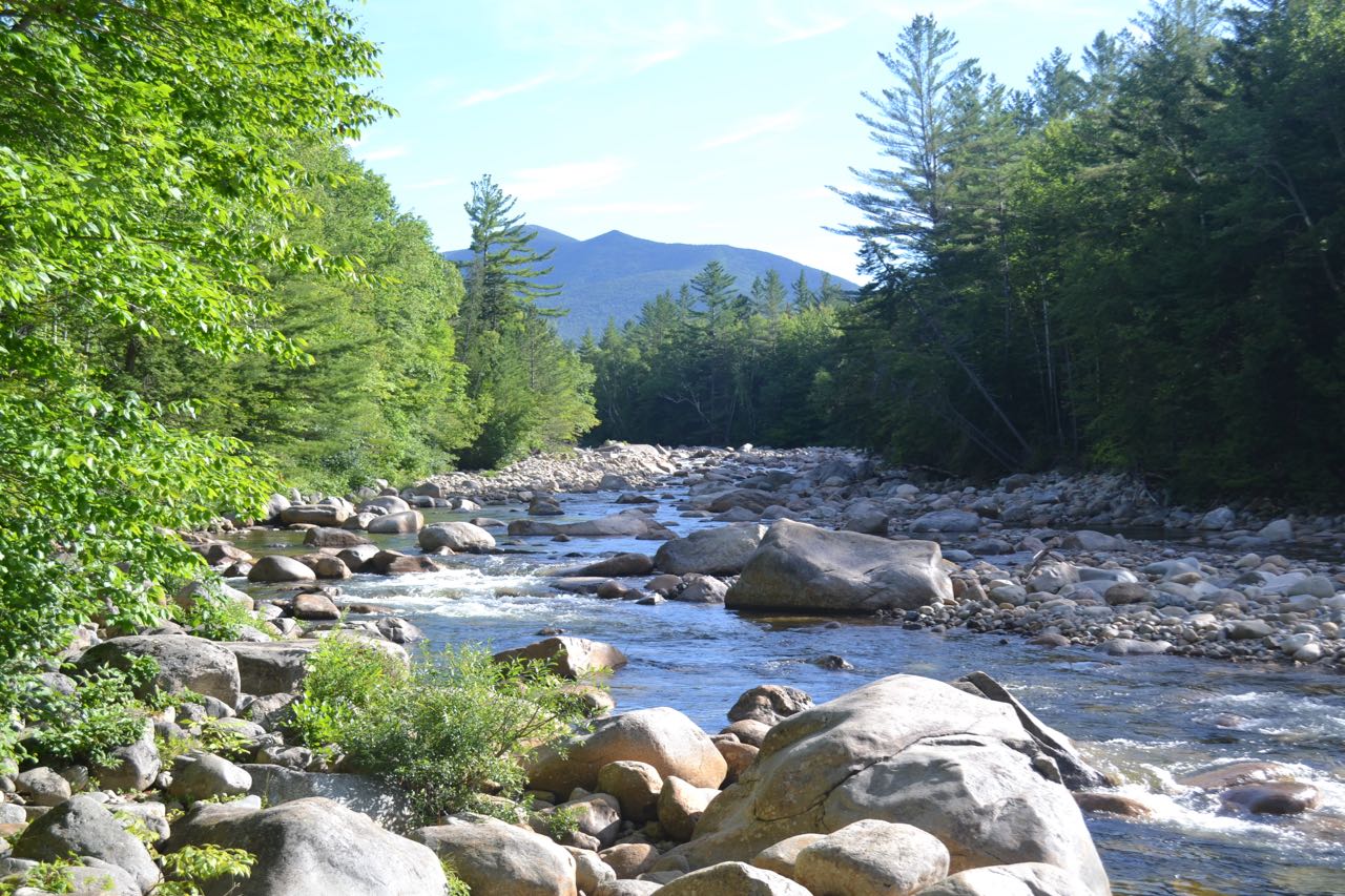
The long walk begins at the Lincoln Woods parking area. Walk to the end of the parking area and onto the deck of the visitor center. Turn left at the trail signs and walk down the stairs onto a gravel connecting path. Turn left, then right and cross the iconic suspension bridge over the East Branch of the Pemigewasset River, a much larger and wilder waterway than the "main" branch of the Pemigewasset River. On the other side, turn right and follow the very wide and flat Lincoln Woods Trail as it follows the East Branch on the bed of an old logging railroad, last operated in 1948. The first mile is mostly over graded surface, but soon after, the pathway becomes studded with railroad ties. At 0.7 miles, the trail goes along a fence atop a washed-out bank, which provides a nice spot to look out over the river. Just beyond, the trail passes over Osseo Brook as it drains into the East Branch and proceeds to parallel it. The trail continues next to Osseo Brook for 0.6 miles before the brook diverges to the left, followed by the Osseo Trail. At this junction is an informative sign about logging artifacts which may be found in the forest. Just after this, the trail passes a clearing from a logging camp on the left. In another 0.2 miles, the trail reaches its second viewpoint over the river, next to a long piece of rail. Bondcliff's south spur rises prominently above the river, with the summit of Bondcliff to its left. The trail then crosses Birch Island Brook on a bridge and continues very straight for 0.9 miles. After this section, Black Pond Trail goes left. A short distance past this, two signs mark a 200-foot interval where hikers are given the opportunity to measure their stride. Franconia Falls Trail goes left soon after (0.3 miles since Black Pond Trail), and Lincoln Woods Trail crosses a bridge over Franconia Brook built around the remains of a railroad trestle. The boundary of the Pemigewasset Wilderness is just beyond. It's worth walking out onto the bridge for the view of Franconia Brook as it merges into the East Branch. Walk back before the bridge and follow Franconia Falls Trail. The path meanders in proximity to the brook over a gentle, well-used surface. After 0.4 miles through the woods, the path comes out to the first of the expansive, splashing ledges that make up Franconia Falls. At this point, you can continue on the trail along the brook side or just follow the open rock upstream. The official path continues another 0.1 miles up the brook past a wide array of cascades and pools across weathered and smoothed rock. The trail ends at a sign adjacent to a round pool and cascade underneath an overhanging cliff.
Printable directions page