

blah blah blah
Frankenstein Cliff
Length: 2.6 miles out-and-backDifficulty (click for info): Hard
Elevation Gain: 980 feet (+100 feet on return)
Rating (click for info): 7/10
Elevation: 2134'
Prominence: 0'
Driving Directions:
Trailhead and parking area are on Arethusa Falls Road in Harts Location, NH. Arethusa Falls Road leaves the west side of Rt. 302 14.5 miles southeast from its junction with Rt. 3. The road is well marked with state park signs. It is also 3.4 miles beyond the Willey House, travelling south, and just past the Dry River Campground. There are two parking areas a short distance up this road. The lower parking area is larger and serves as the overflow for the upper parking lot, which fills up rapidly. The Arethusa Falls Trail begins at the upper parking area. Click here for a Google map.
About the Hike:
Frankenstein Cliff is a prominent sight for travelers coming through Crawford Notch from the south. It's a smaller cousin to the imposing cliffs of Mt. Willard further north. The name of the rock formation has no connection to Mary Shelley's monster but instead honors Godfrey Frankenstein, a German painter who would often stay in Crawford Notch and create works of the local sights. From the open ledge at the top, you will have a grand view over the region past the south end of the notch. You'll enjoy some rugged mountain scenery, both from the view at the top and with the impressive cliffs on the way up.
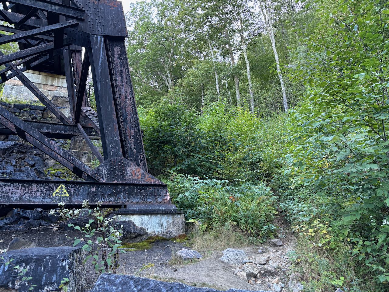
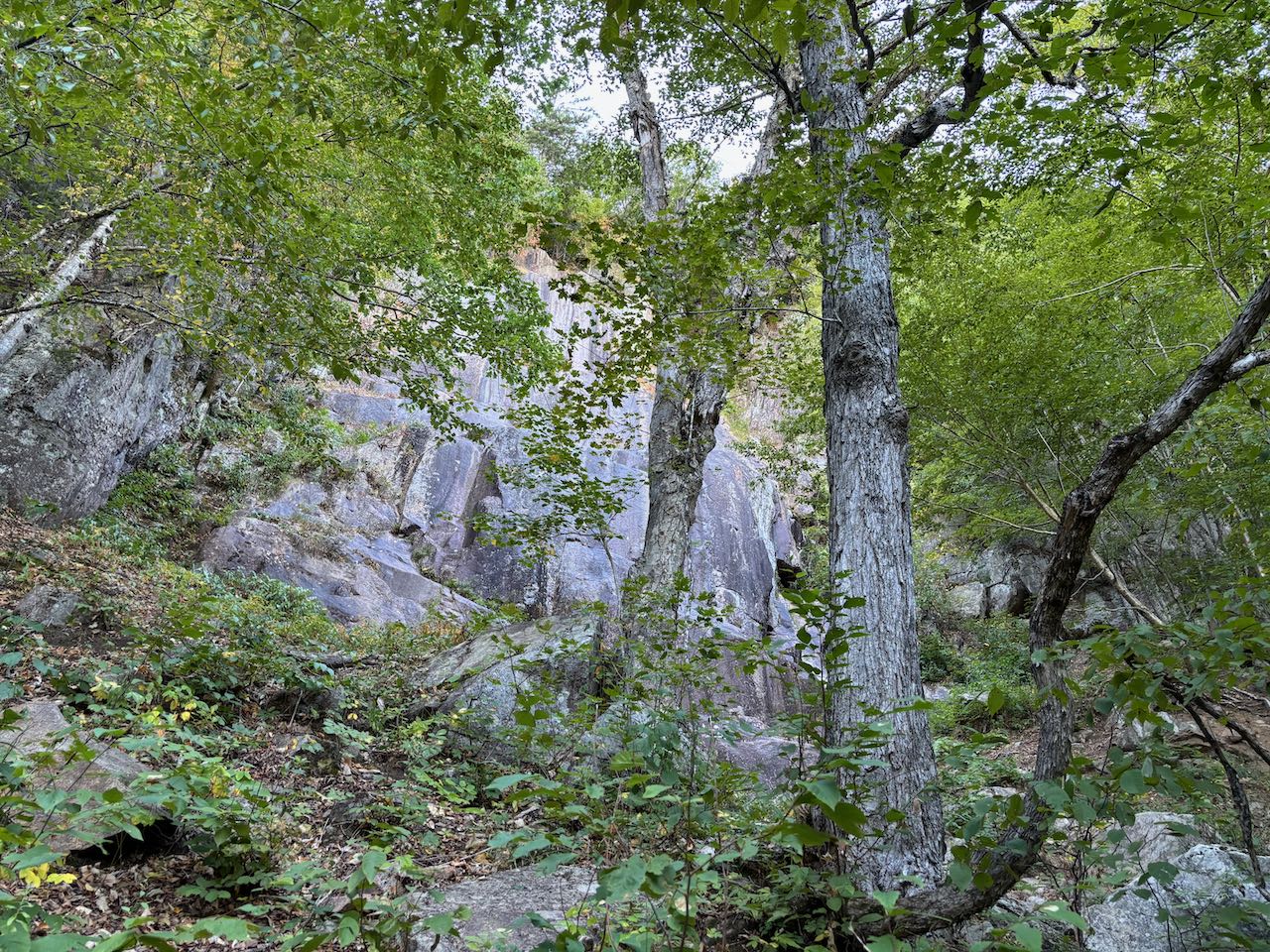
Start your hike from the Arethusa Falls trailhead, where the trail takes off from the right side of the upper parking lot. If you had to park in the overflow lot down lower, you can take a connecting trail that also leaves from the far end and joins the main trail not far in. The trail heads across the hillside through open hardwood forest and some stones here and there following yellow blazes. It crosses a small brook, then passes a junction with Frankenstein Cutoff coming in from the steeper and rockier slope below to the right. The trail parallels the tracks of the Conway Scenic Railroad as it runs past the cliffs high above to reach a point where it can ascend around the precipitous slopes. It then descends slightly so it can cross beneath the railroad at the Frankenstein Trestle. Here, 0.3 miles from the junction, it turns left and passes beneath the impressive structure. Watch for the trail carefully as it bears left and heads up a narrow path through the brush. Now heading into much steeper terrain, the trail climbs straight uphill with boulders all around. Sections of the trail can have loose, gravelly footing. With a looming cliff wall ahead, the trail makes a switchback around to the left and turns right to cross a gully beneath a large rock wall after 0.2 miles. Signage warns of falling ice in this area if you visit earlier in the spring. After climbing out of this, the trail grade improves and it makes a gradual turn back to the left to climb diagonally across the hillside instead of straight up. The forest remains bouldery as the trail crosses past the top of the cliffs you climbed through, with a couple zig zags. In 0.4 miles, after entering an area where the forest is sparse from damage from a 2022 forest fire, the trail swings back to the right and heads up toward another ledge band. It makes a tricky climb through the middle of the mini cliff. At the top, it turns back to the left and heads to the top of the outlook ledges in 0.1 miles.
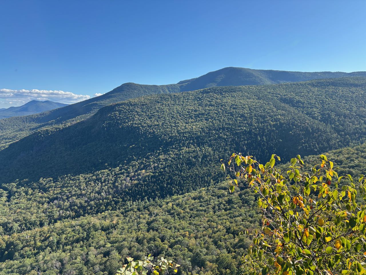
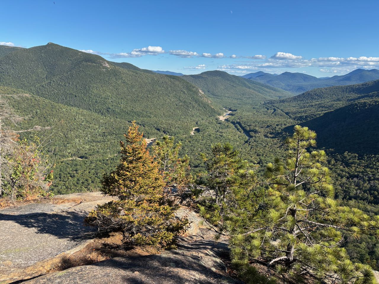
The view from the cliff is very nice. To the left, you can see the rugged peaks of the lower Montalban Ridge - the "Giant Stairs" rock formation on Stairs Mountain, Mt. Resolution, Crawford Dome, and the rocky knob of Mt. Crawford. The view straight out takes in the gentle Saco River valley, with the river itself to the left and the cut swaths of Rt. 302 and the railroad running through it. To the left of the valley is Mt. Hope, with part of the Attitash Mountain ridge to the left. Straight out beyond the end of the notch are more peaks in the Moat Range - Bear Mountain on the left, followed by Bartlett Haystack and Mt. Tremont. Poking up between Bear and Haystack is the rocky pinnacle of Mt. Chocorua, and between Haystack and Tremont is the northeast peak of Mt. Paugus. To the right, close at hand, is the broad, bulky Mt. Bemis. Looking all the way to the right into the valley of Bemis Brook, you can see the upper portion of Arethusa Falls emerge from the trees. Beyond the cliffs, the trail continues to the top of the hill, where it meets Arethusa-Ripley Falls Trail, making it possible to hike a loop down past Arethusa Falls of about 5 miles. More cool views of the rock face can also be found just slightly up the trail as it stays close to the cliff edge in the burned area.
Printable directions page