blah blah blah
Mt. Squam and Doublehead Mountain
Length: 5.3 miles out-and-backDifficulty (click for info): Hard
Elevation Gain: 1760 feet (+340 feet on return)
Rating (click for info): 7/10
Elevation: 2218' (Squam) and 2153' (West Doublehead)
Prominence: 235' (Squam) and 124' (West Doublehead)
Driving Directions:
From the north side of Rt. 113, 8.4 miles northeast of Rt. 3 in Holderness and 3.4 miles west of Rt. 109 in Sandwich, take Thompson Road, a narrow dirt road with mailboxes at the entrance just west of a curve and guardrail. Drive 0.9 miles up the road to a moderate-size parking area on the left side, staying straight past a logging road diverging right at 0.6 miles. Click here for a Google map.
About the Hike:
Notice: The trails described here are among a set of trails maintained by the Squam Lakes Association which are closed annually for mud season. The trails remain closed for at least a month starting from snowmelt.
The Lakes Region is abundant with popular mountain hikes where the objective is a stunning view of one or more of the area's significant waterbodies, and some have received attention to the point of overuse. Crowds can often diminish the hiker's exuberance at experiencing a thrilling vista. One hike around the Squam region, in the mountain range of the same name, which does not receive its due attention is Doublehead Mountain. It competes with the ever-popular Morgan-Percival Loop, just down the road, and clearly loses the battle of preeminence, which to most explorers of local delights, is a wonderful thing. The summit view is similar in many ways to Mt. Morgan, with an open south-facing ledge with a spectacular panorama of the lakes and a more limited northern view just a short walk beyond. The hike utilizes the same well-cared for SLA trail network, and is a managable ascent of just over a mile and a half, with a healthy dose of rockiness near the top. This extended hike loops in Mt. Squam to the trek, including a ridgeline saunter across remote-feeling terrain with a good mix of views and ledges. The extra effort allows access to unique viewpoints in different directions.
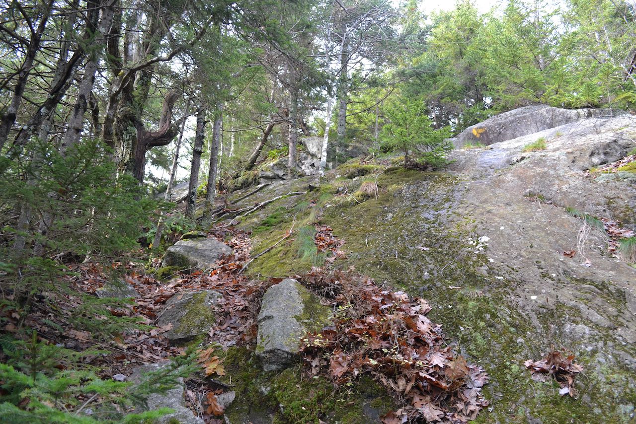
From the parking area, cross the road and follow the sign into the woods along a wide corridor. Ascend along the edge of a cleared field for 0.1 miles, at which point you can access the center of this picturesque field, where a view of Squam Lake and the Belknap Range presents itself framed with a few solitary tree trunks and a weathered stone wall. The trail, designated by plastic yellow diamonds, continues to rise gently through increasingly young deciduous forest, with just a little rockiness underfoot. In a quarter mile, the trail swings to the right and then makes a few s-curves, crossing a set of seasonal streams. The trail then straightens out and directs itself toward the slope of the mountain, accelerating its climb, making a right bend after 0.65 miles up through a rocky gully. In this final attack to the first viewpoint, the trail navigates up through the rock-strewn mountainside for 0.1 miles, making a couple of jogs back and forth, to emerge onto a sunny, south-facing ledge with an unobstructed view across the Lakes Region.
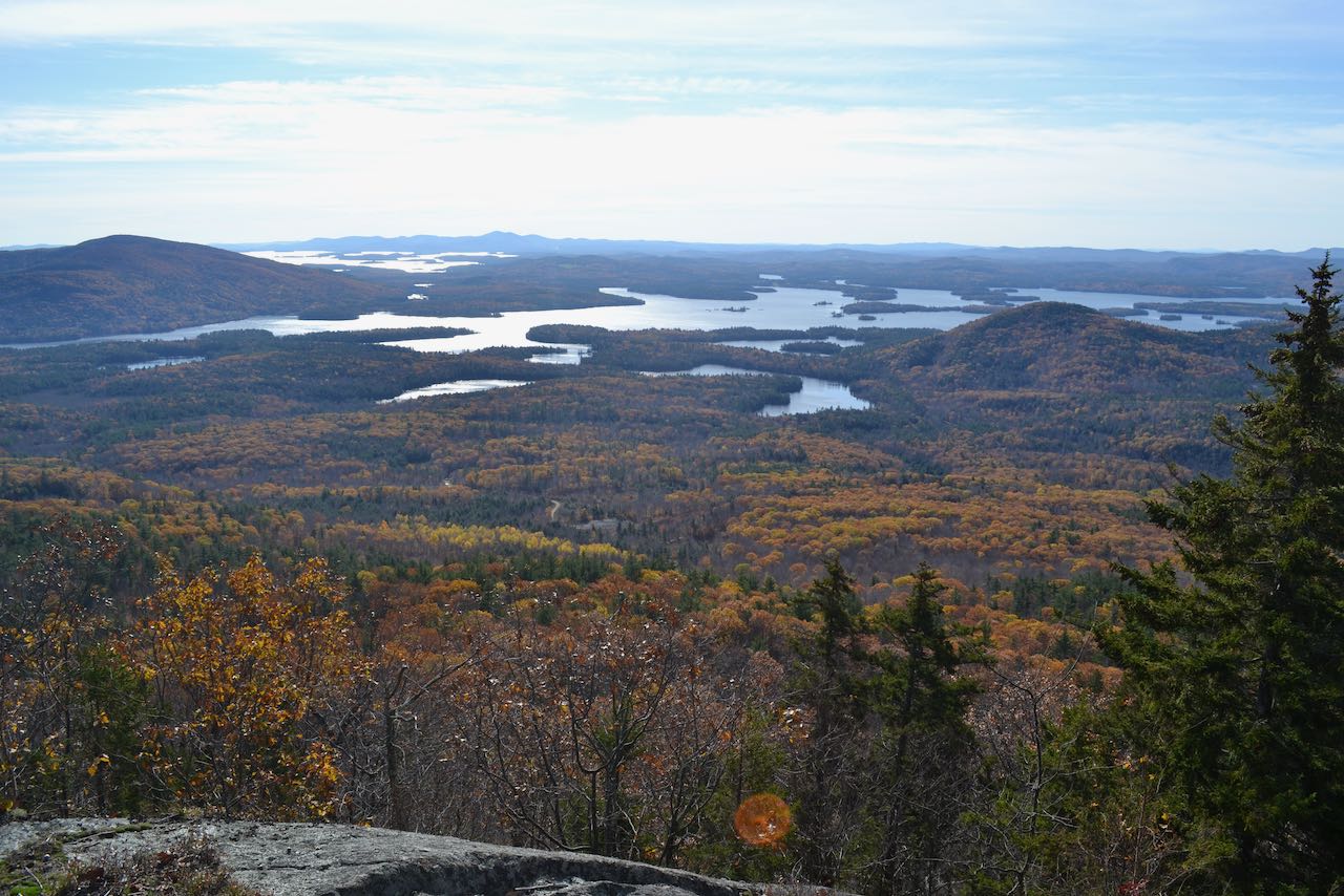
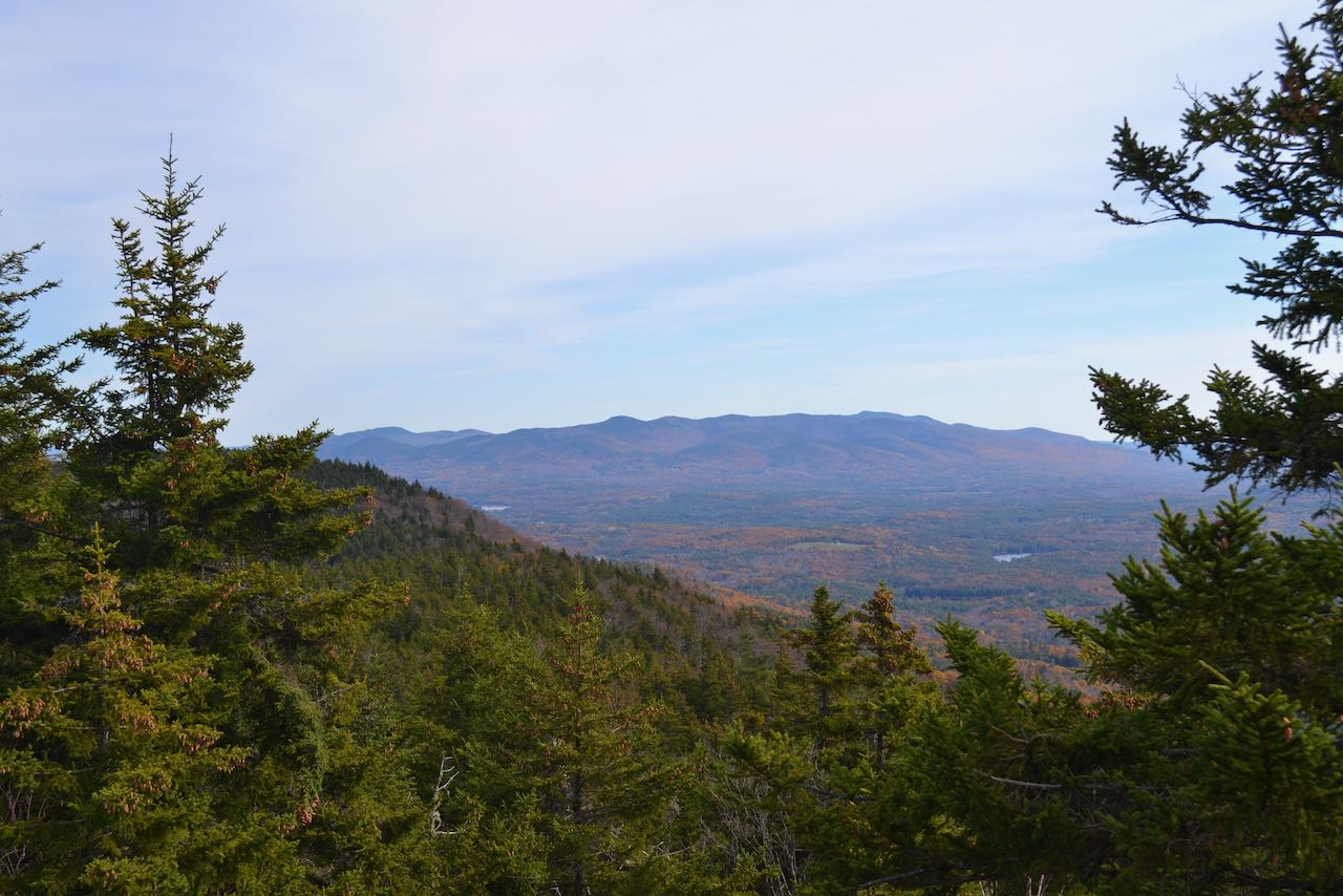
The comfortable rock seating offers a panoramic survey of the lakes and mountains of central NH. All the way to the left, you see the circular, self-contained Ossipee Range. Across the valley, the lower, smoother Red Hill rises amidst the sprawling appendages of two of the state's most major lakes, Squam and Winnipesaukee. The profile of the more distant Belknap Range is seen to the right of Red Hill, behind the lakes. Closer by, at the right side of Squam Lake, are the twin humps of the Rattlesnake Mountains. Beyond the western one afar is the jagged ridge of Hersey Mountain, the triangular Mt. Kearsarge, and Ragged Mountain to its right. The broad hillside of the Squam Range extends to the west from where you are, with Mt. Webster being the largest and most noticeable feature. In a small gap to the right of Mt. Webster, between it and the cliff-faced Mt. Morgan, you can glimpse distant Mt. Cardigan, left, and Tenney Mountain, right, with closer up Mt. Prospect in the middle. After taking in the day's finest view, continue up the trail as it follows the ledge, then swings left and climbs up more ledge in the forest and passes through a garden of mosses and lichens to arrive at the Crawford-Ridgepole Trail. As its name implies, there are two minor summits to Doublehead. The slightly better view is found less than 0.1 miles to the right of this junction, where a rock ramp provides a view centering on the ledge-splotched ridges of Mts. Welch and Dickey and the Kinsmans behind them.
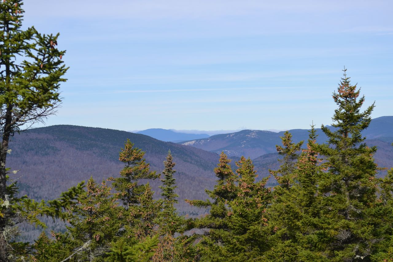
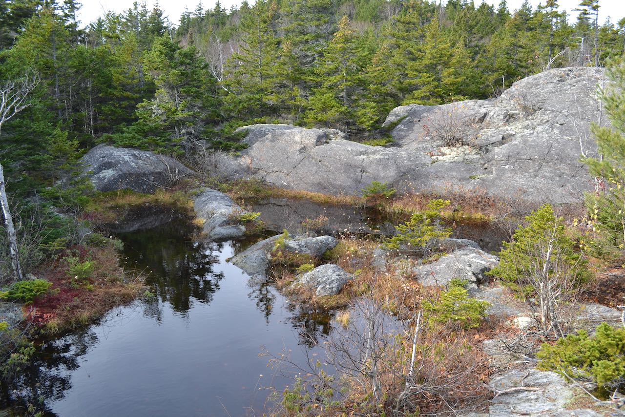
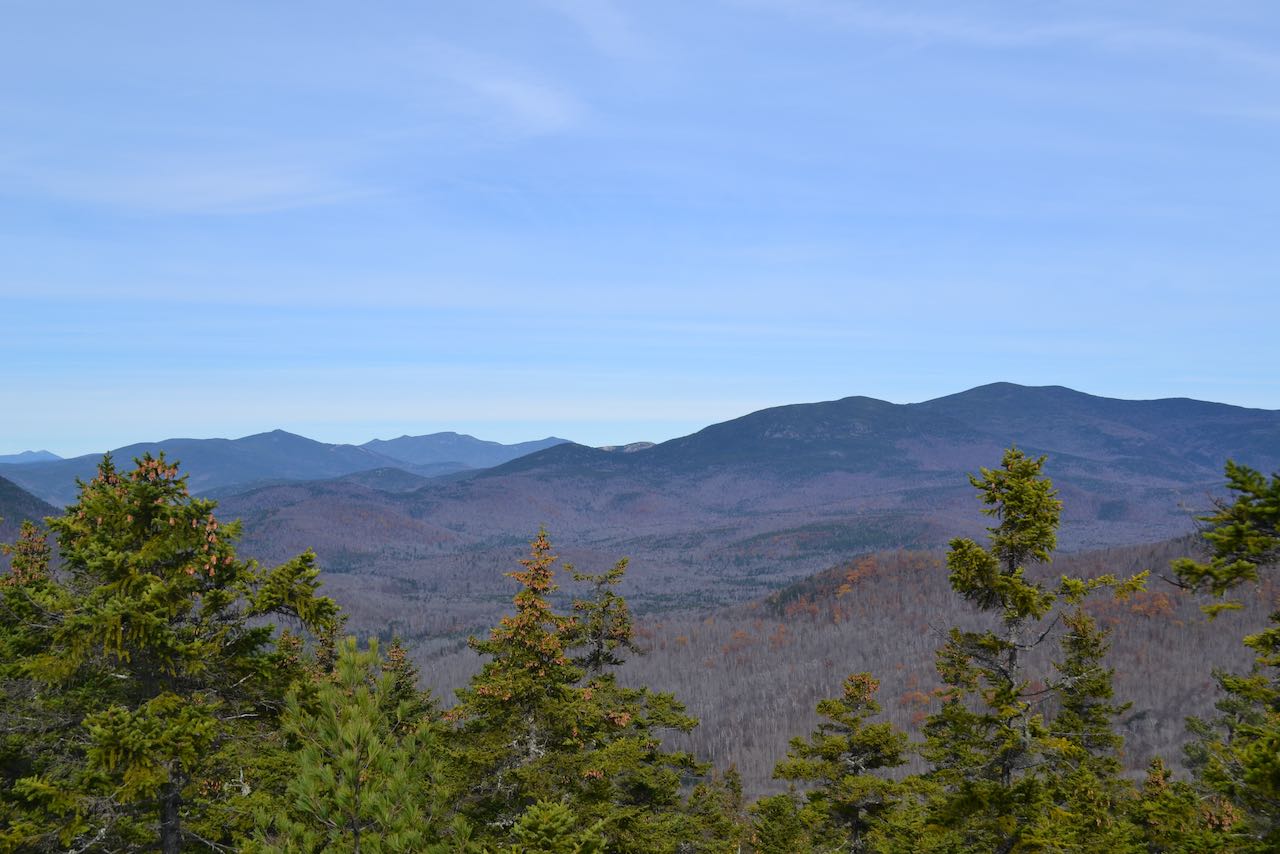
To continue to Mt. Squam, you must first cross over the western summit of Doublehead. Head back to the junction and continue straight on the Crawford-Ridgepole in the other direction, dipping down briefly and climbing up to semi-open ledges in 0.1 miles, where you can view over the treetops past the broad arms of nearby Mt. Weetamoo to such features as Carr Mountain and Mt. Moosilauke. From here, the trail descends through dark spruce woods, climbs over a ledgy mound, and drops into a potentially muddy col after 0.3 miles. The trail may require careful attention to find and follow through here; it generally stays straight through the col and attacks the hike's most difficult section right from the low point. The trail clambers up and around a mossy ledge, then crosses a flatter area on the ridge for a quarter mile and climbs up along the bottom edge of the next rock face to reach a great viewpoint with a similar perspective as the one on Doublehead, but with a better view of the valley to the west of the Rattlesnakes. From here, the trail continues over easier terrain, through the woods for 0.2 miles and then back out onto a more expansive open area with great views to the north, which is the highlight of the trek to Mt. Squam. The official path hugs the left side of the ledges; watch for cairns and other markings to keep track of it, but stray off on the rock on the right hand side for the best views. A rugged mountain vista opens up for you, starting with a view beyond the side of Mt. Israel and a small ledge-covered hill called Sandwich Notch Road Hill out toward Sandwich Range 4000-footer Mt. Whiteface and its eponymous southern cliff. The center of the view is the gentle giant Sandwich Dome, with its trademark double summit and sprawling ridges, including pointy Jennings Peak on its left side, with the rocky Sachem Peak behind. Next to the left is grand Mt. Osceola and East Osceola, and Mt. Tecumseh to their left, with the Waterville Valley Ski Area trails visible. All the way to the left and further away are the lofty summits of the Franconia Ridge. Passing a sub-alpine bog, the trail dips back into the woods and runs flat briefly before making the final climb to the pointy rock which forms the nominal summit. A nice view of the Ossipee Range and part of the lake view seen from previous outlooks is had here. The true highest point is a knob 0.15 miles further along the trail to the west, which tops out only a few feet higher. No exciting views are found here, but summit purists will want to give it a visit.
Printable directions page