blah blah blah
Square Ledge (Pinkham Notch)
Length: 1.1 miles out-and-backDifficulty (click for info): Easy
Elevation Gain: 410 feet (+20 feet on return)
Rating (click for info): 6/10
Elevation: 2421'
Prominence: 16'
Driving Directions:
Trailhead and parking area are on Rt. 16, in Pinkhams Grant, NH, 11.8 miles north of its northern junction with Rt. 302 in Conway and 10.6 miles south of its eastern junction with Rt. 2 in Gorham. There is a very large parking area on the west side of the road at the AMC Pinkham Notch Visitor Center. Click here for a Google map.
About the Hike:
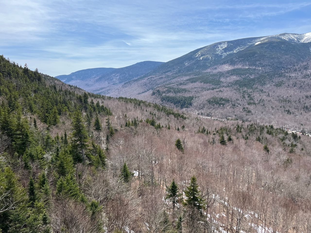
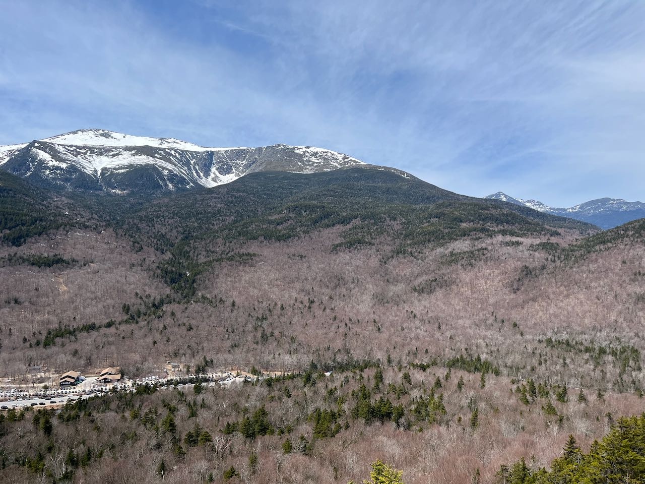
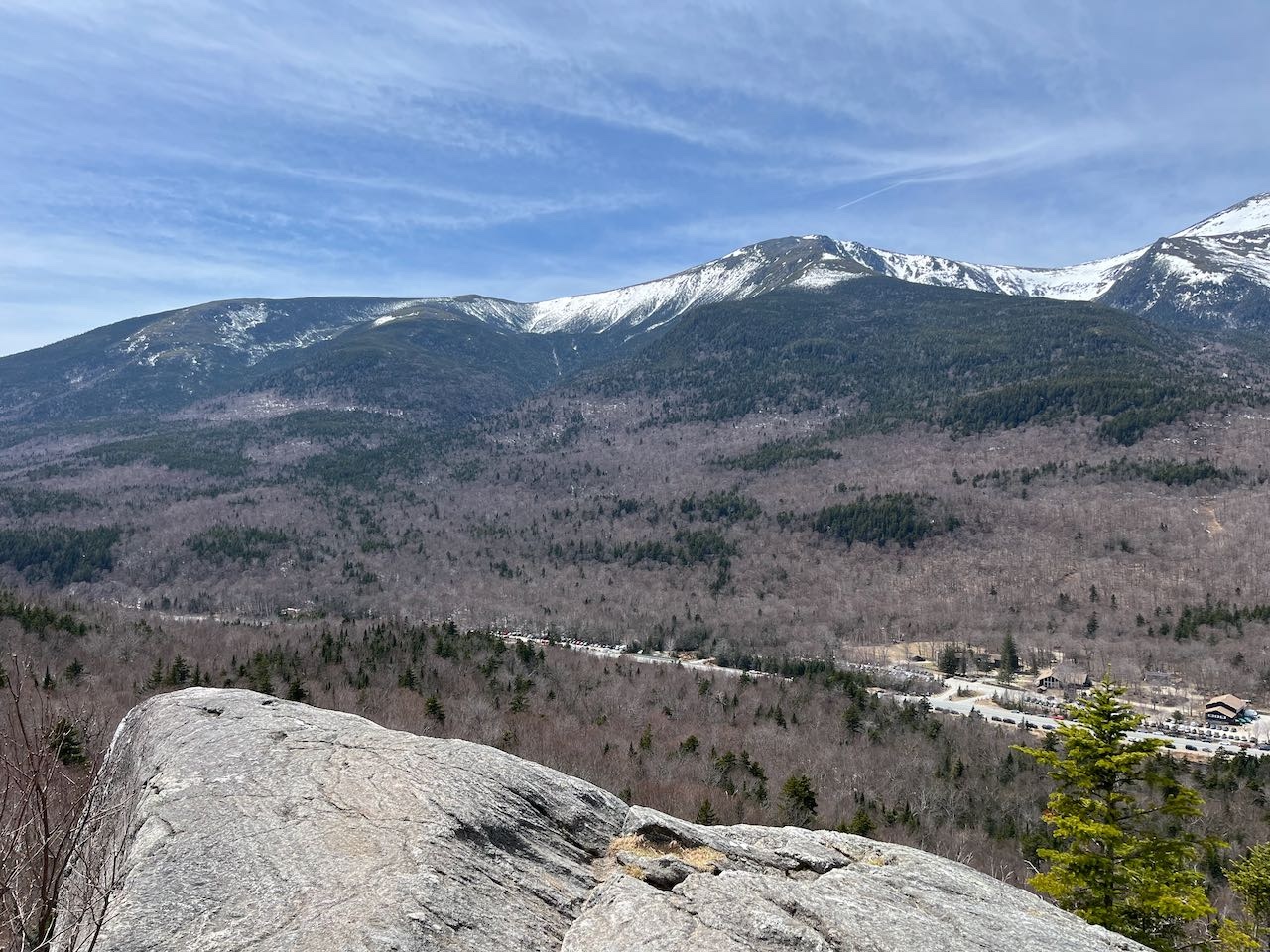
This rock outcropping on the low slopes of Wildcat Mountain, not far from the ski trails, offers a unique close-up view of Pinkham Notch and is one of the more accessible hikes in the area, with lots of reward for the effort required to reach it. The flat-topped rock above the cliff shows off a striking view into the great ravines of Mt. Washington. The short half-mile trail to the top offers just a bit of high mountain ruggedness while still being fairly welcoming for a quick adventure.
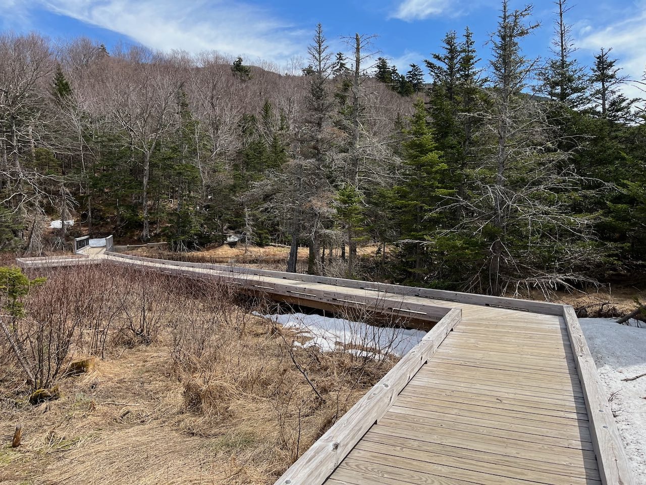
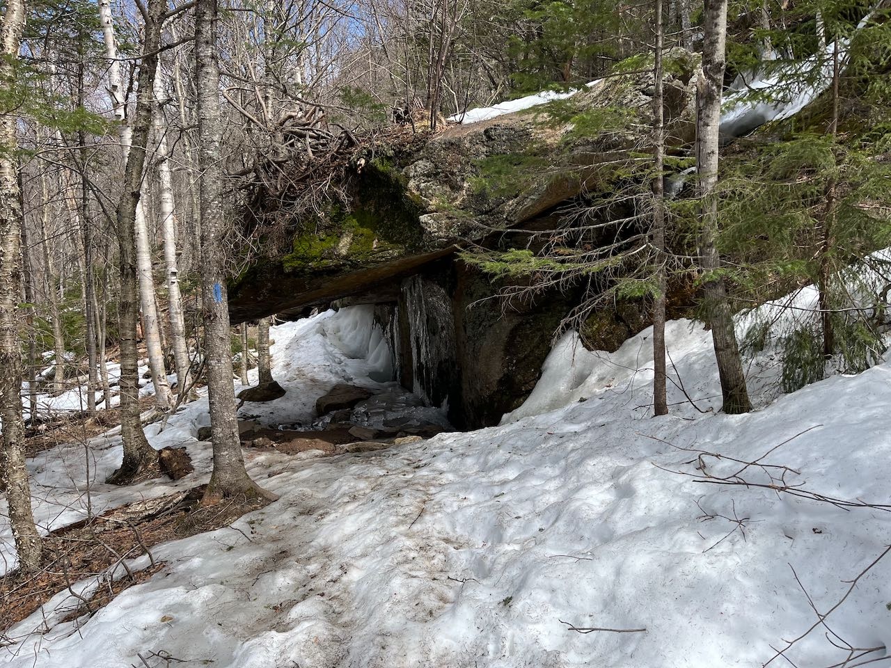
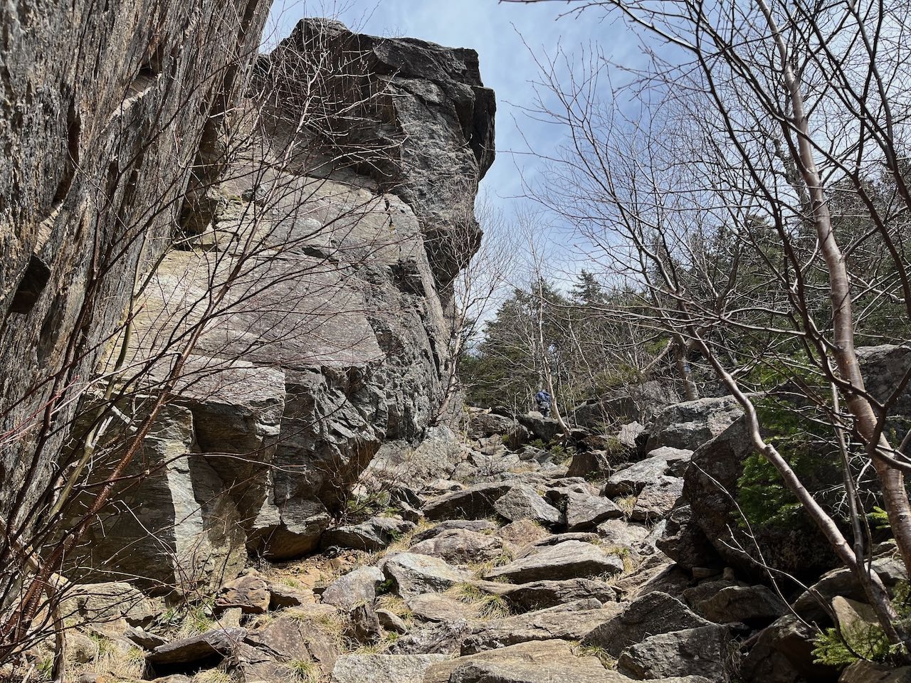
From the visitor center parking area, walk out the entrance and cross Rt. 16, then turn right and walk a short distance to the clearly marked trailhead for Lost Pond Trail. Cross the marsh at the headwaters of the Ellis River on a broad boardwalk with nice views across the water to some of the rugged features around the notch. Head into the woods and immediately bear left onto Square Ledge as the main trail turns right. The trail climbs up a stony pitch and reaches a junction after 0.1 miles. On the left, a path leads a short distance out to "Ladies Lookout", a narrow opening in the trees facing Mt. Washington. The view here is nothing of note. Continue on the main trail as it crosses a cross-country ski trail and heads uphill moderately for another 0.1 miles. It then swings to the left and traverses across the hillside for 0.15 miles, passing beneath Hangover Rock, a flat-bottomed boulder that protrudes out over the trail. The trail then swings back uphill, steepening as it approaches the ledge, visible through the trees ahead. With 0.15 miles to go to the top, the trail comes right out to the base of the jagged cliffs, an impressive sight to see up close, which are popular with rock climbers. Climb up right alongside the rock wall on a steep natural staircase of rocks. The trail swings around through the woods behind the cliffs and rises to the top. Though not far above the notch floor in elevation, the views are quite open. They primarily face Mt. Washington, whose ravines are placed on full display, especially Huntington Ravine, where you can see each crevasse on the sharp cliff walls. To the left, you may be able to see Raymond Cataract, a huge off-trail waterfall below the Lion's Head formation. The interior of Tuckerman Ravine is partially visible. Further over past Boott Spur, the other major ravine is the Gulf of Slides. All the way to the left on the Washington mass past another smaller valley is the broad ridge of Glen Boulder. Out the notch to the left, you'll see the Rocky Branch Ridge. On the right side of Mt. Washington, you can see over to the sharp peaks of Mts. Adams and Madison.
Printable directions page