Arethusa. Ripley. Avalanche. Sabbaday. Waterfall enthusiasts know these as some of the big names in our state. Most of New Hampshire's grandest wateralls require just a modest effort to view and enjoy. Plenty, though, are favorably positioned to attract attention right on the side of the road. The popular White Mountains driving tour, which involves driving the parkway through Franconia Notch, Rt. 3 into Twin Mountain, 302 down through Crawford Notch into Conway, and back to Lincoln on the Kancamagus Highway, introduces tourists to several of the most prominent and easy-to-visit ones. If you're a dedicated waterfall hunter, you'll make no distinction between a cascade on the side of the road and a deep-woods cataract where the price of admission is a nine-mile slog into the wilderness (Thirteen Falls, anyone?). The magnificence of the natural forces and the photogenic opportunity are what you're after. And there are also those who would be interested in taking in the awe-inspiring scenery of kinetic water by opening their car door and could do without the hike. So in the interest of completeness, you will find this to be a comprehensive guide to the waterfalls of New Hampshire that you can drive to. Some are famous tourist attractions, and some are small-town secrets, but all are worth a visit for their natural beauty. They're listed in alphabetical order here. For more waterfalls with ease of access, try searching our library of hikes for waterfall hikes of beginner difficulty. This list covers waterfalls you can view with very little or no walking, but some of the beginner waterfall hikes are not much more difficult!
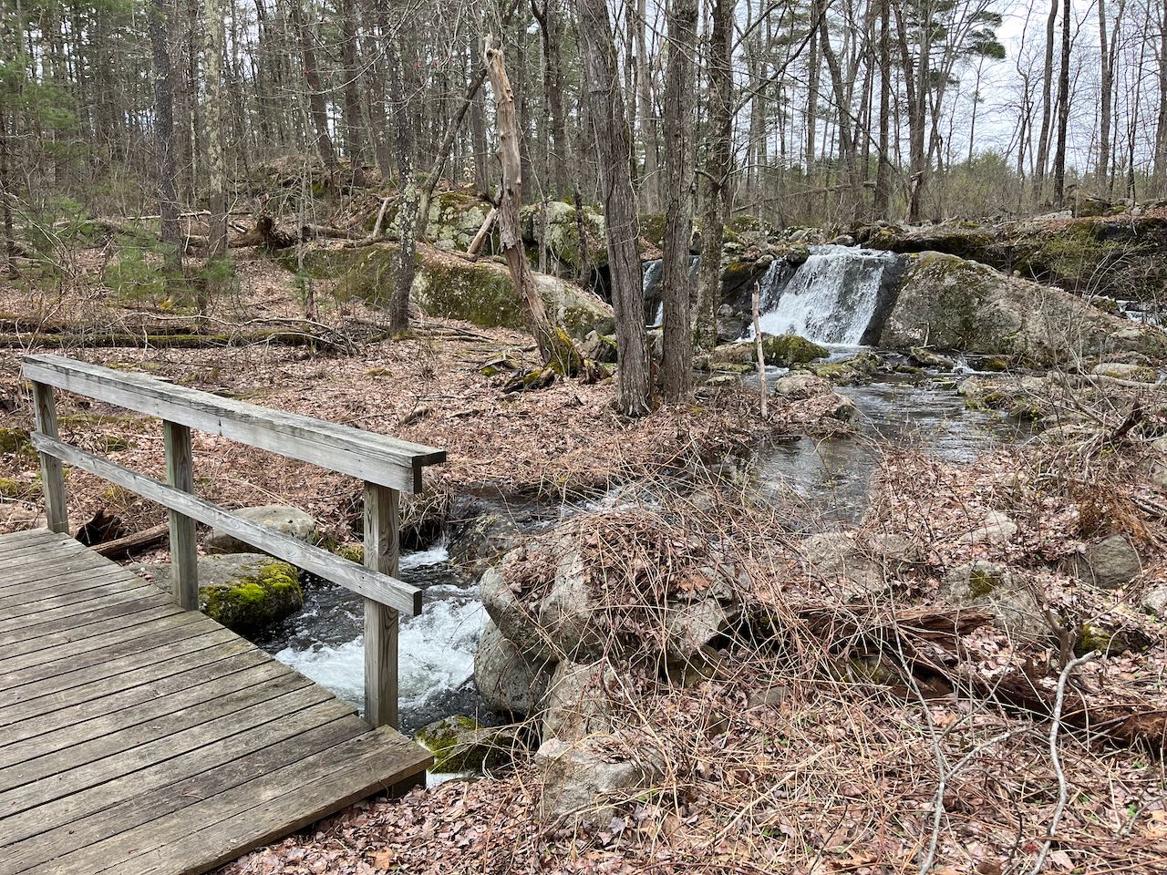
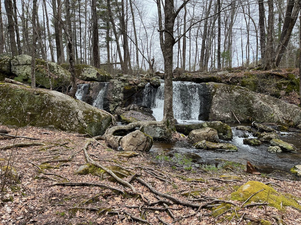
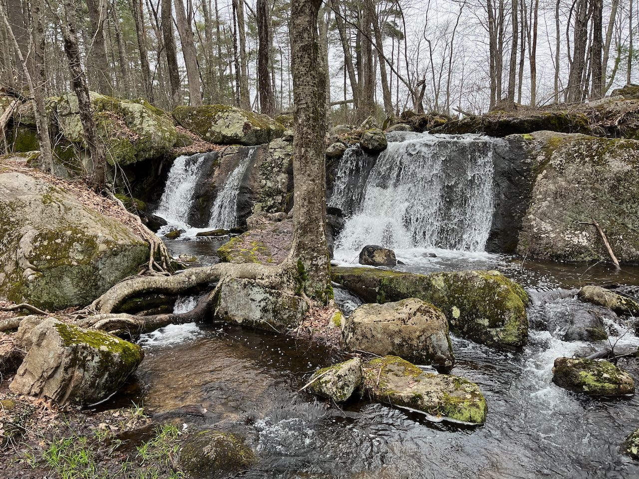
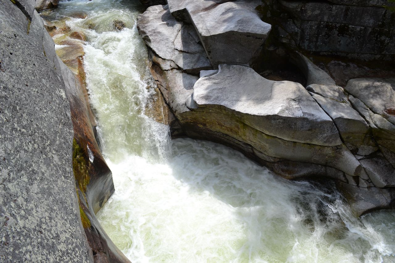
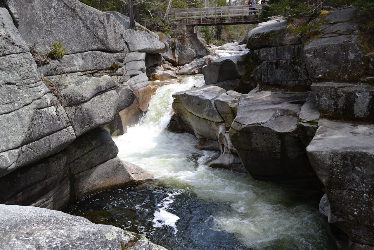
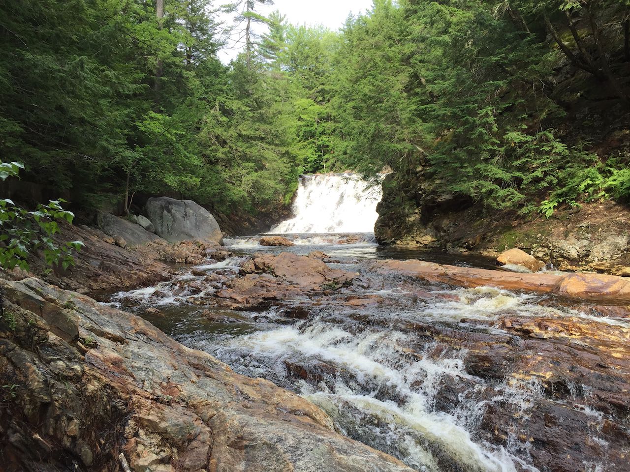
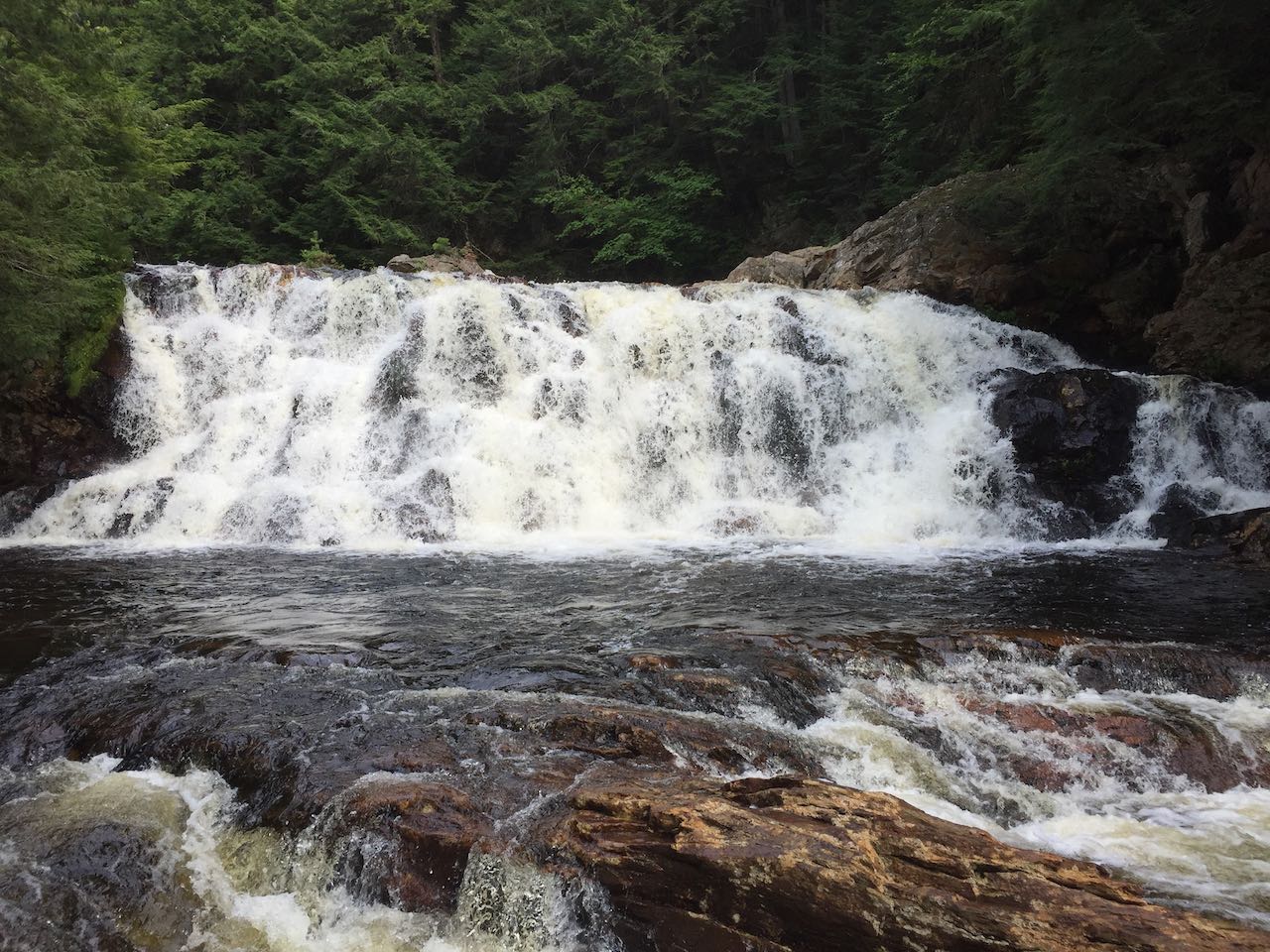
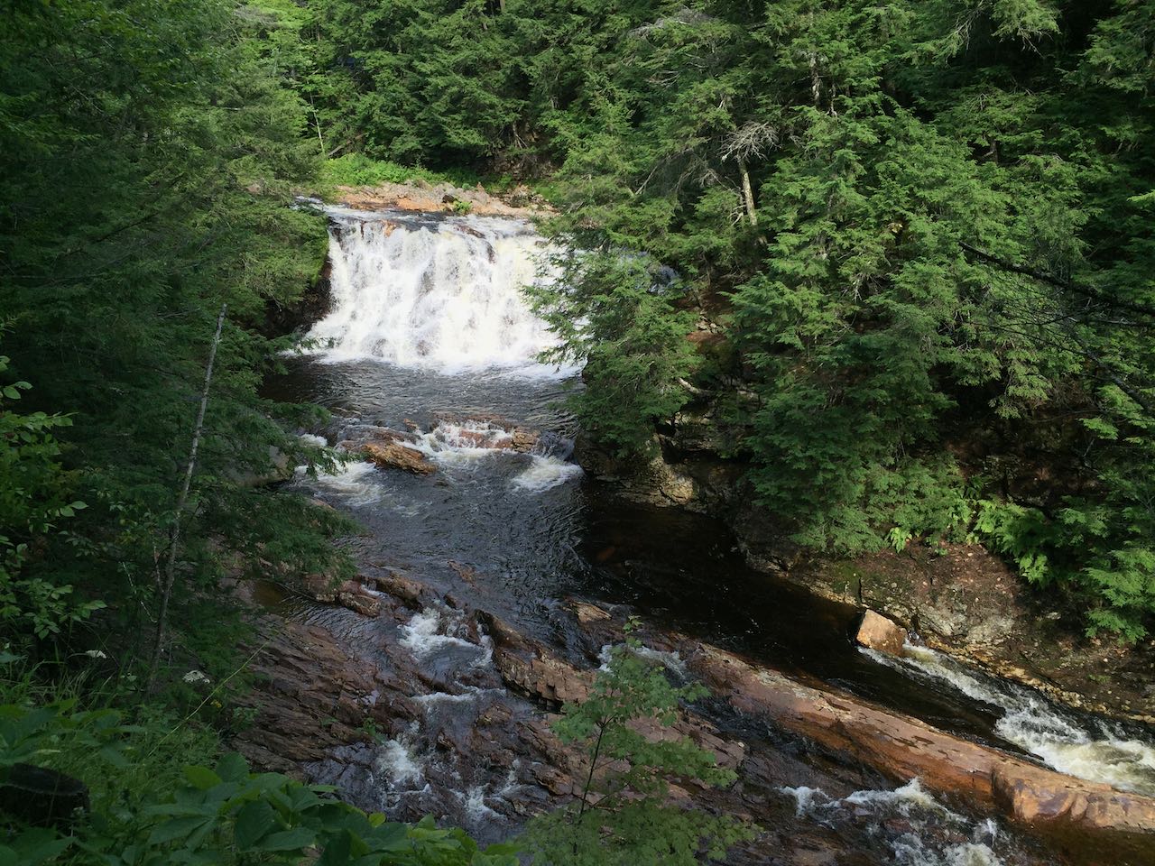
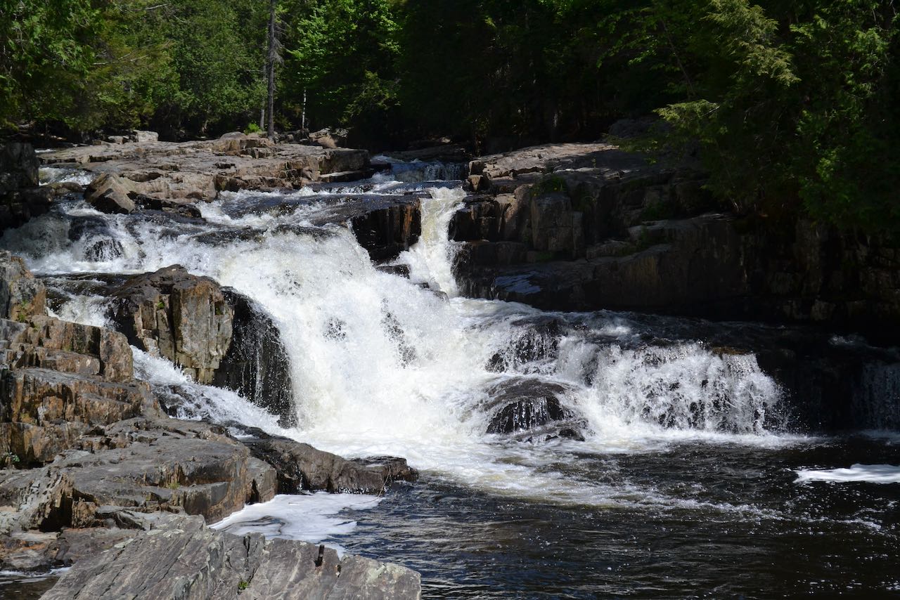
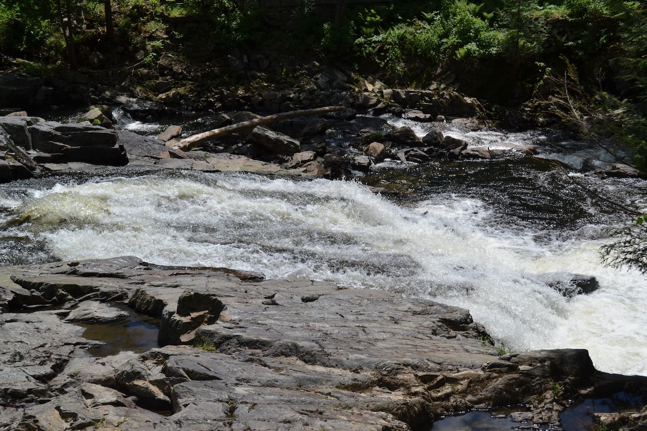
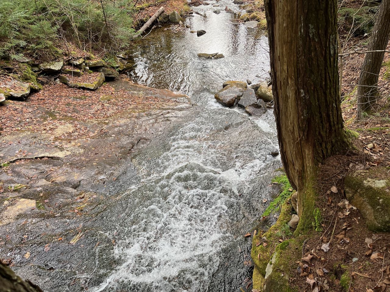
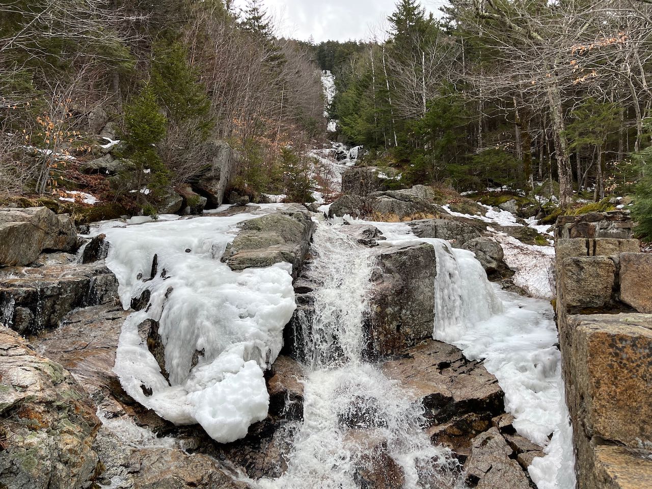
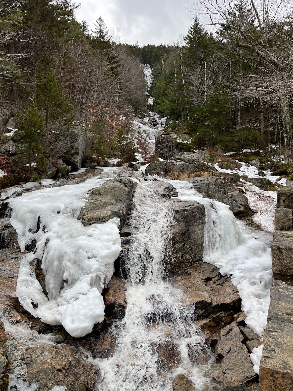
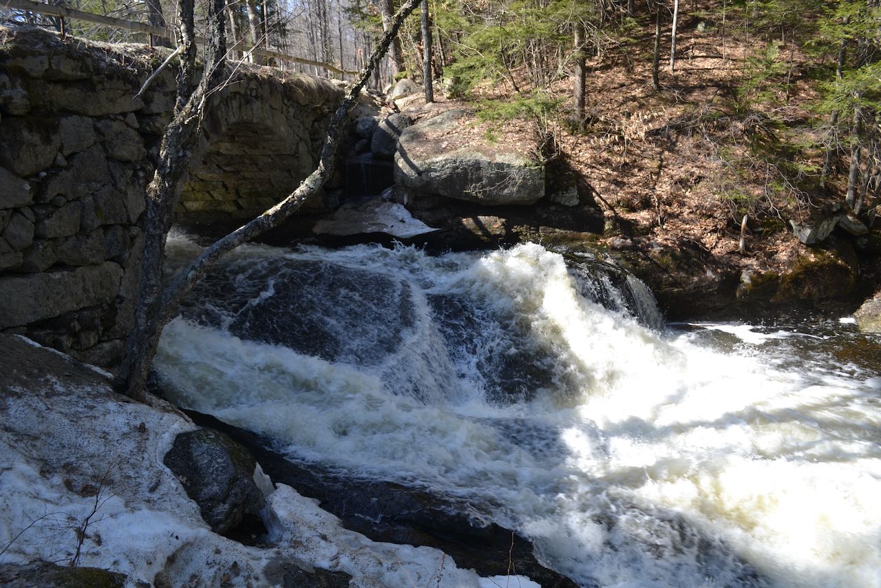
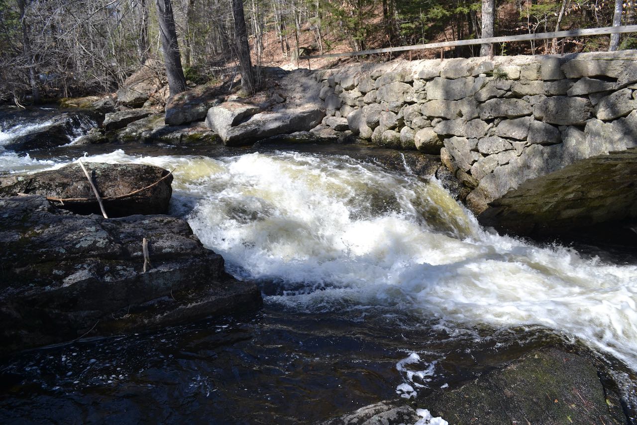
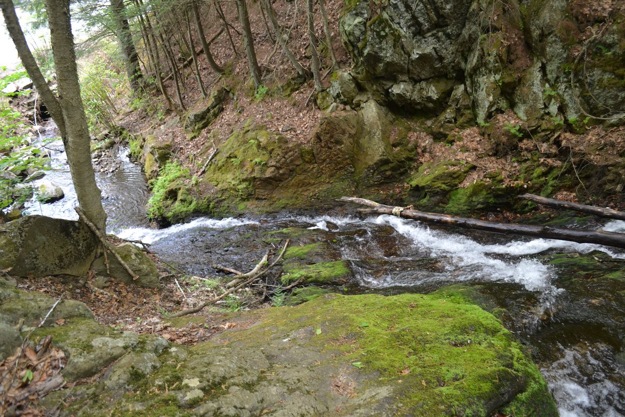
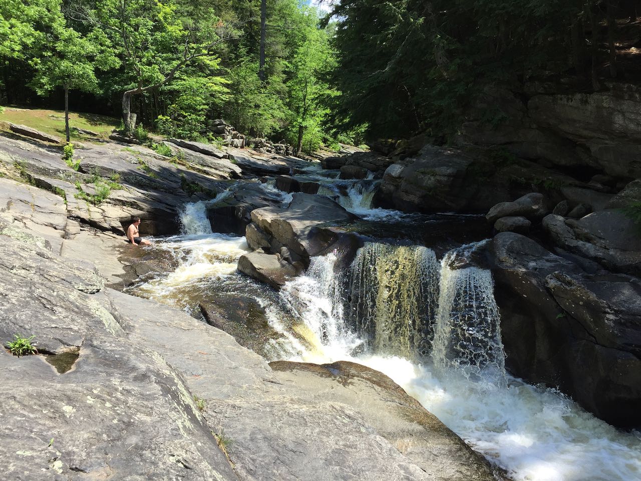
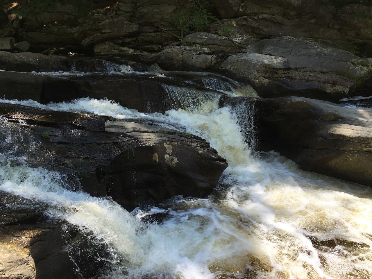
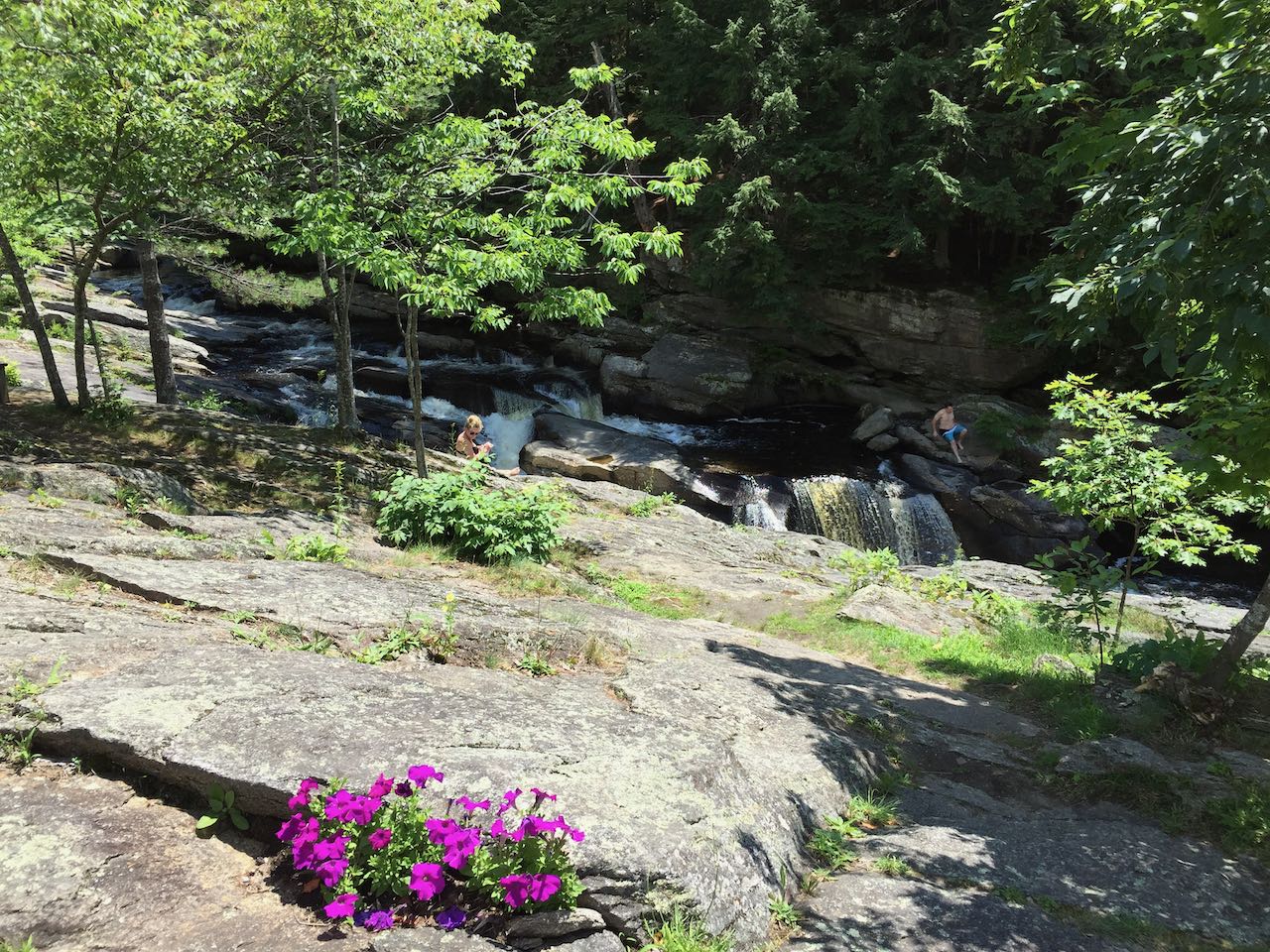
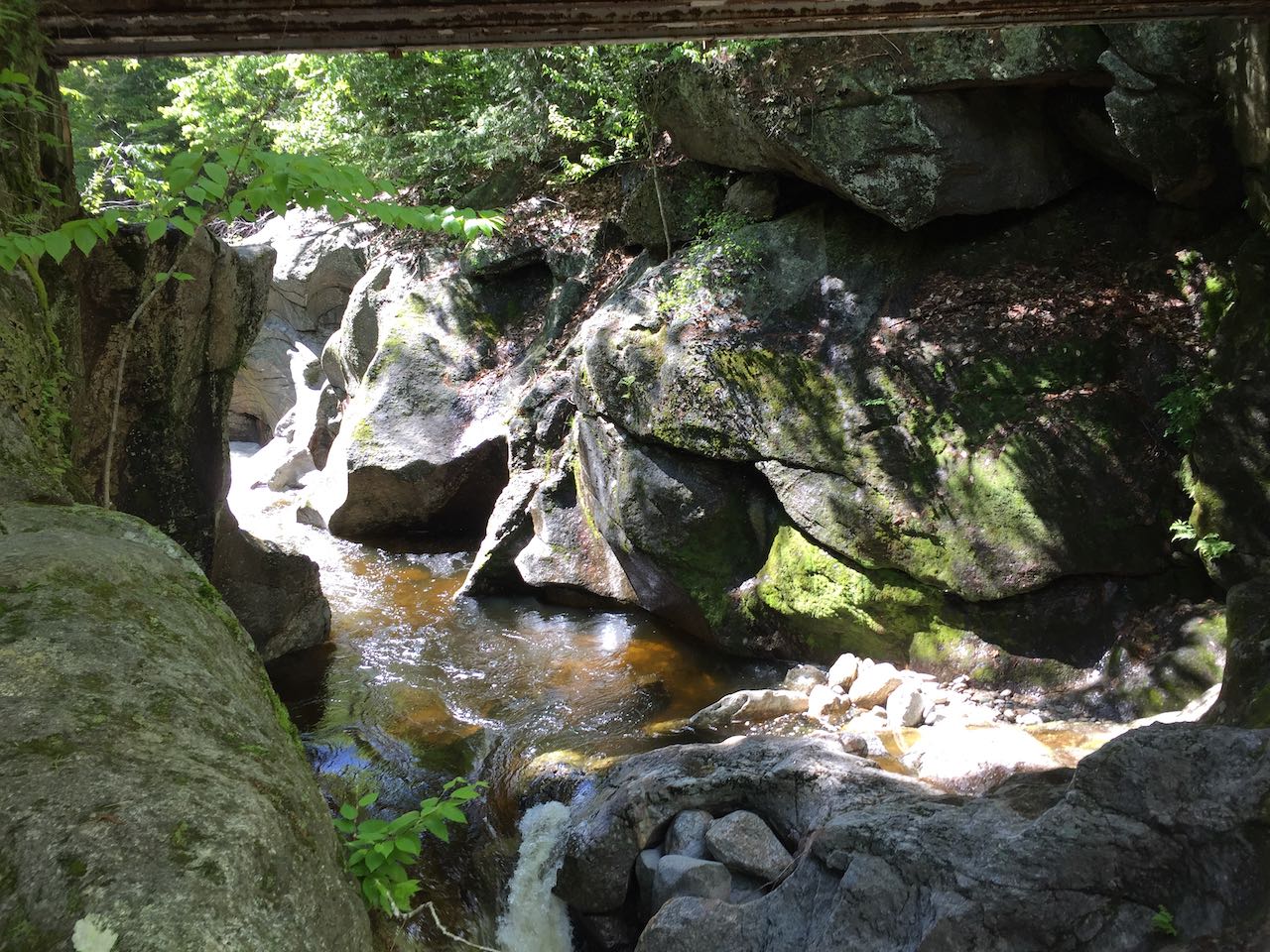
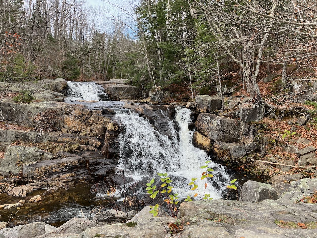
The nascent Ammonoosuc River as it forms from the slopes of Mt. Washington is home to a plethora of cascades and waterfalls, including some of the
highest in the state. These lower-level cascades form a gorge where the river begins to intensify in flow power. Several strong plunges have molded the
gorge walls into irregular, curved shapes, with the cracks and layers of the bedrock exposed. A boulder-filled scene upstream of the falls is contrasted
with the more level, gravelly outflow. Right from the pull-off, you can explore around the top of the rock walls or cross the bridge to the other side
for a different perspective.
From Rt. 302, 4.5 miles east of the junction with Rt. 3 in Twin Mountain, drive east on Base Station Road (marked with signs for the Mt. Washington Cog
Railway). Drive 2.2 miles up the road to where you will see a gravel pull-off and kiosk on the right (watch the mileage closely, as there is more than one
pull-off on this road).
Click here for a Google map.
This easily-viewed waterfall is one of the most popular scenic stops in the sparse north country. The well-kept wayside opens a clear view over the lawn area
to the magnificent, fanning drop over high ledges. Two equally impressive tiers make up the total drop, with a break between them. A path leading over a
bridge beyond the fence allows you up-close views of the outpouring at the base of the sloping ledge. More scattered paths allow for exploration around the
edges of the falls.
From Rt. 3 in the center of Colebrook, drive north on Rt. 145 for 2.4 miles. You will see the large state wayside area on the right side, with the falls
visible from the road.
Click here for a Google map.
On a particularly steep and winding section of state highway 175, you have to know what you're looking for to find the thunderous cataract on the Beebe
River down the ravine walls in the valley below. Just upstream of an interesting arch bridge in a particularly ledgy section of the riverbed, the
falls in higher flow are a mesmerising torrent, crashing over a single drop as the river jogs around a corner. The falls are larger in width than in height,
lending to their powerful appearance. A beaten path from the pull-off leads along a narrow terrace on the hazardously steep slope. It is possible to get
down to the river from here but could be dangerous with the angle and erosion. The main path leads to an opening where you can look down on the falls
through the trees.
Parking is located on the east side of Rt. 175, 3.0 miles south of Rt. 49 and 5.1 miles north of the junction with Rt. 175A near the
highway. There is room for a few cars to park in this pull-off on a steep and curvy incline. It will be just north of a bridge over the Beebe River and
just south of a triangle junction with Perch Pond Road.
Click here for a Google map.
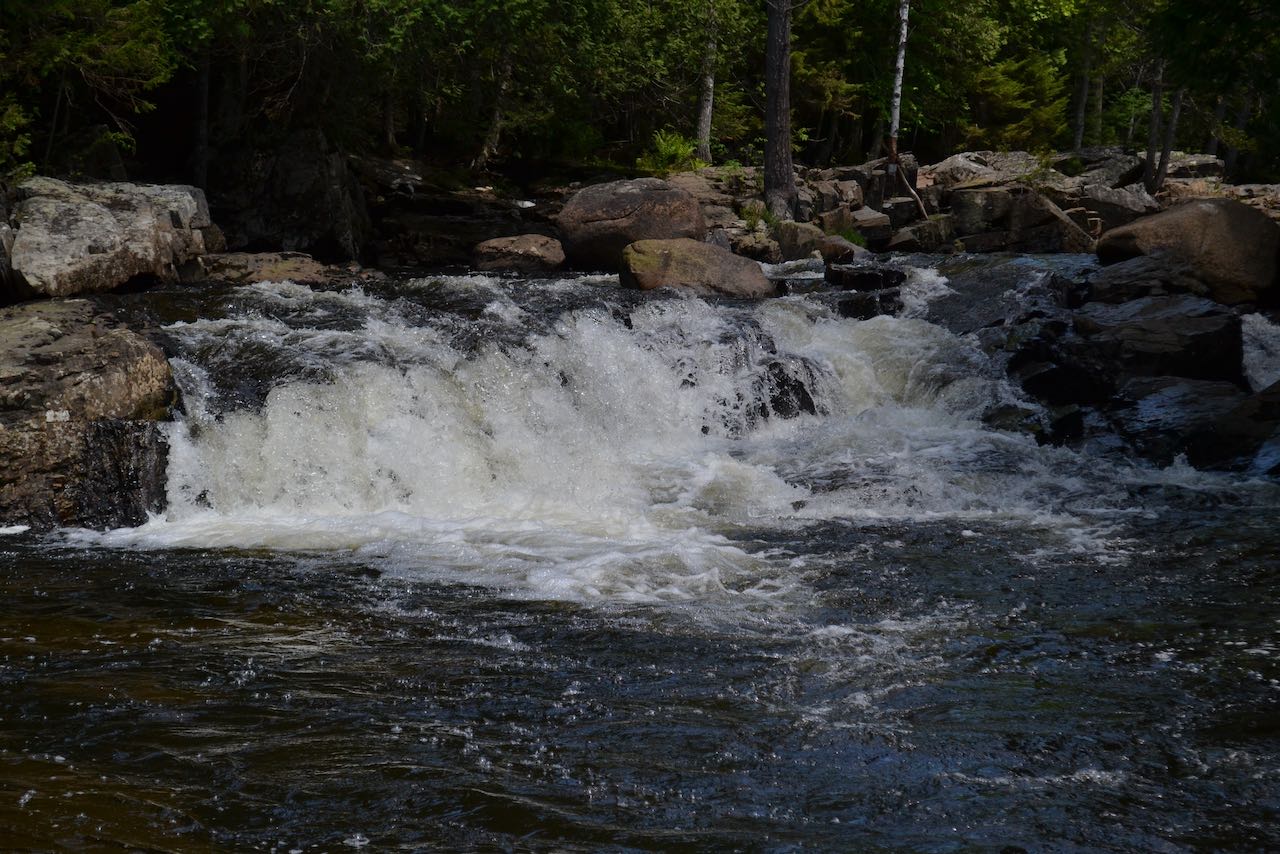
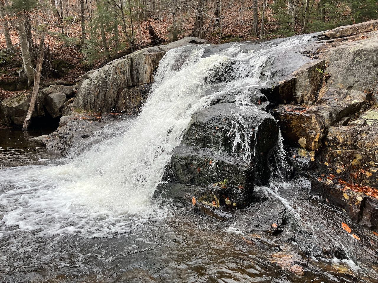
This voluminous waterfall will not stun you with its height, as it just surpasses the scale of mere rapids in a river, but the massive quantity
of water roaring through its fragmented bedrock will surely impress you. Phillips Brook seems big enough to be called a river, and that fact combined with
the riverbed formed of entirely ledge make it quite the natural wonder to observe. Closest to the bridge are some low-angle, bubbly rapids where the brook
spreads out over the rock. Further back is the main attraction, where the water plunges down a set of rock steps into a deep, foamy pool. The total drop
is perhaps 10 feet in all. From the pull-off, you can approach the falls by following a wide path into the woods and to a cement retaining wall, which
provides a convenient viewing place. You can explore in the woods and around the ledges to get closer.
From Rt. 110, 11.2 miles east of Rt. 3 and 2.5 miles northwest of Rt. 110A, turn north onto Paris Road and drive across the bridge over the Upper Ammonoosuc
River. At a four-way junction 0.8 miles up the road, turn left onto Dewey Hill Road. You will see the falls on the right at the bridge over Phillips Brook
just 250 feet from the junction. You can pull off the road on the right on the other side of the bridge.
Click here for a Google Map.
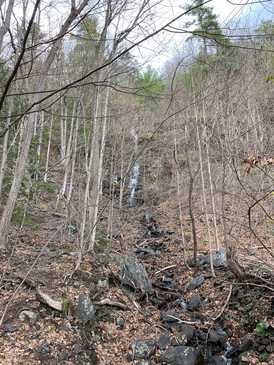
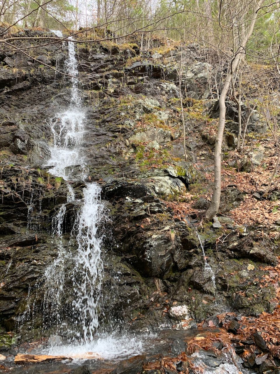
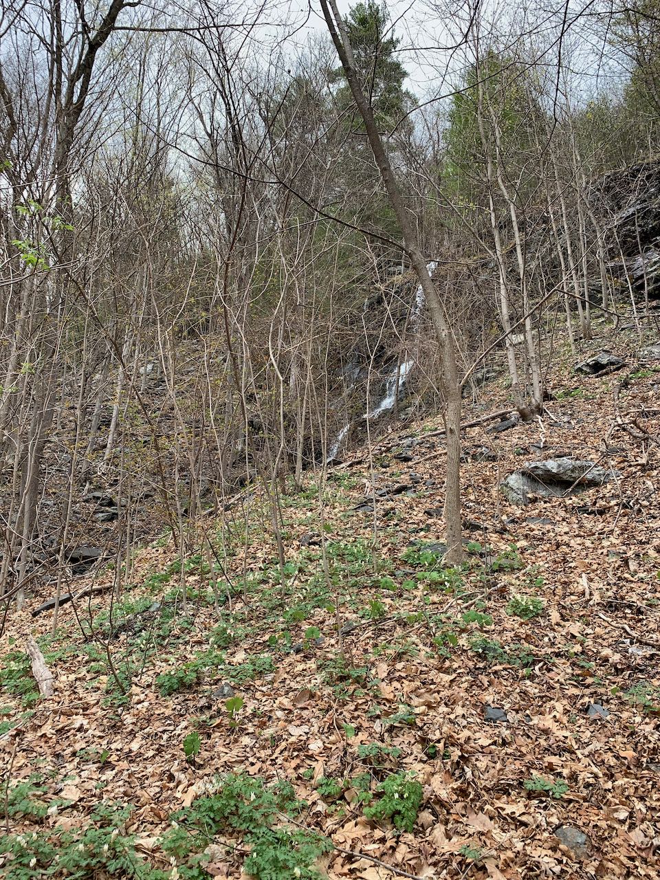
This very little known cascade is located on the far southwestern end of the White Mountain National Forest. Located just off the side of a forest road mostly
used for logging and by some hunters, nothing is there to even alert you to the presence of the cascade. The falls are not the most photogenic, as there is
not an unobstructed view of the whole cascade to be found. It's difficult to estimate the total height of the cascade, but it seems to be about 20' tall, and
much longer as it fans out over a slippery, layered ledge ramp. At the base of the falls is a short plunge into a pool. Due to the steep embankment around
the brook, the best place to view it is from the middle of the cascade. Walk past the gate and up the road for about 400 feet, and look through the trees on
the right side for the falls as it begins to climb uphill. You'll have to sneak through a couple trees to get a clear view of it.
Park at the Cobble Hill trailhead, on the north side Rt. 112, 1.4 miles west of the western junction with Rt. 116 in Woodstock and 7.2 miles east of the
end of Rt. 112 at Rt. 302. Pull into an entrance to a dirt road and park on the left side before the gate. You'll see a sign for the hiking trail.
Click here for a Google map.
The Dixville Flume, also called the Baby Flume, is one of the scenic highlights of wild, northern Dixville Notch, the most rugged and remote of New Hampshire's
mountain passes. As its name suggests, the falls are contained within a high-walled gorge, befitting the rough character of the area, where gothic rock spires
loom overhead as you drive through the park. From the side of Flume Brook below the outfall of the gorge, you view the falls, set back at the other end, over
a jumble of boulders on the streambed. The brook slides smoothly down the high-angled ledge into the gorge like a log flume amusement park ride. Below is a
pool which invites wading by its visual appearance but not its icy temperature, then a smaller water slide. The environment is dark and mossy and quite
evocative.
The Baby Flume Picnic Area is found on the northeast side of Rt. 26, 11.6 miles east of Rt. 3 in Colebrook and 10.0 miles northwest of Rt. 16 in Errol.
It is also 0.3 miles north of the wayside for Huntington Cascades and the cemetery. The entrance is marked with a sign for Dixville Notch State Wayside.
At the far end of the circular parking area, follow the short path past the state park signs down to the gorge.
Click here for a Google map.
Travelers through Crawford Notch get a free look at Flume Cascade as they drive the steep hill just south of the crest. Flume and its neighbor Silver Cascade
careen down the steep wall of Mt. Webster on the east side of the notch. Flume is the lower volume of the two and can tend to be more seasonal, but it is also
noticeably taller. The steepest drop is set far back from the road at the top of the cascades, which are hard to approach. It is partially obscured from view
by tree branches. Flowing from the base of the high ledges, the brook tumbles down some lower-angle cascades over bedrock to flow under the bridge. If you
look over the west side of the bridge, you can see the bottom of the cascade flow through a neat sluice to join the Saco River down below.
From the junction of Rt. 3 and Rt. 302 in Twin Mountain, drive east on Rt. 302 for 9.2 miles. As you crest the height of the notch and begin down the steep
hill, look for the entrance to a scenic area on the right. From the far end of this parking lot, you can follow a gravel path back out to the main road at the
bridge over Flume Cascade.
Click here for a Google map.
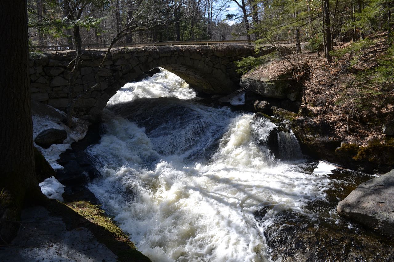
Located on a quiet back road, Gleason Falls is as much about the architecture of the stone arch bridge spanning Beard Brook as it is about the cascades
tumbling beneath. The falls are best seen in high springtime flow, when they gush over the mossy, angled ledges under the bridge. The rapids start just
upstream of the bridge, then accelerate underneath and end in a bubbling pool. You can walk down beside the brook underneath the shady hemlocks to get the
best view of the water and bridge in one photogenic scene.
From Rt. 31 in Hillsborough, 0.4 miles north of the junction with Rt. 9/202 at Kat's Corner, turn right onto Shedd Road. Drive 1.1 miles and arrive at
a four-way junction. Take the left onto Beard Road and continue another 1.1 miles as the road becomes dirt. You will find space to park on the right,
just before the stone arch bridge under which flows the waterfall.
Click here for a Google map.
No scenic wayside marks this pretty cascade; no tourist stop, not so much as a sign alerts passers-by to its presence, despite being right on the side of a
state highway. You'll feel like you're discovering something special as you poke through the trees around this multi-tiered, mossy slide. A pool forms
at the base of the lowest cascades, just before the brook passes through an unassuming culvert under the road. It's really just a sight on the side of the
road with nothing to call attention to the scenic beauty. Most of the waterfall can be seen from the road, but it is easy enough to walk around the sides of
it.
The falls are located on the side of Rt. 10, 6.7 miles north of the northern junction with Rt. 9 and 4.7 miles southwest of the southern junction with Rt. 123.
Look for space to pull off on the gravel shoulder on the south side of the road, 0.2 miles east of Riverside Street. You'll see a minor bridge over the brook
and the waterfall will be through the trees (right side, heading north/east).
Click here for a Google map.
Jackson Falls could be described as a photographer's playground, and it would be too if it were not also one of the most popular swimming holes in the area.
The sizeable Wildcat Brook tumbles over sunny ledges for nearly a quarter mile as it flows toward the Ellis River in Jackson Village. You'll find it is the
ideal place to splash around on a hot summer day as you go exploring around the multitudes of little cascades and falls, and the dozens and dozens of other
visitors will likely agree. There are some broad and short plunges near the top of the cascades, starting from below the bridge. Shallow and stony pools
abound. As you travel further downstream, eye-catching blocky shapes in the bedrock take over and form larger and more interesting waterfalls. There are
fewer areas to wade around down here, but the cascades are better. You can still get into the water at the base of some of the falls. In several places,
the water fans out and slides down oddly angled ledges. The brook splits up into multiple channels as it flows down through the variety of features.
From the northern junction of Rt. 16 and Rt. 302 in Glen, drive north on Rt. 16 for 2.7 miles to the second entrance to the northern Rt. 16A loop. Drive
0.4 miles and take a left into the first entrance to the Rt. 16B loop (Carter Notch Road). You will find nearly continuous available parking pull-offs on
the right side of the road from 0.2 - 0.4 miles in, ending at the bridge on Valley Cross Road. The various parking locations allow access at different
points along the cascades.
Click here for a Google map.
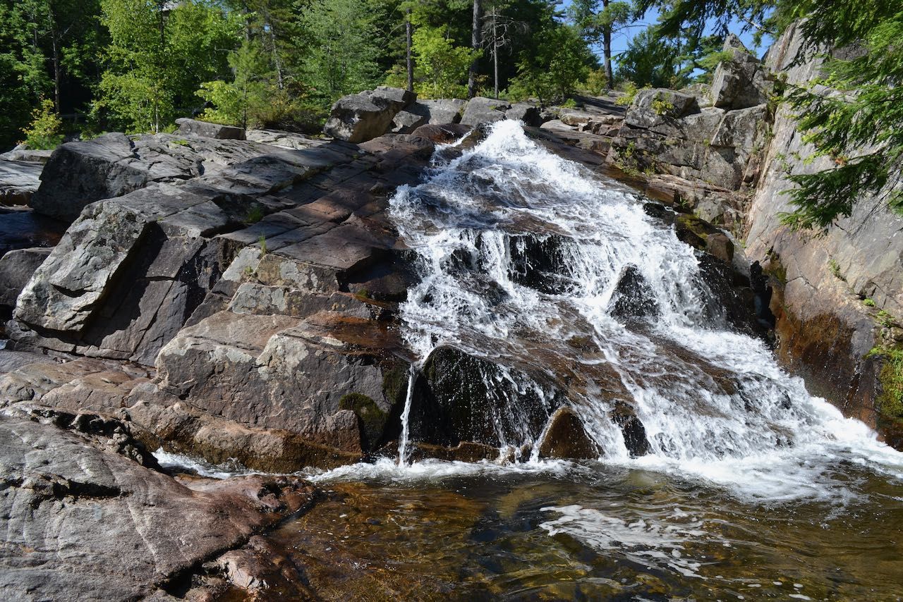
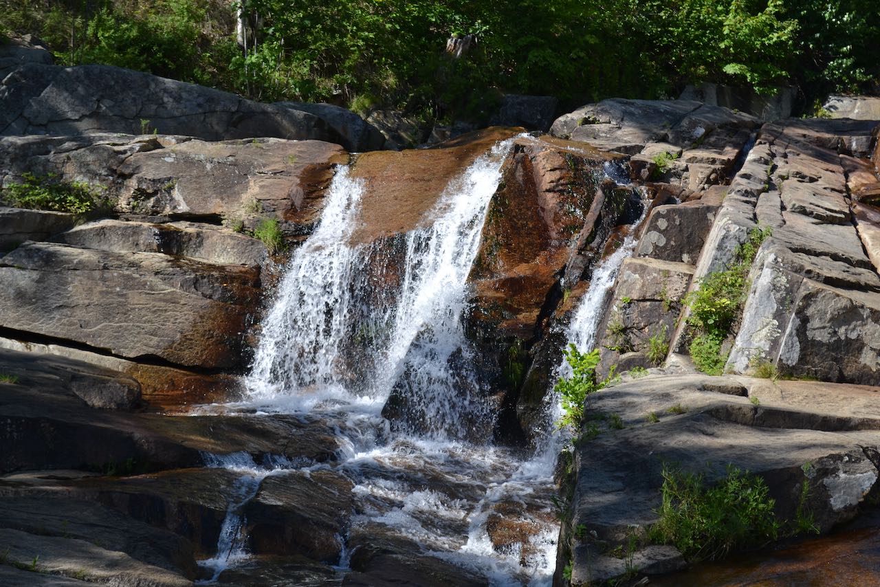
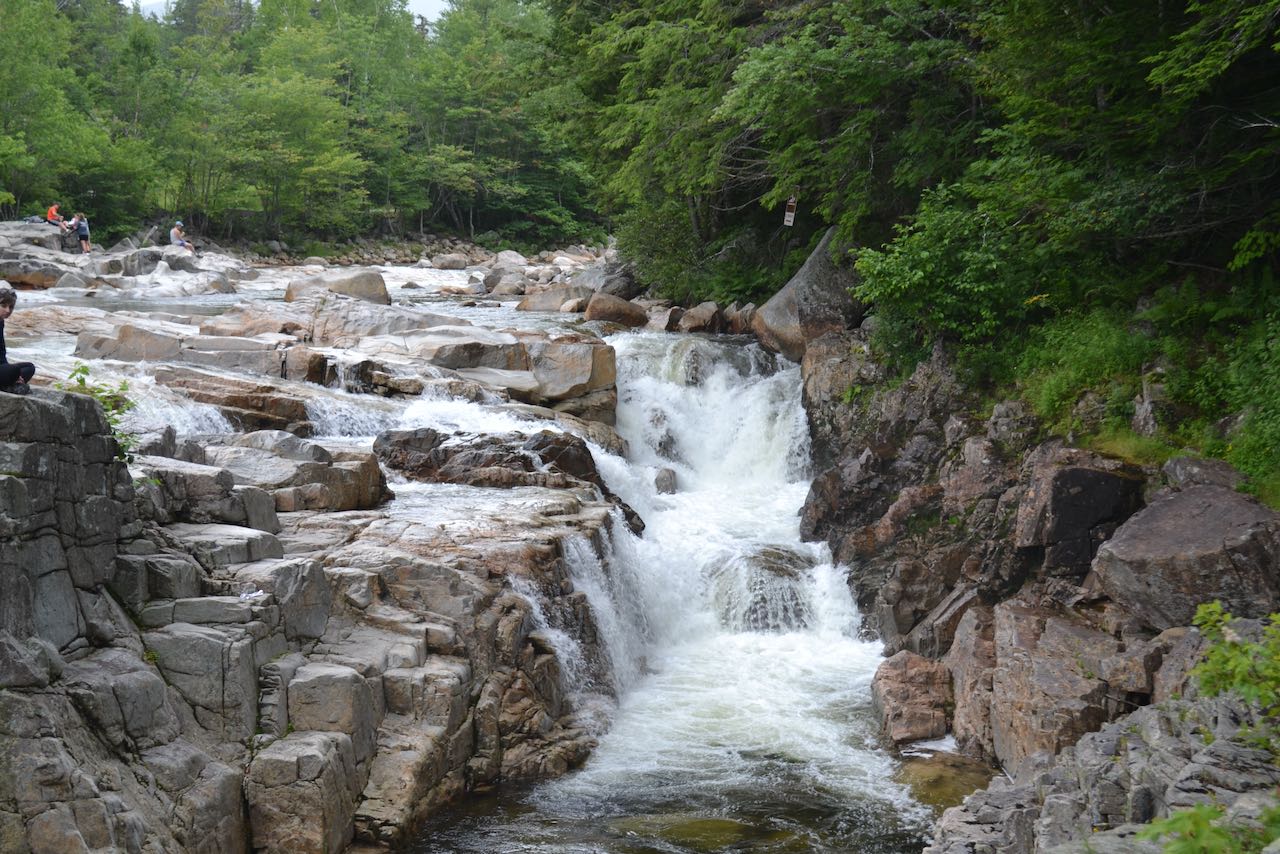
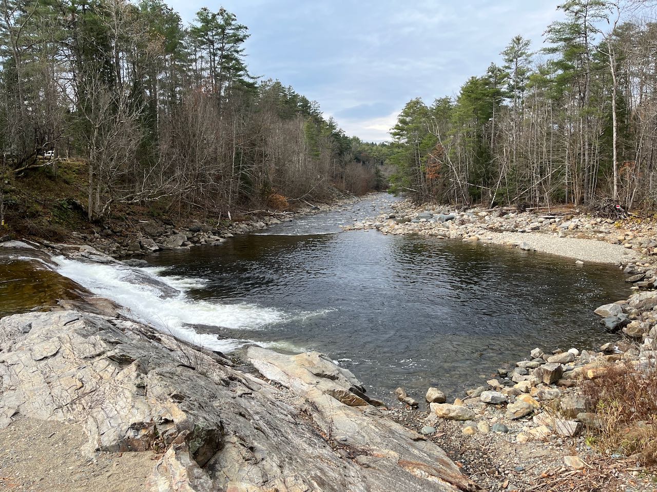
Downstream of Rocky Gorge, the Swift River turns out yet another major scenic attraction in Lower Falls. Its reputation as a swimming hole and recreational
area is unmatched, even if other waterfalls may provide better opportunities in that regard. The draw is a wide open and sunny area in the river, where
small cascades and pools abound. Following the paved walking paths on the south side of the parking area, you can easily find the broad ledges where the
river splits into a large number of playful cascades. There is not much in the way of vertical drop with this waterfall, but it is plenty scenic. All the
cascades culminate in a huge pool in the river, which is what draws in the swimmers. Most of the falls and the pool are visible from the highway if you're
driving westerly. If you're looking to enjoy the scenery without the crowds, it's best to visit off-season.
The entrance to the Lower Falls Scenic Area is on the west (northerly) side of the Kancamagus Highway, 6.9 miles west of Rt. 16 in Conway and 28.3 miles east
of exit 32 off I-93 in Lincoln. The eastern access to the huge parking lot, about 0.1 miles from the western, is the entrance (the parking lot is a one-way).
It is clearly marked with a White Mountain National Forest sign. Look for the visitor's building nearby to the entrance. It's located between other major
scenic attractions Rocky Gorge to the west and the Albany Covered Bridge to the east.
Click here for a Google map.
The former mill on the south branch of the Sugar River was powered by this series of small but powerful waterfalls. A popular local swimming hole, the
falls welcome visitors with areas of flowerbeds and benches. Several parallel plunges pour through worn-down ledge, between the near side, with a gently
sloping ledge you can walk down to the water, and the far side, where the ledge forms a wall against the river. You can find some stone wall remains of the
old mill structures just upstream of the main falls. The whole recreation area is privately owned and maintained by one of the nearby residents, and has a
short walking trail showcasing the natural beauty of the area.
From Rt. 10, 1.9 miles south of the junction with Rt. 103 in the center of Newport and 3.4 miles north of the junction with Rt. 31, turn northwest onto
Pollards Mills Road at a four-way junction. Drive 0.4 miles and turn left at a triangle junction onto Falls Road, a short spur road to three driveways.
After about 200 feet, turn left into a small parking lot opposite the first driveway.
Click here for a Google map.
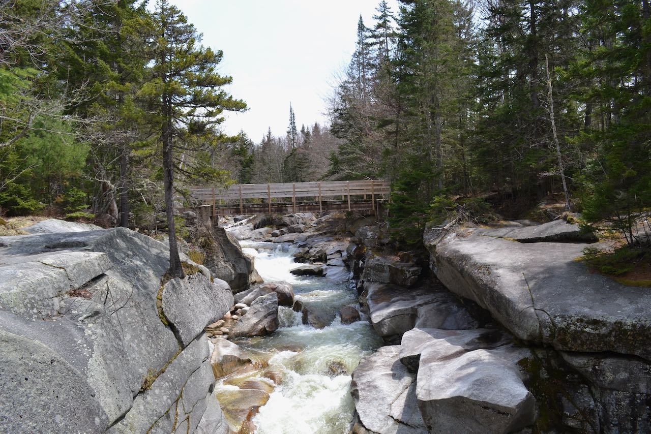
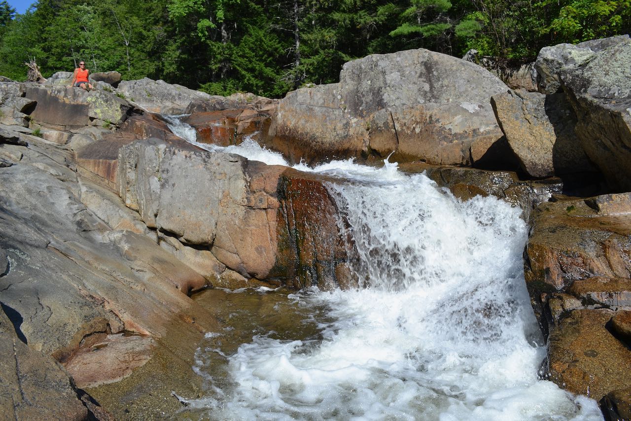
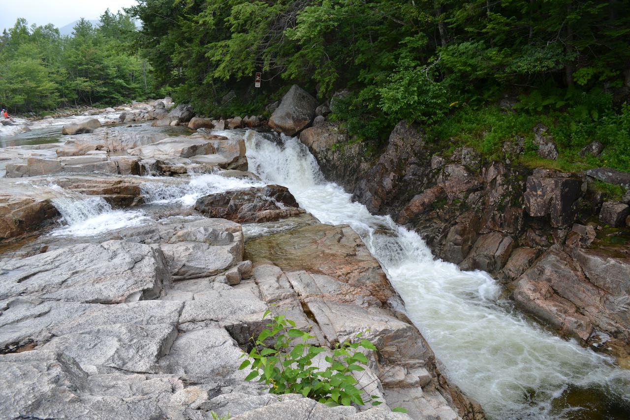
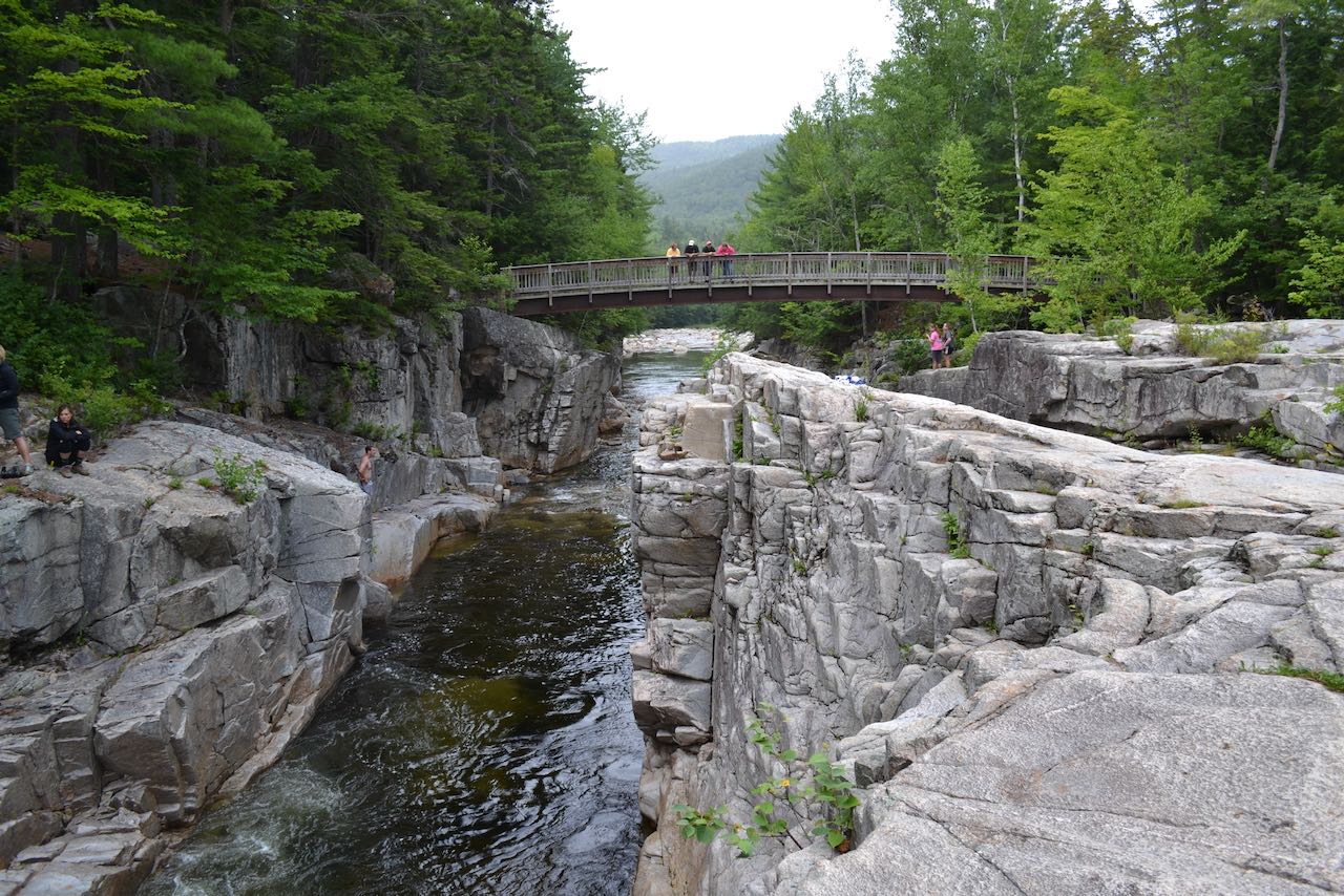
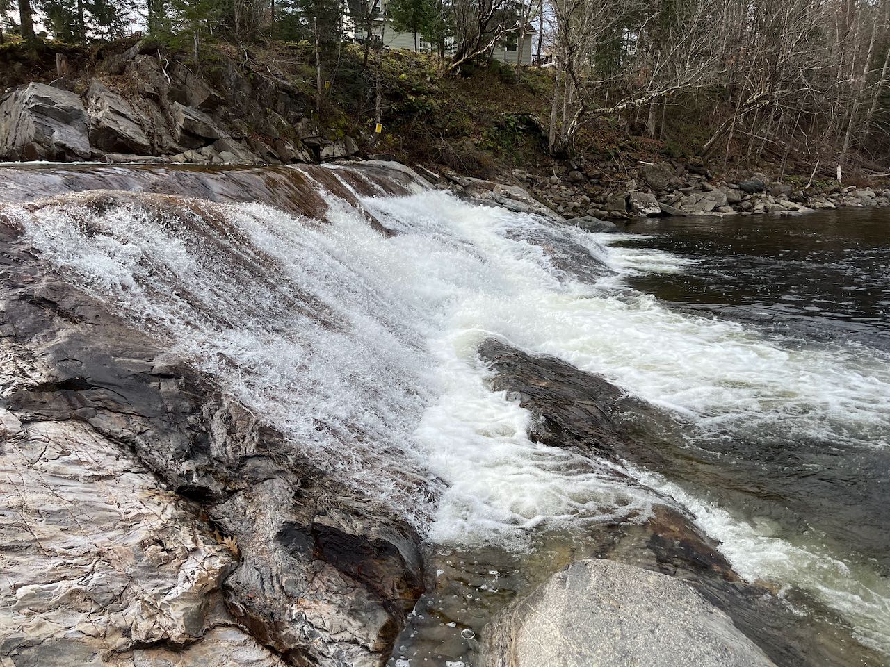
Rocky Gorge is just what its name suggests. It's an impressive rocky chasm in the Swift River that is one of the most popular scenery stops on the Kancamagus Highway. The wide river is constrained and accelerated into a single powerful waterfall down into the gorge, then flows between the rock walls, where intricately layered stone displays a network of fractures. An arched footbridge spans the river just downstream of the gorge, providing prime viewing up through it. To get to the footbridge, you'll have to walk the paved pathway 0.1 miles down from the parking lot. For a longer walk beyond the gorge, you can follow the path another 0.1 miles past the bridge and up to scenic Falls Pond. The entrance to the Rocky Gorge Scenic Area is on the west (northerly) side of the Kancamagus Highway, 9.2 miles west of Rt. 16 in Conway and 26.2 miles east of exit 32 off I-93 in Lincoln. It is clearly marked with a White Mountain National Forest sign. You'll find it between other major parking lots for Champney Falls Trail to the west and Lower Falls to the east. Click here for a Google map.
Some small cascades flow through this tall gorge on the Cockermouth River, but what really makes this a scenic site are the smooth rock walls that look like
interlocking puzzle pieces which give the natural area its name. You can cross the road and follow the short path onto a bridge over the top of the gorge.
From here you can look down on the cascades, as well as the odd protrusions and potholes that riddle the walls. A few sections of the ledge have broad half-
circles carved into their sides, where the river spins around.
From Rt. 3A at the northern end of Newfound Lake, 8.8 miles north of the junction with Rt. 104 in Bristol and 4.9 miles south of the traffic circle at Rt. 25,
drive west on North Shore Road into the town center of Hebron. At the junction with West Shore Road, the road becomes Groton Road. Continue 1.6 miles.
Continue straight again as North Groton Road turns off to the right and the road becomes Sculptured Rocks Road. Look for the large and well-marked parking lot
on the left side of the road after 1.2 miles.
Click here for a Google map.
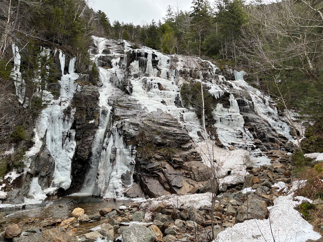
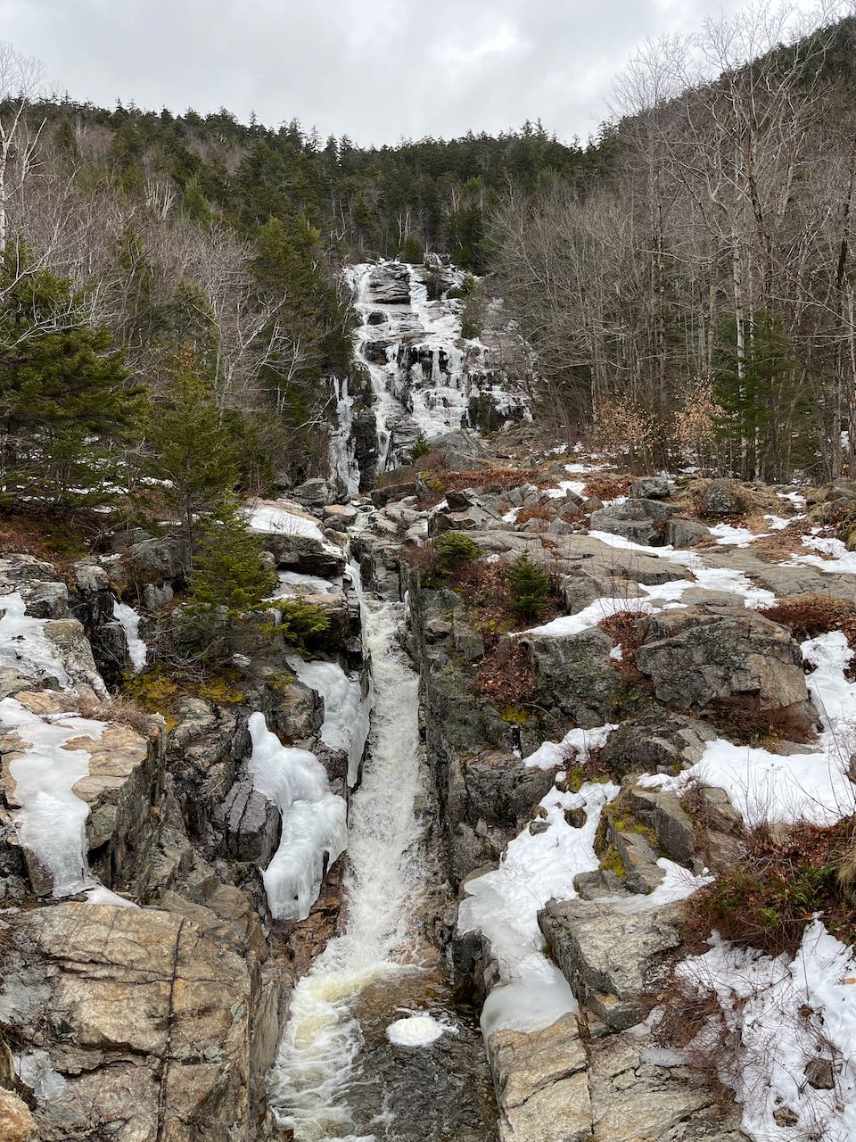
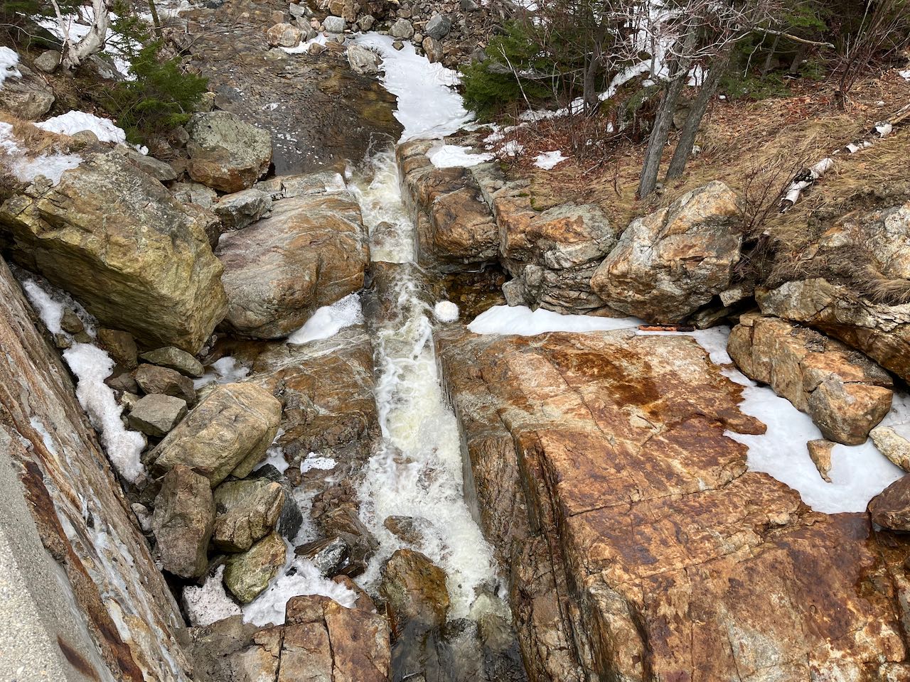
Travelers through Crawford Notch get a free look at Silver Cascade as they drive the steep hill just south of the crest. Silver and its neighbor Flume Cascade
careen down the steep wall of Mt. Webster on the east side of the notch. Silver is the shorter of the two, but always has a higher volume of water flowing
over it and is positioned closer to the road, making it more attractive to look at. The lower portion of the cascade consists of a narrow and deep channel in
the ledge which spans both sides of the bridge. Further back from the road, the cascade is more vertical as it crashes over series of ledges into a small pool.
Most of the time, the flow is confined to a cutout in the left side of the rocks. Unlike Flume, it is easy to get up close to this largest portion of the
cascade. Just hop over or walk around the guardrail, and you can follow a beaten path beside the ledges of the brook bed to a rocky point overlooking the
pool. Here you can stand in awe of the magnitude of the cliffs overhead.
From the junction of Rt. 3 and Rt. 302 in Twin Mountain, drive east on Rt. 302 for 9.4 miles. As you crest the height of the notch and begin down the steep
hill, cross the bridge past Flume Cascade and look for two parking areas on the right, one on each side of the next bridge over Silver Cascade. From either
one, you can walk the sidewalk to the bridge.
Click here for a Google map.
To find this waterfall, you'll have to navigate through the tiny hilltop town of Ellsworth, where the only thoroughfares are backwoods roads tucked deep
into the mountains. The drive through this remote locality is almost as appealing as the destination, with abundant scenic views, and neither are
frequently visited. When you finally arrive at the waterfall, you'll be greeted with the sight of the foamy white brook careening over a series of
"steps" in the ledgy brook bed. The unfortunate placement of the road means the lowest step falls underneath the bridge, but it is still an impressive sight,
and by moving around, you can get a sense of the scale of it. South of the road is private land, but on the north side, a forest road leads uphill beside
the falls, so you can observe it from different angles. Step out onto the ledge in the midst of the falls and you can get right up close to the upper
drop. At the highest and shortest drop, the brook plunges over a little ledge into a small pool, then forks and falls over the second drop, where the two
streams merge together at the bottom. Under the bridge, the brook is funneled into a narrow channel and spills out into a pool below. The brook
eventually flows down to Ellsworth Pond and continues to the Pemigewasset River.
From the junction of Rts. 3 and 49, west of exit 28 off I-93, drive south on Rt. 3 and immediately take the first right onto Dan Webb Road. Drive up the hill
to the four-way junction at a curve in the road and take the nearest right onto Ellsworth Hill Road. You'll be on this road for a total of 7.6 miles before
you reach the waterfall. The road leads uphill past several scenic views and through the indistinct town center before becoming a dirt surface after 4.6
miles. The road is not maintained during the winter months just beyond this point. After another 3 miles, look for a pull-off on the right, just before the
bridge over Brown Brook, where you'll see the waterfall. If visiting during the winter season, you can approach from the south via Stinson Lake Road from
Rt. 25. 6.9 miles up the road, past the north end of Stinson Lake, there is parking available at the Three Ponds Trailhead. The falls are just 0.3 miles up
the road from this point, and you can walk to them easily if the road is not passable.
Click here for a Google map.

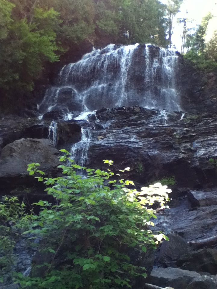
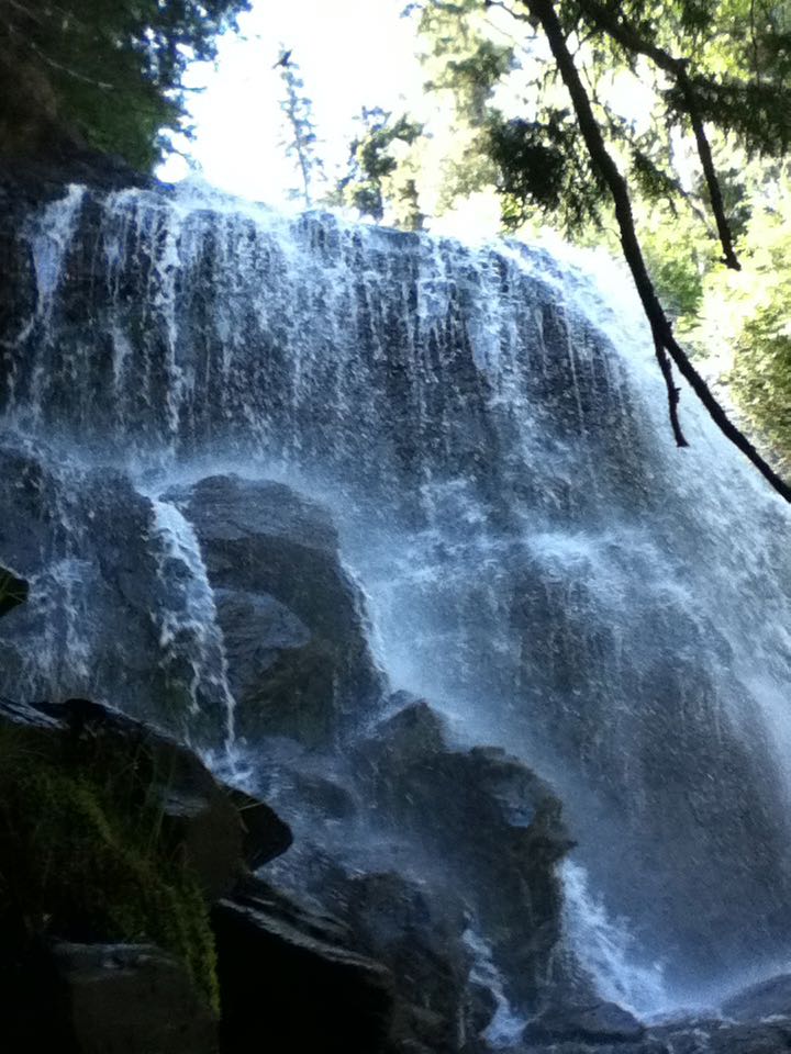
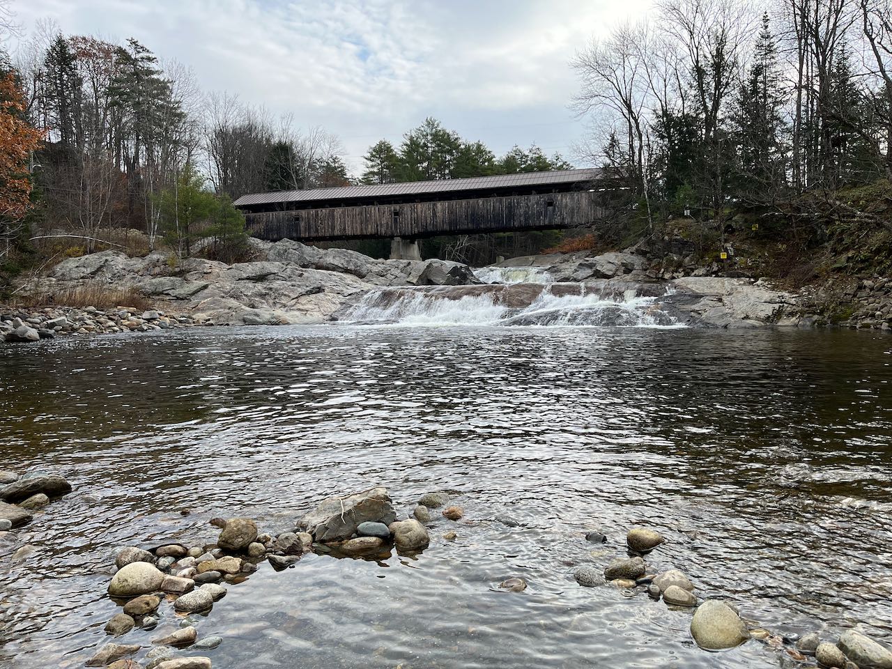
It's hard to imagine a more quintessentially New Hampshire scene than a waterfall and a covered bridge. In the town of Bath, the 1849 Swiftwater Covered
Bridge provides a backdrop for the waterfall of the same name on the Wild Ammonoosuc River. Though not much in height, the volume of water pouring over
the falls continually is impressive. The river winds past a sandy spot under the bridge and gushes over textured bedrock in two drops. The lower drop
spans the much more of the width of the rock and spreads the water out into bubbling beads as it fills the expansive pool below. In the summer months,
this pool is a prime swimming venue as the cool mountain waters swirl around. It's also an excellent object of photography, to capture the beautiful
natural forces and the weather-aged covered bridge.
From Rt. 112, 2.1 miles southeast of its end at Rt. 302 and 6.5 miles northwest of the western intersection with Rt. 116, turn northeast at a wide corner onto
Porter Road and drive across the Swiftwater Covered Bridge. Right on the other side, turn left and drive down into a large gravel parking lot, where
several paths lead out to the river.
Click here for a Google map.
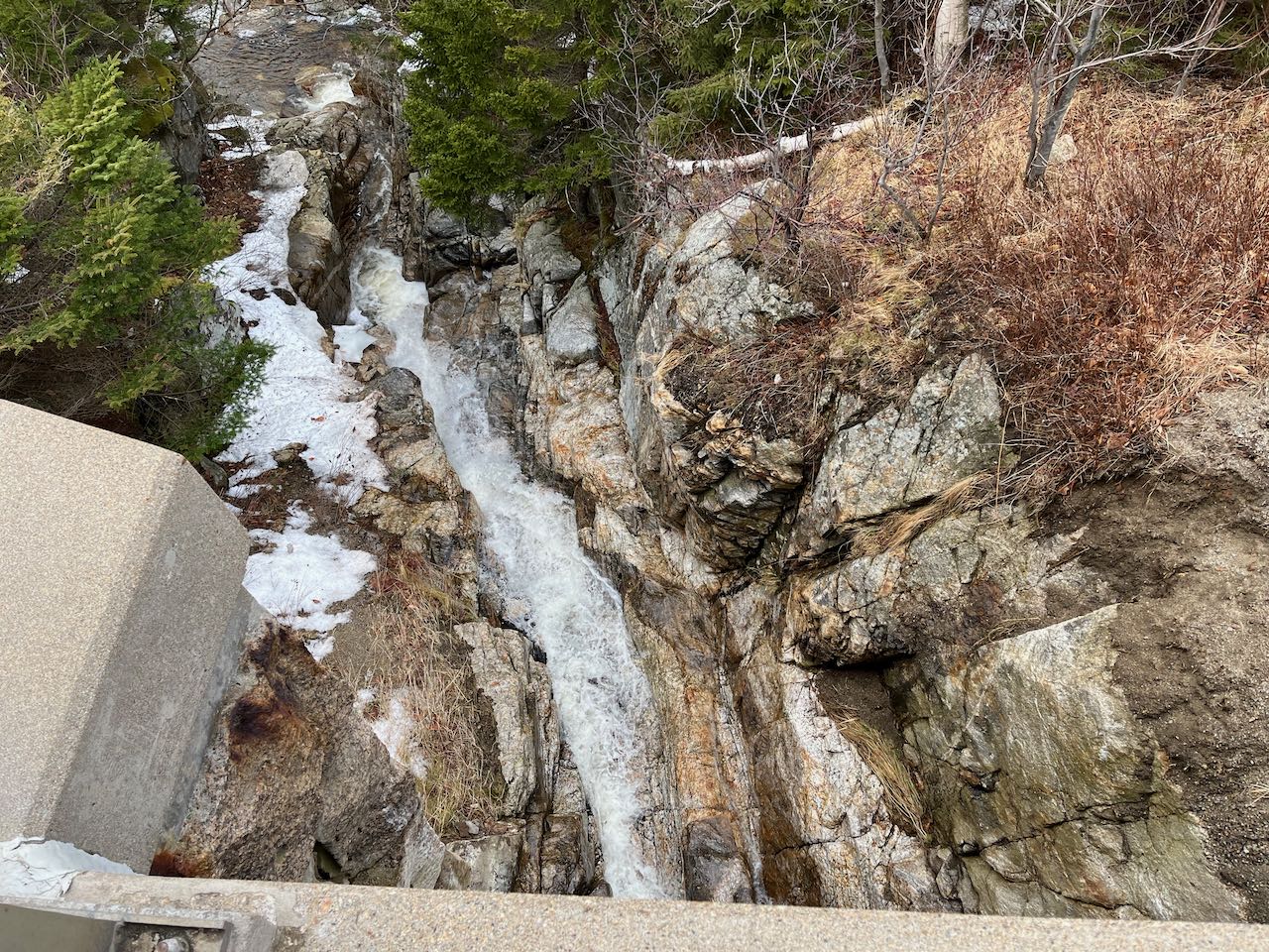
Located right at one of the trailheads for hiking Mt. Wantastiquet, the view of this seasonal cascade takes in the lowest portion of a tiny, nameless stream
on its rendezvous directly with the Connecticut River. It's essential to visit in the spring, as the source of the falls will be nearly dried up in all
but the wettest times of the year. It's not a debate whether to call this the westernmost waterfall in New Hampshire, as the true westernmost point on
land is less than half a mile away down at the riverbank. From the parking area, stay to the right of the lower woods road and walk up the Wantastiquet
Mountain Trail to the orange gate. From either side of the brook around here, you can look up toward the waterfall. It is a bit set back up the steep slope.
Beyond the stony outflow at your feet, you can see the near-vertical rock wall high above. Despite its very low flow volume in any conditions, the plunge
over the rock is impressive. Beaten paths lead upslope closer to the falls.
From Rt. 119, immediately east of the bridge over the Connecticut River to Brattleboro, turn north onto Mountain Road. Drive 0.2 miles uphill on this narrow
dirt road, and as a driveway loops off to the left, pull into the parking lot on the right.
Click here for a Google map.
This waterfall with a storied history is small in stature, but for the far southern town of Hollis it's quite an attraction. Though not tall, the plunge
carries enough water that it was the site of several bustling sawmills from the 1850's to the 1910's. Remains of the multiple buildings that occupied
the site over the years are scattered over the forest floor to find. A historical marker next to the site explains the full story. The falls themselves
are a wide, 6-foot plunge over a block of ledge, as Rocky Pond Brook exits Worcester Mill Pond.
From the junction of Rts. 122 and 130 in the center of Hollis, take Rt. 130 west for 0.5 miles and turn right onto Rocky Pond Road. Drive 1.5 miles and look
for the wide dirt pull-off on the left. You'll be able to see the falls through the trees from the parking. Walk down Old City Trail past the kiosk for about
300 feet. Cross the footbridge for the best viewing of the falls. The mill site is to the right of the falls, on the near side of the bridge.
Click here for a Google map.